1. Project Overview
The Majitang Anhua Expressway in Yiyang City (referred to as the Ma’an Expressway) forms the western section of the Pingyi Expressway. It is part of the third horizontal highway in the “5 Vertical and 7 Horizontal” expressway network within the “3+5” urban agglomeration, linking the Yima and Guan’an Expressways.
The Ma’an Expressway Section 2 spans from pile K9+260 to K20+040, covering a total length of 10.781 km. Key structures along this route include four major bridges (Yinghuochong Bridge, Wangjiaping Shanxi Bridge, Chixi Elevated Bridge, Yangjiacun Bridge), one tunnel (Chixi Tunnel), Yangjiaotang Interchange and its Connection Line, as well as the Lengshi Parking Area.
The entire project is built to a four-lane expressway standard, designed for speeds up to 100 km/h, with a subgrade width of 24.5 meters. Bridges and culverts are constructed to Highway – I vehicle load standards. The Yangjiaotang connecting line is built to second-class highway standards, designed for speeds of 40 km/h, a subgrade width of 8.5 meters, and bridges and culverts designed for Highway – II vehicle load levels.
This project presents five major construction challenges:
- The route corridor is narrow, necessitating extensive engineering work;
- Complex terrain and geological conditions complicate construction;
- Limited temporary access roads restrict material transportation;
- Scarcity of sand and gravel results in high flooring material costs;
- Variable and complex climate conditions have significant overall impacts.
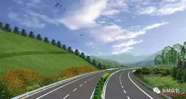
Figure 1: Rendering of Ma’an Expressway
2. Project Model Display
Given the multi-point and linear nature of highway projects, this application employs segmented BIM models, including road, tunnel, bridge, and culvert models. These models support line layout visualization, construction management, and process simulation for each section, enabling detailed management at every stage.
1. Road Model
Before modeling the road, contour lines and elevation points are extracted from design terrain files using the software’s terrain filter, forming a triangular network to generate a digital 3D terrain.
A road centerline is created based on the terrain data, with the longitudinal section positioned according to the slope and vertical curve tables. A 3D road model is then generated using imported road cross-section templates.
The main challenge lies in modeling the three-dimensional interchange. At Yangjiaotang Interchange, Ramp A has a roadbed width of 8.5 meters from the level crossing to the toll station, expanding to 15.5 meters from the toll station to the junction with ramps B and C. Ramps B, C, D, and E each have a single-lane width of 8.5 meters, designed for speeds of 30-40 km/h with a minimum turning radius of 50 meters.
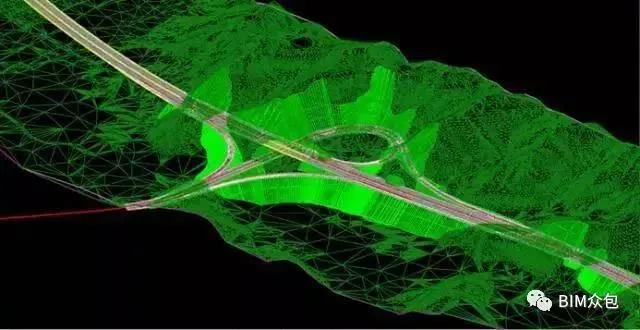
Figure 2: Yangjiaotang Interchange Model
2. Tunnel Model
The Chixi Tunnel, situated in Yeyatang Village, Anhua County, traverses a low mountain and hilly terrain with undulating topography. The highest elevation near the tunnel reaches 310.00 meters, and the maximum burial depth is approximately 117.49 meters.
This tunnel consists of separate left and right tubes. The left tunnel extends from pile ZK13+592 to ZK14+548, measuring 956 meters, with sections of Grade III, IV, and V surrounding rock. The right tunnel runs from K13+595 to K14+555, spanning 960 meters with similar rock grade distributions.
The design features a separated composite lining and a bamboo-cut type portal entrance.
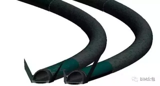
Figure 3: Chixi Tunnel Model
3. Bridge Model
The Yinghuochong Bridge is located in Yunling Village, Yangjiaotang Town, Anhua County, centered at K10+006 with a 270° right intersection angle relative to the route.
The bridge crosses a gully approximately 100-120 meters wide within low mountainous terrain. The slopes at both ends are undulating, with natural slopes of 25-30° at the small mileage abutment and 20-25° at the large mileage abutment.
Constructed with prestressed concrete continuous T-beams across nine 30-meter spans, the bridge length totals 276.08 meters. Its substructure includes column piers and pile foundations for abutments.
The bridge model is developed using MicroStation software and aligned with the roadbed via coordinate positioning.
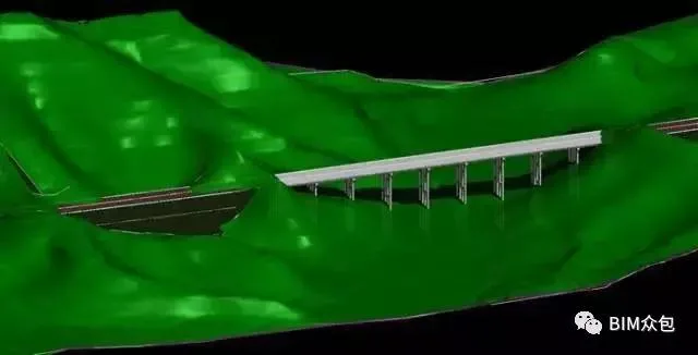
Figure 4: Yinghuochong Bridge Model
4. Culvert Model
This contract section contains 21 culverts along the main line. Their structural types and apertures are selected based on factors like catchment area, hydraulic performance, hydrological calculations, geological conditions, culvert fill height, availability of construction materials, and construction complexity.
For structural safety, irrigation, flood discharge, and erosion control, all culverts feature non-pressurized water flow and concealed designs. Types include reinforced concrete circular pipe culverts, slab culverts, and arch culverts.
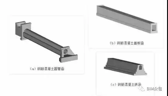
Figure 5: 3D Model of Culvert
3. Exploration of BIM Application
1. Site Layout (ABD)
Using AECOsim Building Designer, the project office and three centralized sites (beam prefabrication yard, mixing station, steel processing plant) are strategically planned and arranged to enhance production efficiency. Various signs and markers are presented in 3D visuals for clearer, more intuitive understanding.
2. Construction Progress Simulation
Construction progress simulation integrates a time dimension into the 3D spatial model, virtually reproducing the actual construction sequence. By linking the BIM model with the construction schedule, the software animates progress, enabling virtual construction in a simulated environment.
This approach allows real-time interaction with the construction process, virtual testing of plans, dynamic feasibility checks, and optimization of equipment and procedures. It enhances information integration and visualization of progress, resources, costs, and site conditions, improving efficiency and shortening timelines.
Using 5D construction management software or Navigator, project schedules can be imported directly, automatically syncing with the model to enable intuitive animated simulations.
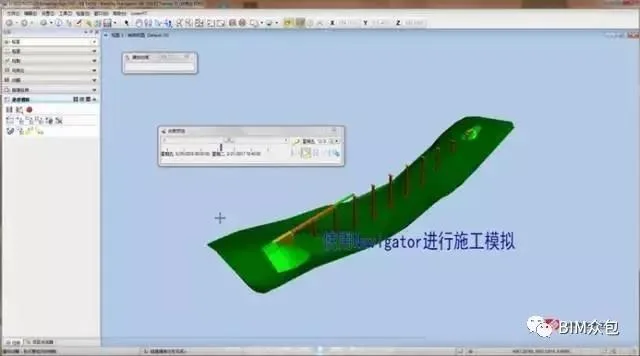
Figure 6: Construction Progress Simulation
3. Construction Process Demonstration
Given the complexity and multiple stages involved in highway construction, the project employs Powercivil integrated models combined with process timing data to virtually simulate construction in a digital environment.
This enables identification of critical points, preemptive solutions, continuous optimization of sequences and key milestones, and formulation of optimal construction plans. Animated displays of these processes help detect unreasonable elements, facilitate plan refinement, and support on-site briefings with workers and teams, boosting communication efficiency and ensuring quality.
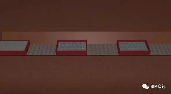
Figure 7: Screenshot of Culvert Construction Animation
4. Mid-Term Measurement
By importing the initial ledger into 5D construction management software, it automatically links with the BIM model. This allows adding detailed information such as quantities, construction dates, quality inspection photos, and physical completion images to each model component.
During measurement, marking completed portions exports current quantities, clearly indicating data completeness and whether concrete curing meets standards. This facilitates flexible adjustment of measurement reports per owner requirements.
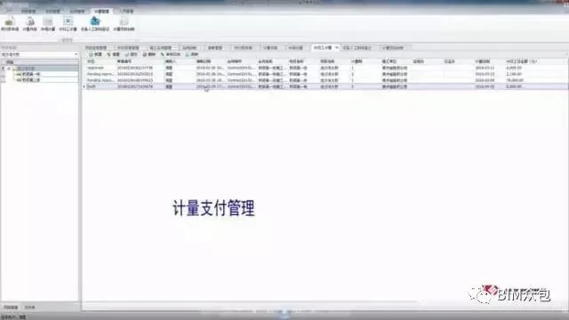
Figure 8: Mid-Term Measurement Management
5. Labor Subcontracting Settlement
Labor subcontractor names and component settlement prices are added as additional data within model sections. Filtering by subcontractor name simplifies management and settlement of labor contracts.
6. Contract Management
The 5D construction management platform categorizes contracts by entities such as suppliers and construction teams, attaching relevant details (names, signing dates) and documents (signed contracts, scanned copies). Accessible via the ProjectWise network platform, authorized project and company leaders can conveniently review contract information.
7. Material and Machinery Planning
By aligning the construction schedule with site-related data (e.g., concrete, steel bars, formwork), a material usage plan is generated. This supports efficient resource allocation based on project quantities, assisting in machinery deployment and material procurement decisions.
8. Accurate Engineering Quantities
BIM serves as a rich engineering information database, delivering precise quantity data essential for cost management. Leveraging this, computers can quickly analyze components, reducing manual work and errors.
This frees construction managers from repetitive calculations, allowing them to focus on improving management quality and project control.
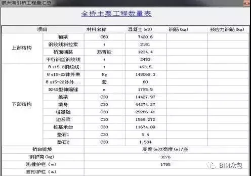
Road and tunnel quantities can be exported via software component commands; bridge and steel reinforcement quantities are also extractable.
These quantities assist in early cost estimation, design option evaluation within budget constraints, construction cost comparisons, pre-construction budgeting, and final settlement, optimizing material use.
Simultaneously, this enhances project cost analysis and control, supports business settlements and financial accounting, and helps maximize project profitability.


Must log in before commenting!
Sign Up