Hello everyone, here are some of my personal thoughts on the challenges currently present in traditional design. If there are any shortcomings, I welcome corrections and look forward to discussing them together.
Design Habits and Current Situation under the Traditional Mode
1. There are distinct divisions both between and within traditional design disciplines;
2. In each design phase, route design is constantly adjusted and optimized, often requiring rework across different specialties;
3. Data exchange between different professions and departments is chaotic and inefficient;
The Emergence of Collaborative Work Requirements
1. Multiple versions of drawings and numerous intermediate process files exist;
2. The workflow is long and cumbersome, limiting overall efficiency;
3. Current work efficiency has reached a bottleneck;
The BIM Concept as a Solution for Work Collaboration
1. Optimization within Route Design
The horizontal and vertical aspects of route design are no longer treated separately. Using three-dimensional terrain data, designers no longer have to rely on experience to visualize the original terrain when selecting routes. When designing a plan, they can simultaneously consider vertical sections, and vice versa, gradually achieving a more reasonable alignment.
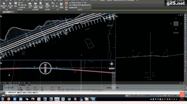
3D route selection allows designers to intuitively understand the surrounding conditions. The image below illustrates how optimization reduces the length of structures, minimizes farmland occupation, and limits the impact area of adverse geology. By considering multiple factors during route selection, route design quality improves, reducing subsequent modifications and rework.
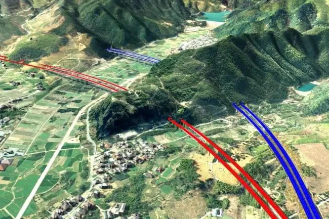
▲ Before optimization (blue) and after optimization (red)
2. Collaboration between Route and Roadbed Specialties
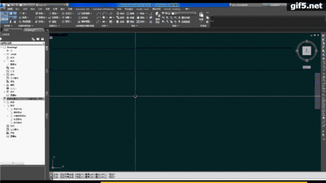
A central file is stored on the server instead of individual computers. Designers from various specialties modify their relevant files directly. Route designers upload the route to the server via data shortcuts, eliminating the need to copy or send files manually. Files automatically appear in the collaborative server folder.
Roadbed designers reference the route in their newly created drawings. Even if the route changes, synchronizing the reference updates the entire roadbed design automatically. Only the roadbed sections affected by route adjustments require redesign. Simultaneously, modifications to the roadbed are instantly reflected in the overall plan.
▲ Design files are managed on the server
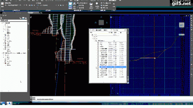
▲ Real-time updates of cross-sectional changes reflected in the floor plan
3. Collaboration between Routes and Interchange Specialties
Previously, collaborative design of various ramps for interchange lines was not feasible. With Civil 3D, multiple route horizontal and vertical designs can be handled within the same drawing. Vertical sections of each ramp are projected onto the new ramp, allowing efficient control over ramp nose elevation and simplifying the design of interchange line positions.
▲ Ramp elevation (white) and mainline connection (blue)
4. Collaboration between Route and Bridge Structure Specialties
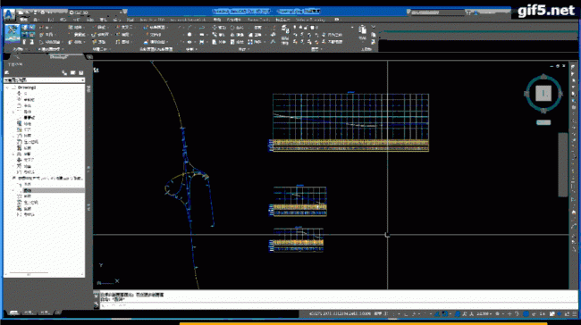
Similar to the roadbed specialty, after selecting the line position, simply specify the station number and drag to quickly lay out structures along the route. When adjusting the alignment, moving the station number of a structure adjusts it in conjunction with the roadbed excavation, enabling rapid modifications.

▲ Quickly modify station values and adjust structures
5. Improvement in Coordination Across Disciplines and Drawing Production
Drawings for route, longitudinal, and subgrade specialties are based on the created model. When the model is modified, corresponding drawings update automatically, eliminating the need for manual redrawing. Design changes are made simply by modifying the model, and related cross-sectional drawings refresh accordingly.
▲ Cross-section updates corresponding to line position modifications


Must log in before commenting!
Sign Up