The Integration of BIM and 3D GIS in the Energy Industry
Chai Jing’s documentary Under the Dome, released in 2015, not only sparked widespread public discourse but also challenged prevailing perceptions of air pollution, particularly haze and smog. While petroleum and petrochemical industries remain essential energy sources for our survival, they have increasingly become significant threats to human health. In response to the severe haze challenges in recent years, major energy companies like PetroChina, Sinopec, and others involved in natural gas, coal, and electricity have placed greater emphasis on sustainable development. The adoption of “Smart Energy” concepts and technologies has become an urgent priority, highlighting the advantages of integrating Building Information Modeling (BIM) with 3D Geographic Information Systems (GIS).
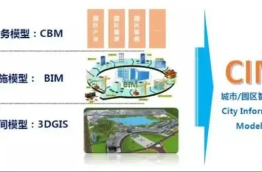
BIM offers powerful features such as information visualization, realistic construction simulation, and precise cost estimation, making it invaluable in managing buildings and facility construction. However, its scope alone is insufficient to meet the fast-evolving demands of the energy sector. “Smart Energy” requires a comprehensive, one-stop solution encompassing data acquisition, processing, and application. Therefore, relying solely on BIM or 3D GIS is no longer adequate. Instead, integrating BIM across multiple stages of the industrial chain, supported by 3D GIS, is essential to advance the energy industry while promoting energy conservation and emission reduction.
Case Study: Petroleum Industry Applications
Skyline serves as a leading software platform in the 3D GIS field, offering mature BIM support. Let’s explore a classic example of BIM and 3D GIS integration within the petroleum sector. The China Petroleum Geographic Information System (A4) is a 3D data sharing service platform developed on Skyline, covering the entire petroleum industry chain—from exploration and development to collection, refining, and transportation.
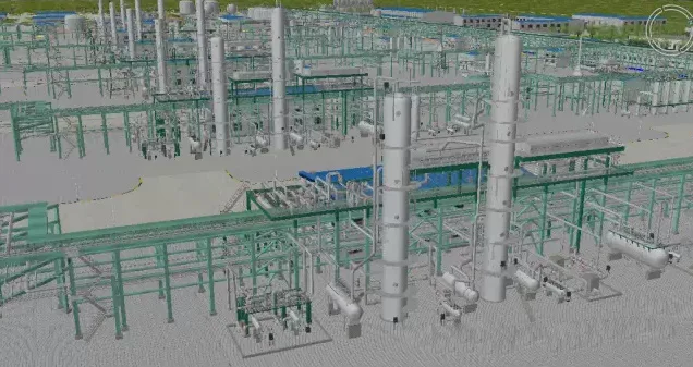
Skyline’s robust 3D capabilities enable key business functions such as spatial analysis, joint measurements, automated pipeline generation, geological data integration, and collision detection. Effective management and construction of building facilities require the incorporation of BIM models. For instance, BIM is utilized in constructing survey platforms during oil exploration, building oil wells in the collection phase, and developing refining facilities in the smelting stage. This integration enhances project cycle management by combining BIM’s material time attributes with Skyline’s engineering cycle simulation, allowing for detailed construction process simulation, early identification of issues, and reduction of unnecessary economic losses.
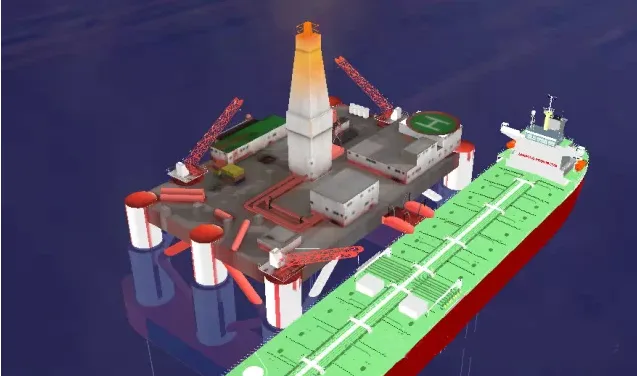
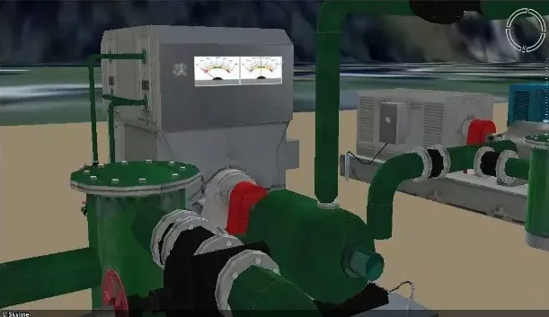
BIM Model – Building Oil Wells
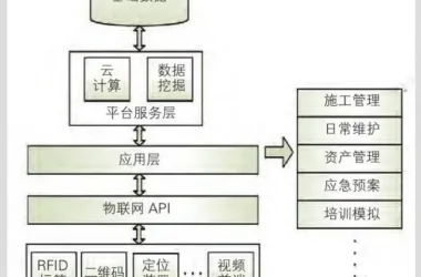
All assets—whether visible or hidden—within building facilities can be managed and queried efficiently. This includes maintenance personnel schedules for drilling facilities and detailed repair records. When equipment malfunctions, maintenance staff can be quickly contacted to assess the situation. Historical repair documentation helps improve work efficiency and reduce operational costs, making the entire industry chain more comprehensive and manageable.
Asset Management 1
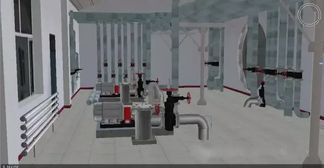
Asset Management 2
The petroleum industry is prone to accidents, making the integration of Internet of Things (IoT) data critical for security monitoring. Skyline not only supports IoT data access but also offers powerful emergency response planning capabilities. By integrating BIM data, it enhances the effectiveness of IoT information and emergency command systems.
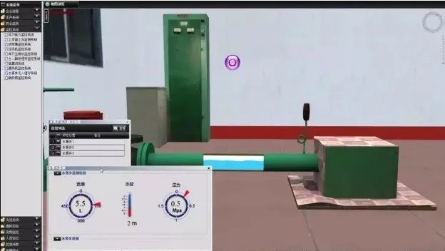
Monitoring Information & Intervention Equipment
For example, when a fire is detected in refining equipment, combined with Skyline’s 3D positioning technology, the exact location of the emergency can be quickly identified. Leveraging BIM’s comprehensive equipment data, responders can determine the appropriate firefighting methods, execute emergency commands promptly, and minimize economic losses.
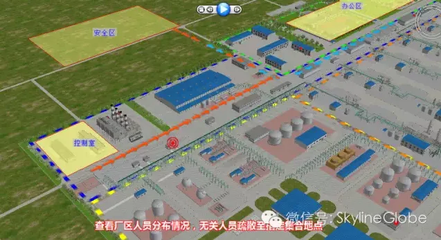
Emergency Command Interface
Summary:
The A4 project exemplifies the successful integration of BIM and Skyline technology within the petroleum industry, marking a new milestone for the energy sector. We look forward to continued support from relevant authorities to fully realize the vision of smart energy.


Must log in before commenting!
Sign Up