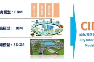
With the rapid advancement of Building Information Modeling (BIM) technology, more design firms, construction companies, and project owners recognize BIM’s significant role in enhancing productivity, reducing costs, and shortening construction timelines. In China, the current focus of BIM application mainly revolves around integrating individual buildings and pipelines, while its use in site design remains limited. This article offers a brief overview of the exploration and implementation of BIM for site design within an ongoing project.
Project Overview
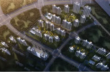
This project involves developing a school in a mountainous region of Fujian, spanning approximately 1,500 acres with a total investment of 3 billion yuan. The planned construction area covers about 560,000 square meters. The project is scheduled to be completed in four phases. One phase includes a construction area of around 110,000 square meters. Currently, the first phase’s individual buildings have been topped out, and outdoor construction is underway. Additionally, construction drawings for some buildings and roads in Phase II have been finalized.
Exploring BIM Applications
Mountainous projects demand careful ecological consideration due to their sensitive environments and varied terrain. Minimizing mountain disruption, protecting vegetation, preserving hydrological conditions, and maintaining natural terrain integrity during construction are critical. Therefore, site design must address multiple factors from the outset, particularly the vertical design scheme, which plays a key role.
During the early and overall outdoor construction drawing stages, Autodesk Civil3D was primarily used for site analysis, modeling, and drafting construction drawings. Below is a summary of its application in several key areas.
1. Preliminary Terrain Analysis and Plan Optimization
In the initial design phase, especially in complex terrain projects, analyzing the original site conditions is essential. This foundational understanding guides the design process. While various terrain analysis software options exist, Civil3D was chosen for its ability to quickly and accurately analyze elevation, slope, and aspect early on (Figure 1). More importantly, as the design advances, the models and analyses created can be refined and extended through subsequent stages, culminating in detailed construction drawings.

Figure 1: Analysis of original site elevation, slope, and aspect
2. Application in Mountain Road Design
Road design is typically prioritized early in mountainous projects since a well-planned road network greatly benefits construction progress and cost savings. Therefore, developing an efficient road plan during the preliminary stages is crucial. The quality of the road design depends not only on its aesthetics but also on minimizing the required quantity of roadwork. This requires the ability to quickly visualize the road’s final form and estimate work volumes during plan adjustments.
Civil3D effectively addresses these challenges. It allows roads to be integrated visibly with original terrain (Figure 2) and enables rapid calculation of construction quantities. Any adjustments to the road’s alignment or elevation are automatically synchronized across related data, facilitating efficient plan revisions. This capability improves both efficiency and the quality of integration between roads and the site (Figure 3).
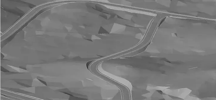
Figure 2: Integration of road design with original terrain
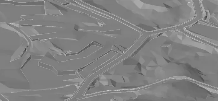
Figure 3: Relationship between site construction foundation pit and road
Transforming preliminary plans into construction drawings is a major efficiency challenge for designers. Civil3D simplifies this process by converting conceptual road designs into detailed construction drawings with minimal additional work. This greatly enhances productivity. Figure 4 shows the road construction drawings produced by Civil3D for the project’s first phase.
Figure 4: Construction drawing of Phase I road for the school project
3. Overall Outdoor Site Application
Traditionally, determining the overall elevation for outdoor buildings relied heavily on experience and imagination. Now, Civil3D’s modeling capabilities allow detailed visualization of these concepts (Figures 5 and 6), providing direct feedback on design feasibility. Moreover, the surface models created can be directly used for earthwork calculations and site leveling with high accuracy, reflecting real conditions. Following refinement, these models expedite the completion of construction drawings (Figures 7 through 10).

Figure 5: Relationship between individual elevation, original terrain, and designed roads
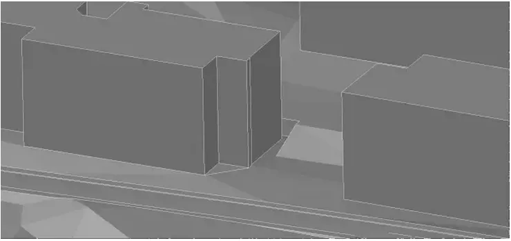
Figure 6: Relationship between elevation and site after completion of individual units
Future Prospects of BIM in Projects
Currently, this project focuses on exploring and applying BIM during the conceptual and overall outdoor design phases. The next step involves integrating BIM models of individual buildings, structures, pipelines, and other elements into the site model. This integration will enable comprehensive information modeling from the site level through to individual building components, realizing the full potential of BIM.


Must log in before commenting!
Sign Up