In Dual Thinking on Urban Coordinates (Part 1), we explored the design concept behind the Wuhan Yangtze River Center International Competition. The plan featured a city grid that prioritized full public accessibility and the creation of an inclusive “urban gathering place.”
By mid-2024, we were honored to receive a new commission from China Resources Land, the project owner, to develop a fresh design. Working within the spatial layout they provided, our focus shifted to defining a new commercial positioning: a comprehensive urban community blending an art center, commercial towers, hotel, and office spaces.
△ Transition from competition design to implementation plan
This article continues our reflection—from open-ended concepts to concrete implementation—on the questions: What are urban coordinates? and How are they defined? We explore a feasible approach that balances government planning, development needs, future occupant experiences, and the public interest. Construction began in August, with the art center now completed and operational.
What Are Coordinates?
Diverse Interweaving and Heterogeneous Neighborhoods
Public accessibility remains central to our vision for new urban coordinate buildings. In the competition plan, the idea of “urban gathering places” was realized by activating dynamic public spaces within the neighborhood. In the implementation plan, as the program evolved and usage needs became clearer, “openness” was reinterpreted as a multidimensional spatial narrative. This includes the complex interplay between public and private spaces as well as the integration of crowd flow and mixed-use functionalities.
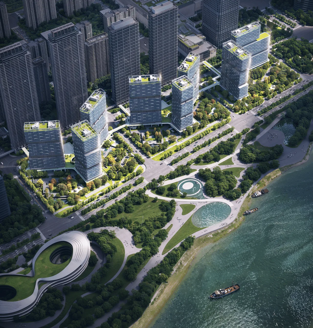
△ General layout plan
How can we balance these complex and diverse demands to achieve efficient urban connectivity, shared landscape resources, and public vibrancy? This question drives our understanding of “what coordinates are.” As the project shifts from a high-end office park to a mixed-use community, our definition of “coordinates” evolves from a broad “urban gathering place” to a more focused daily “residential neighborhood.”
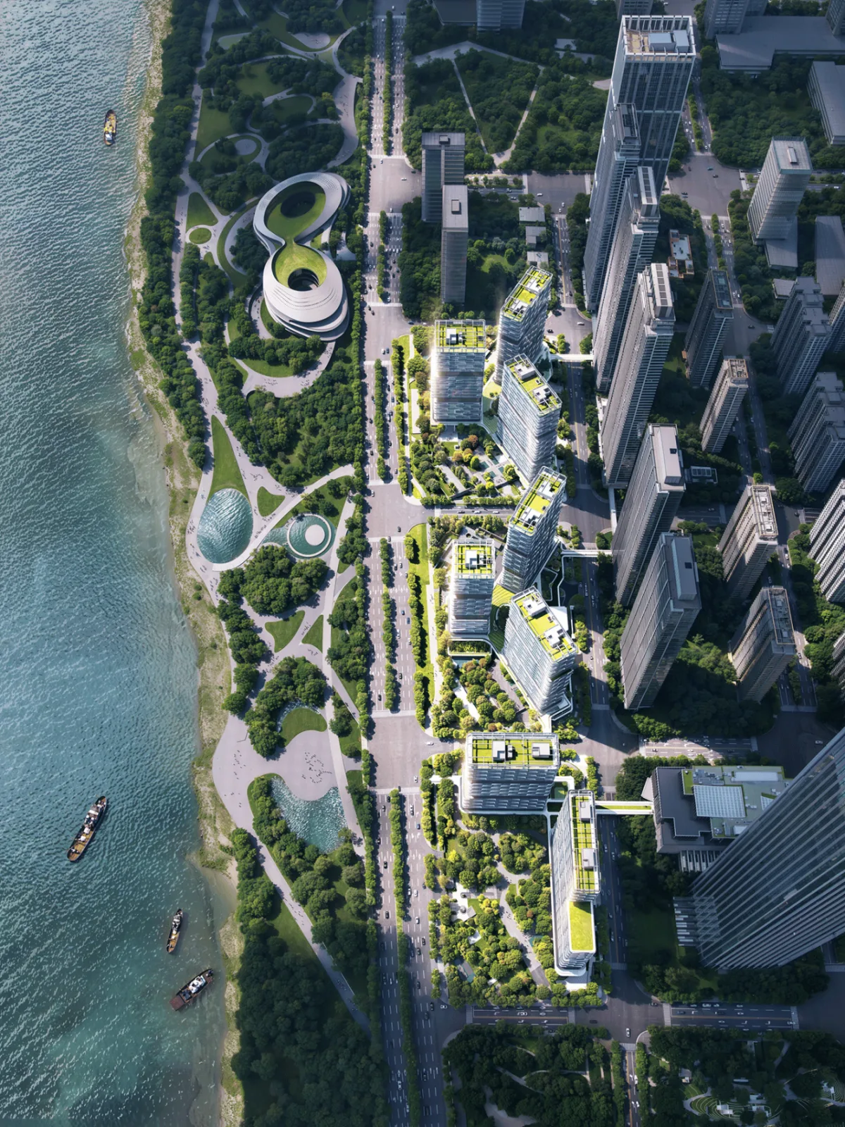
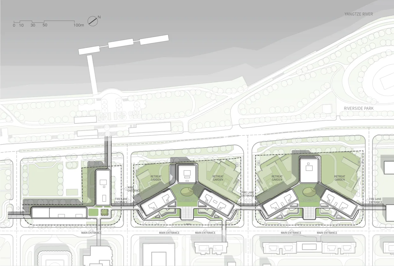
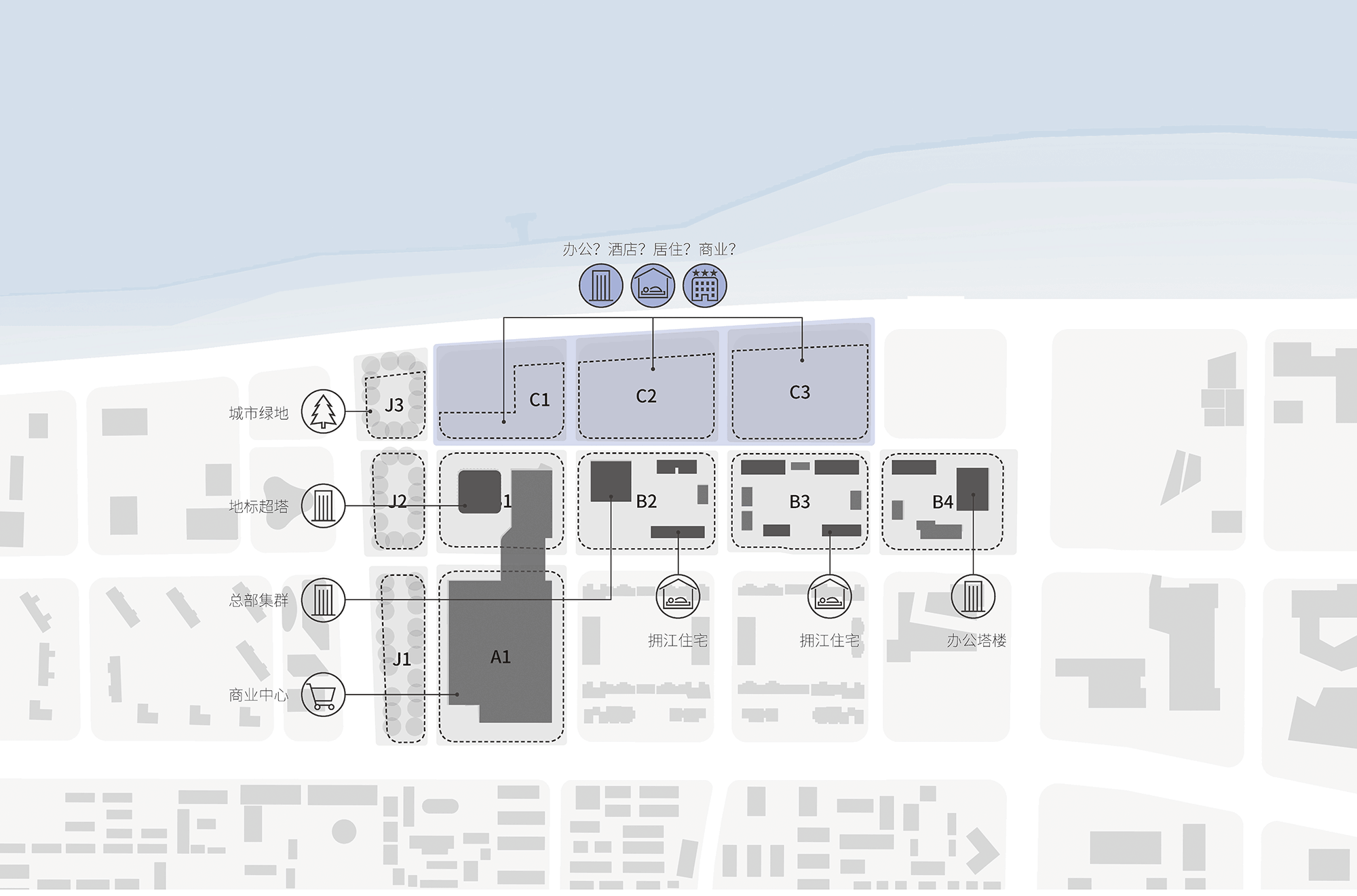
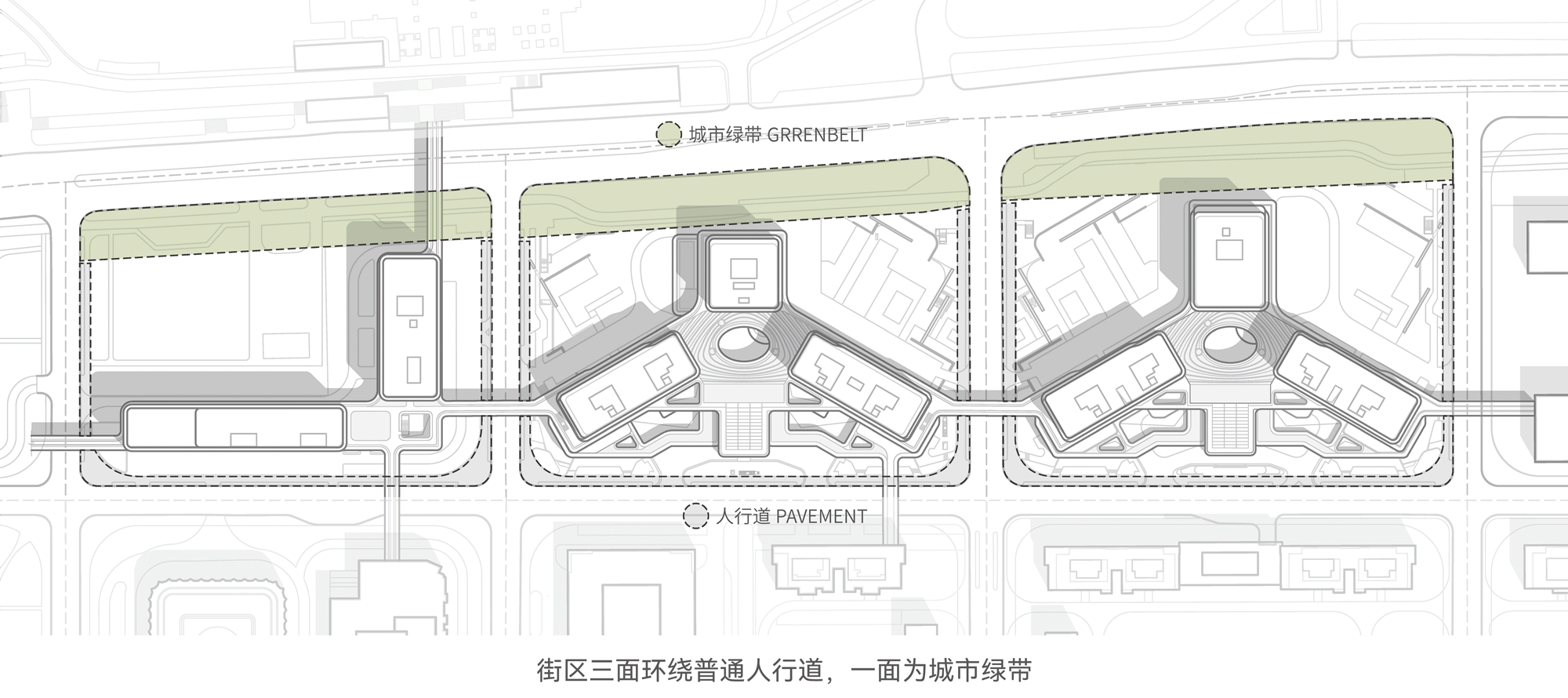
Unlike the urban grid integration featured in the competition plan, the owner’s designated “double Y-shaped + L-shaped” configuration forms a unique spatial structure within the grid city. We continue to apply a three-dimensional zoning approach and the concept of a “habitat chassis” introduced in the competition plan. At a human scale, we optimize scale and spatial guidance to reduce feelings of distance and alienation caused by heterogeneous layouts. On a broader scale, we establish urban coordinates that combine distinctive architectural forms with efficient accessibility. This “habitat chassis” is key to multi-level, multi-stream operations that foster interaction among different commercial formats and direct diverse user groups.
△ Planning analysis
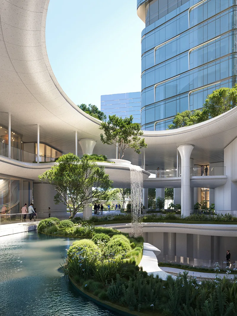
As the project’s functional positioning becomes clearer, the demands for privacy and publicness from different user groups also become more defined. This drives our ongoing effort to create natural habitats within the design as a means to resolve spatial conflicts. Through a multi-level and flexible landscape strategy, the building embraces the river landscape and harmonizes with its surroundings. It integrates seamlessly into the site and waterfront green belt, achieving openness and visual and functional engagement with the environment.
△ Natural habitat
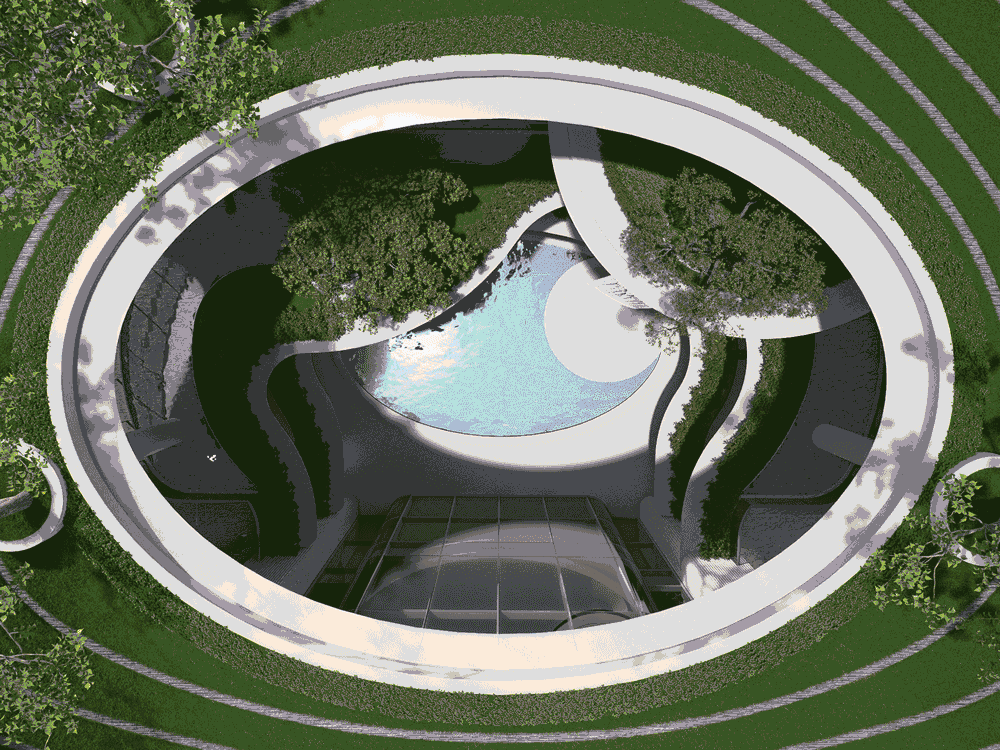
△ “Ring of Vitality”
How to Coordinate?
Heterogeneity, Generativity, Multidimensionality, and Publicness
Building on the ideal of convenient access, human scale, diverse uses, and open spaces proposed in the competition’s “City Gathering Field,” the refined “Heterogeneous Neighborhood” plan continues to address the relationships between city, block, and space scales. It focuses on layout adjustments, scale coordination, spatial strategies, and layered experiences—from full openness to multi-level openness—maximizing integration with the environment and sparking new vitality.
Heterogeneity: Varied Textures at Appropriate Scales
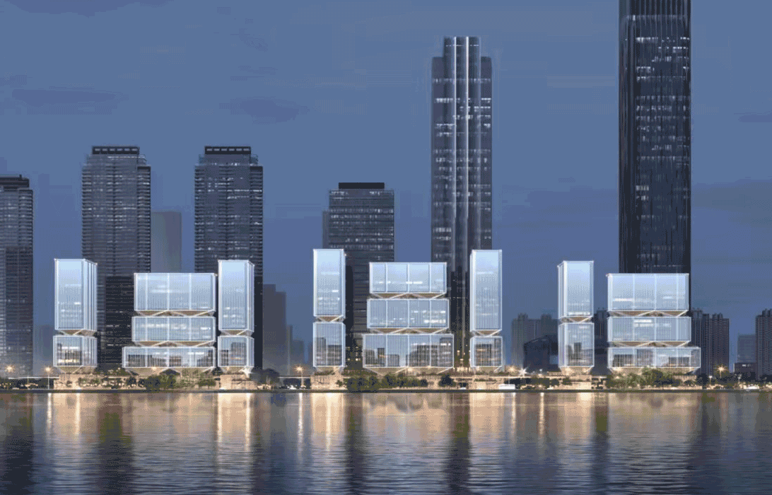
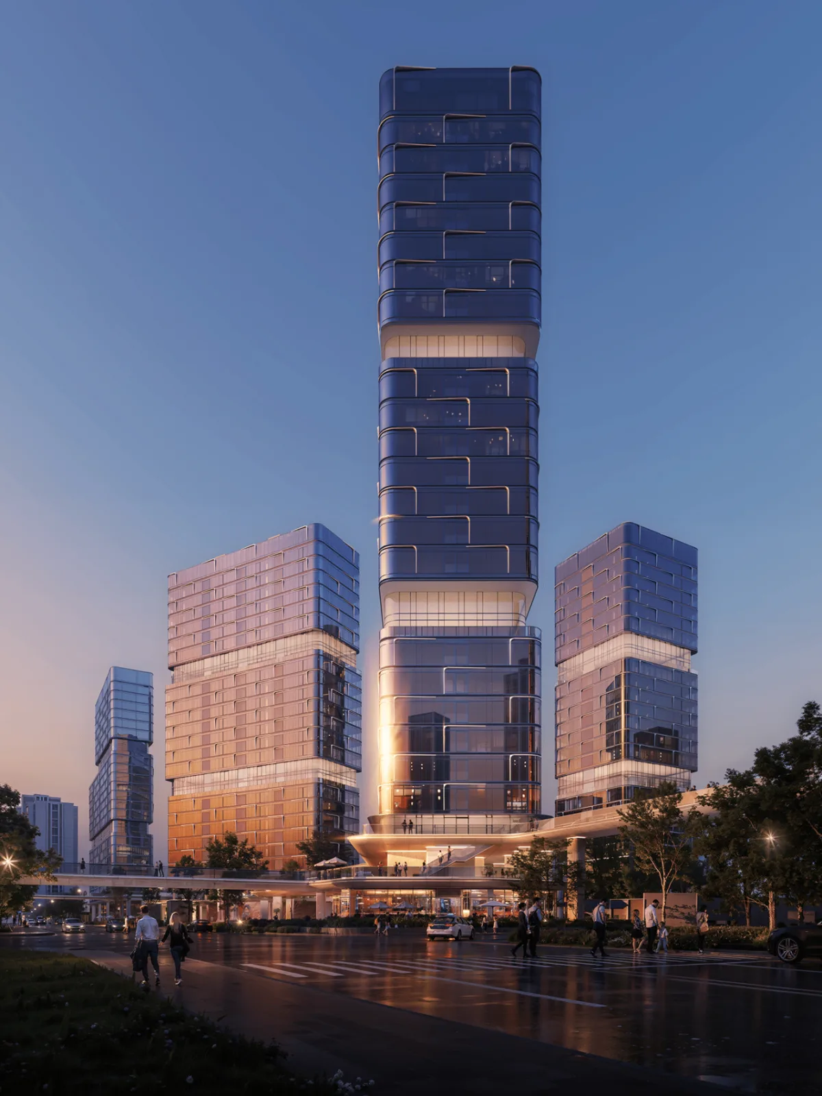
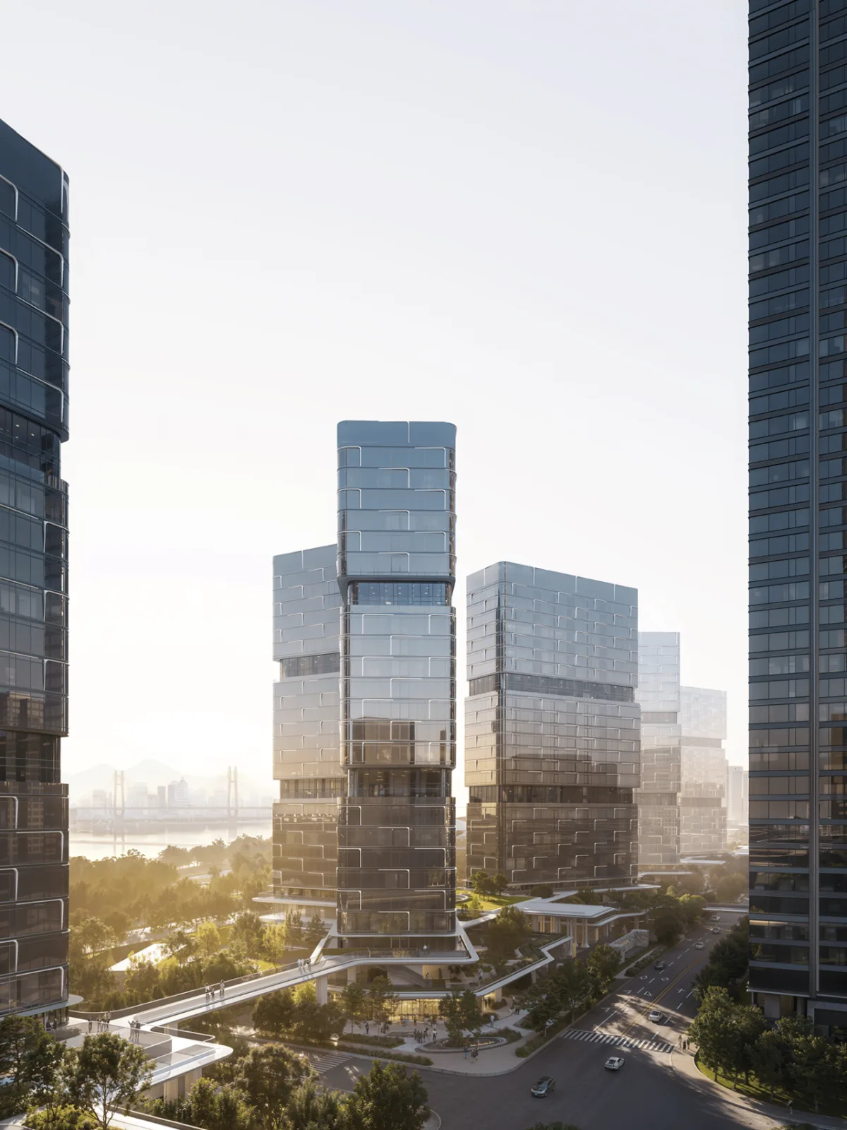
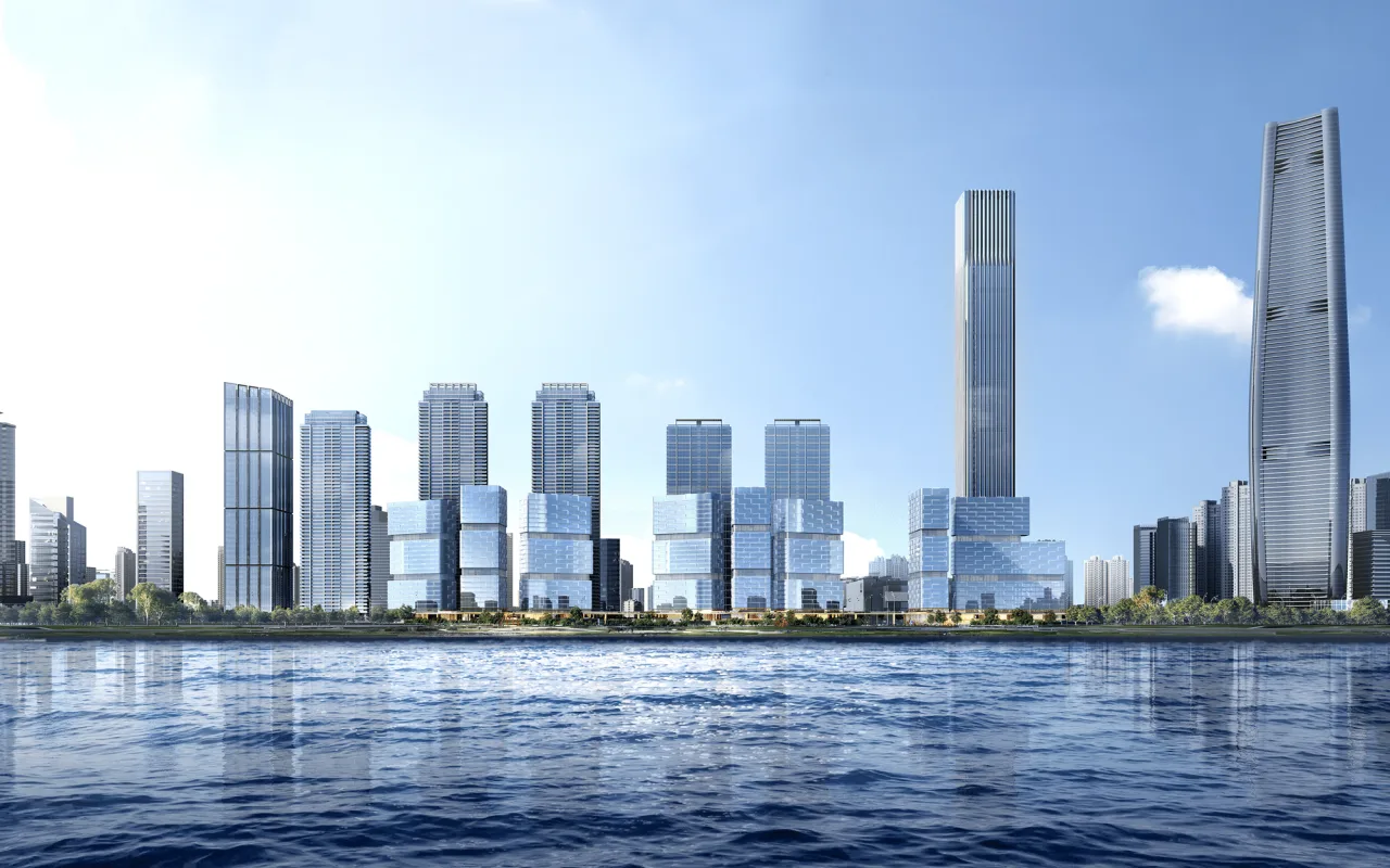
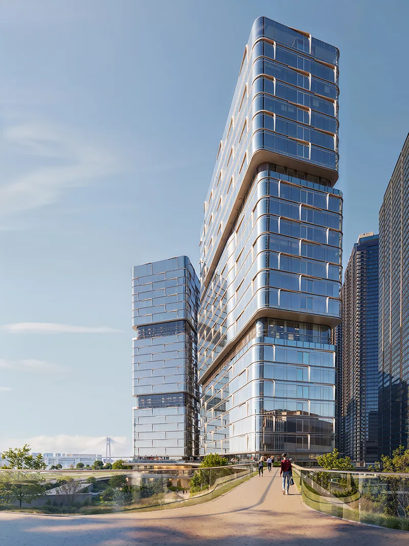
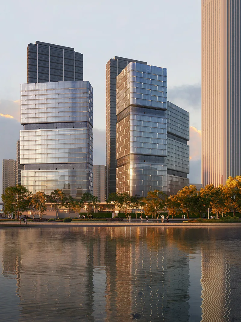
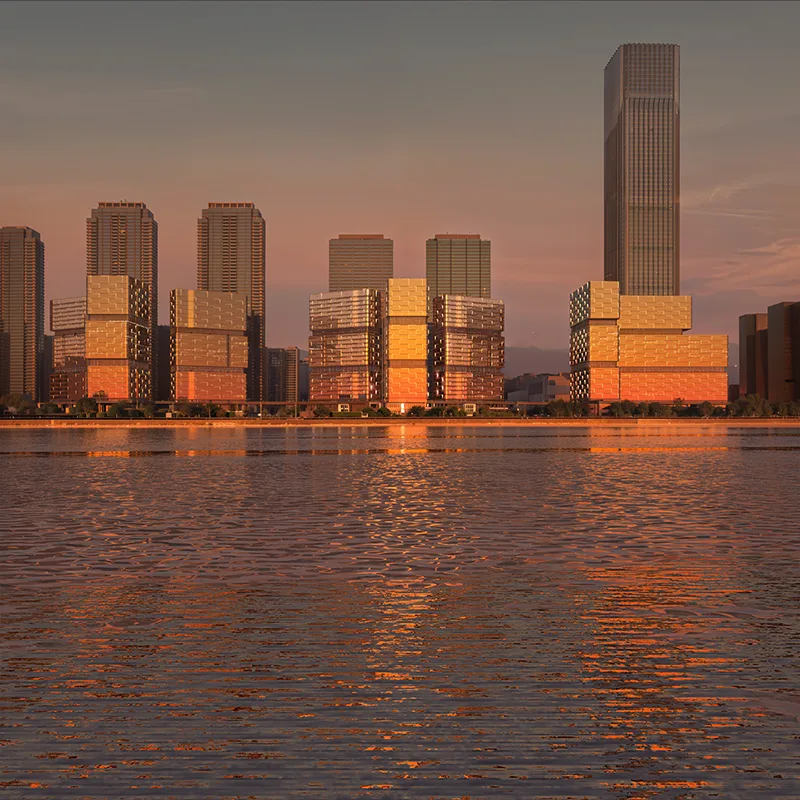
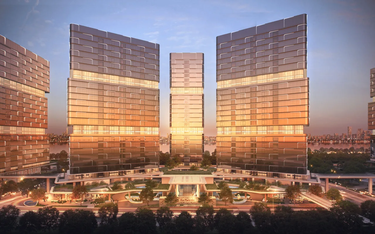
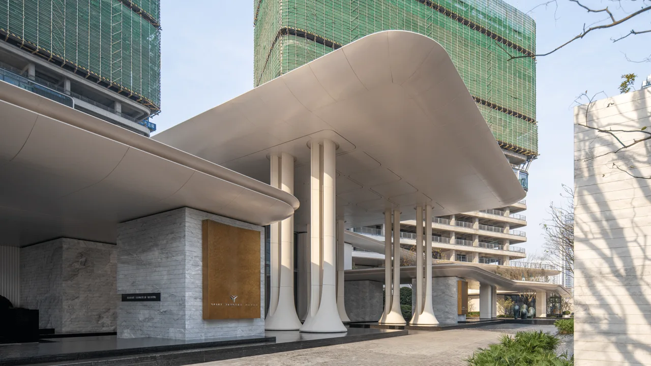
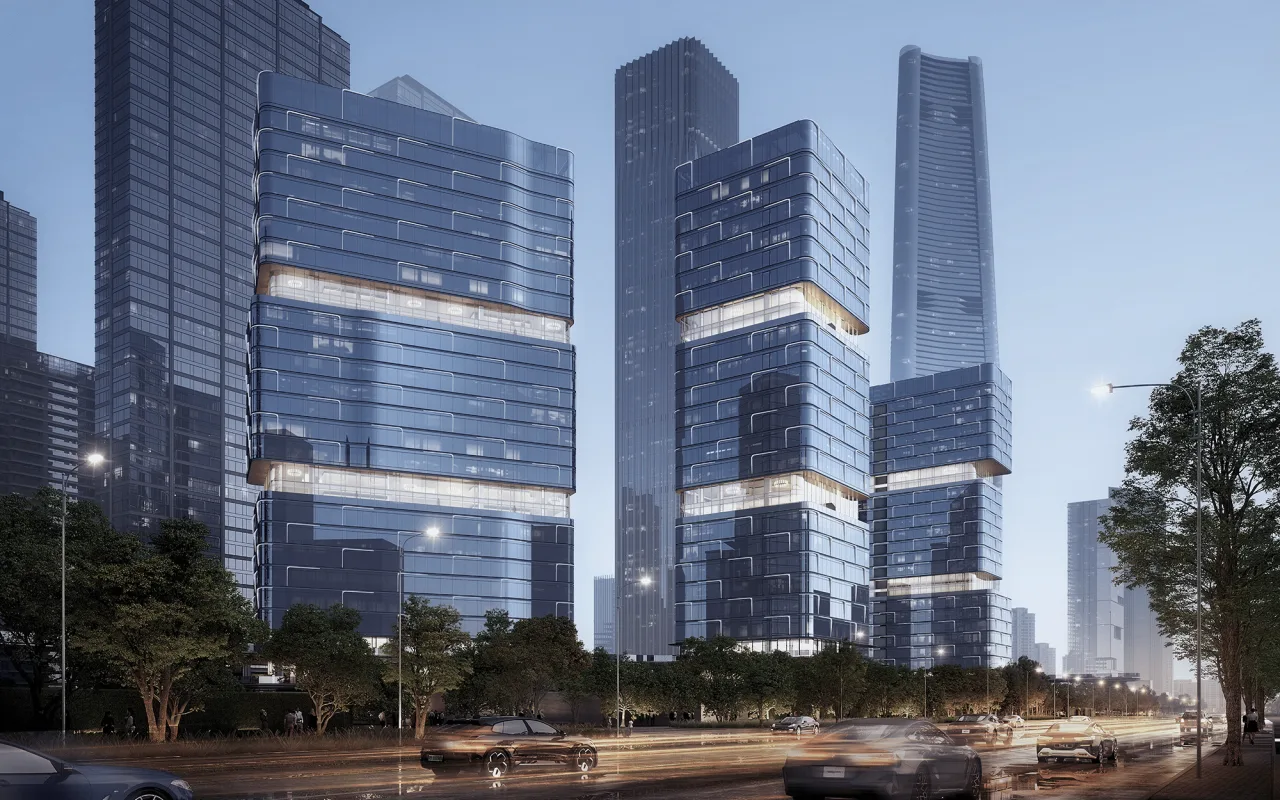
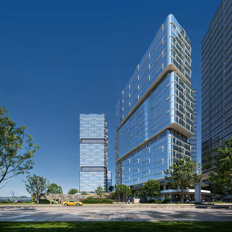
The overall architectural concept continues the “Yangtze River Painting Screen” group image style introduced in the competition. Individual buildings maintain a vertical three-section volume division. The eight panel towers are designed as segmented blocks with front and rear setbacks, expanding outdoor terrace spaces and optimizing horizontal scale. This strengthens the relationship between the buildings and the river, creating a dynamic and rhythmic skyline.
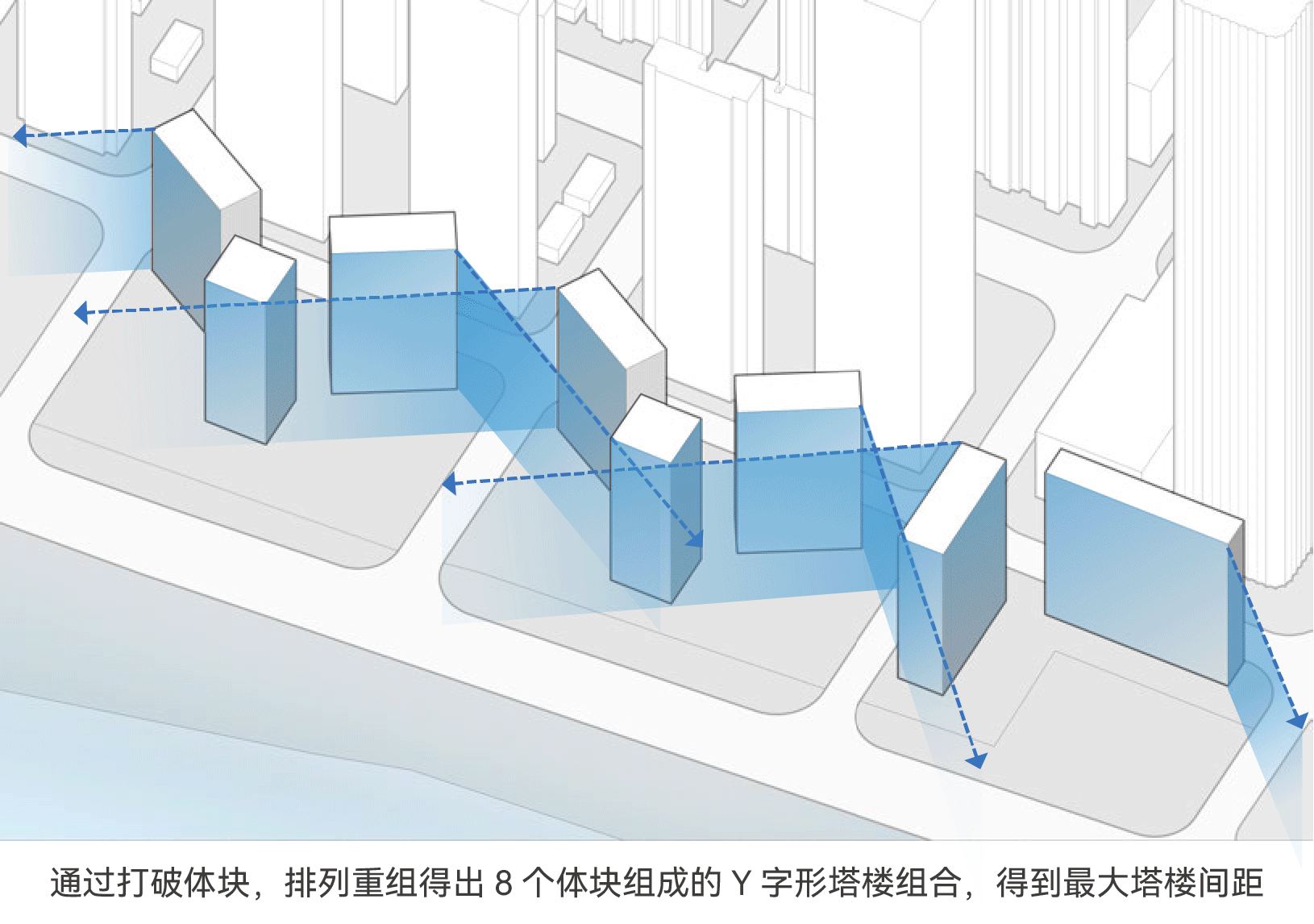
△ Shape generation
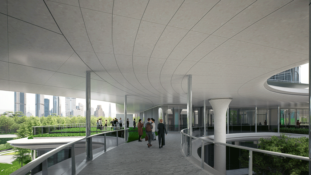
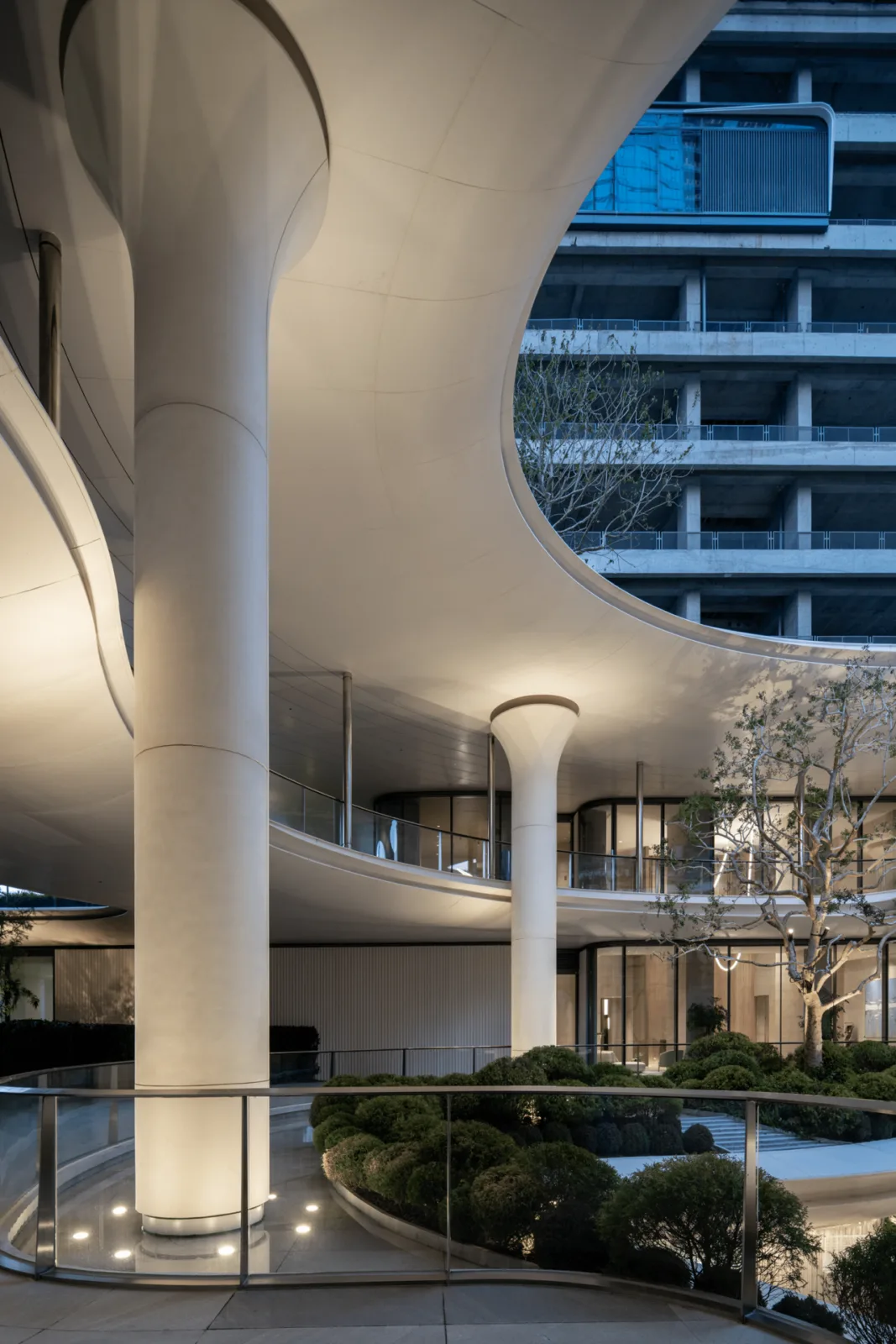
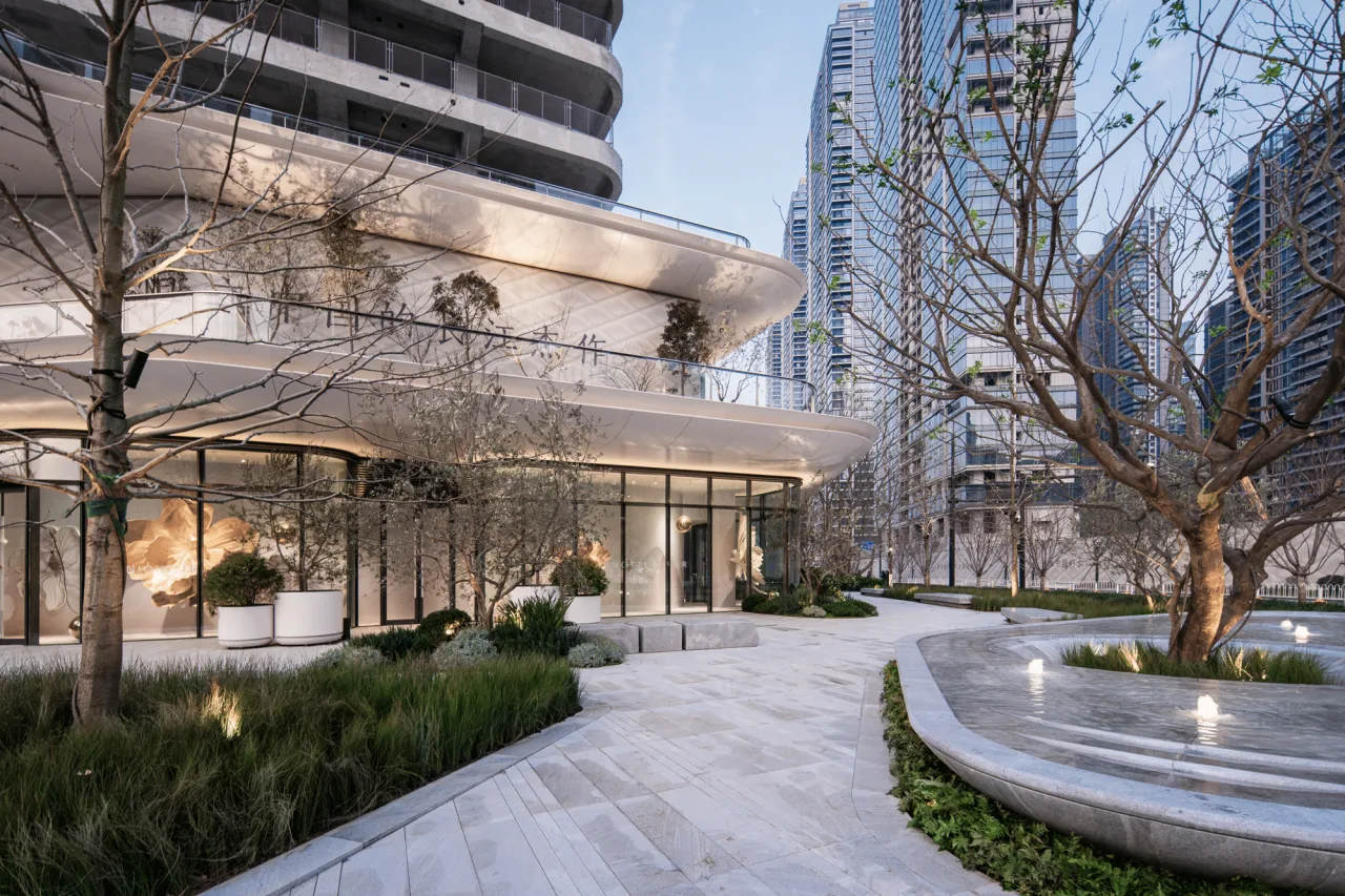
The “habitat chassis” at the lower levels connects the eight towers, nearby communities, and the riverside green belt through a three-dimensional circulation system. The ground floor forms an open block along the street, while a community highline park is situated 10.5 meters above ground. This approach creates a more approachable urban scale featuring commercial spaces, an art center, staggered sky streets, and green areas that break down building volumes.
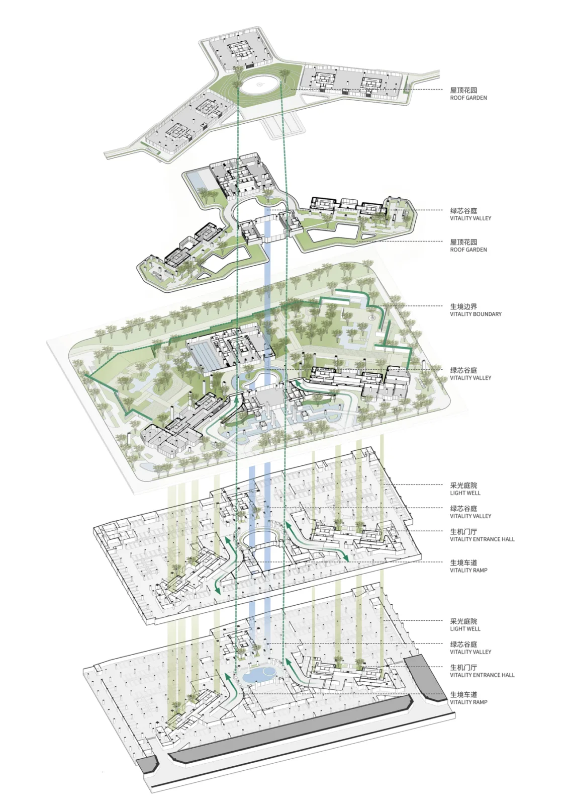
Habitat Chassis Concept Analysis
△ Habitat chassis
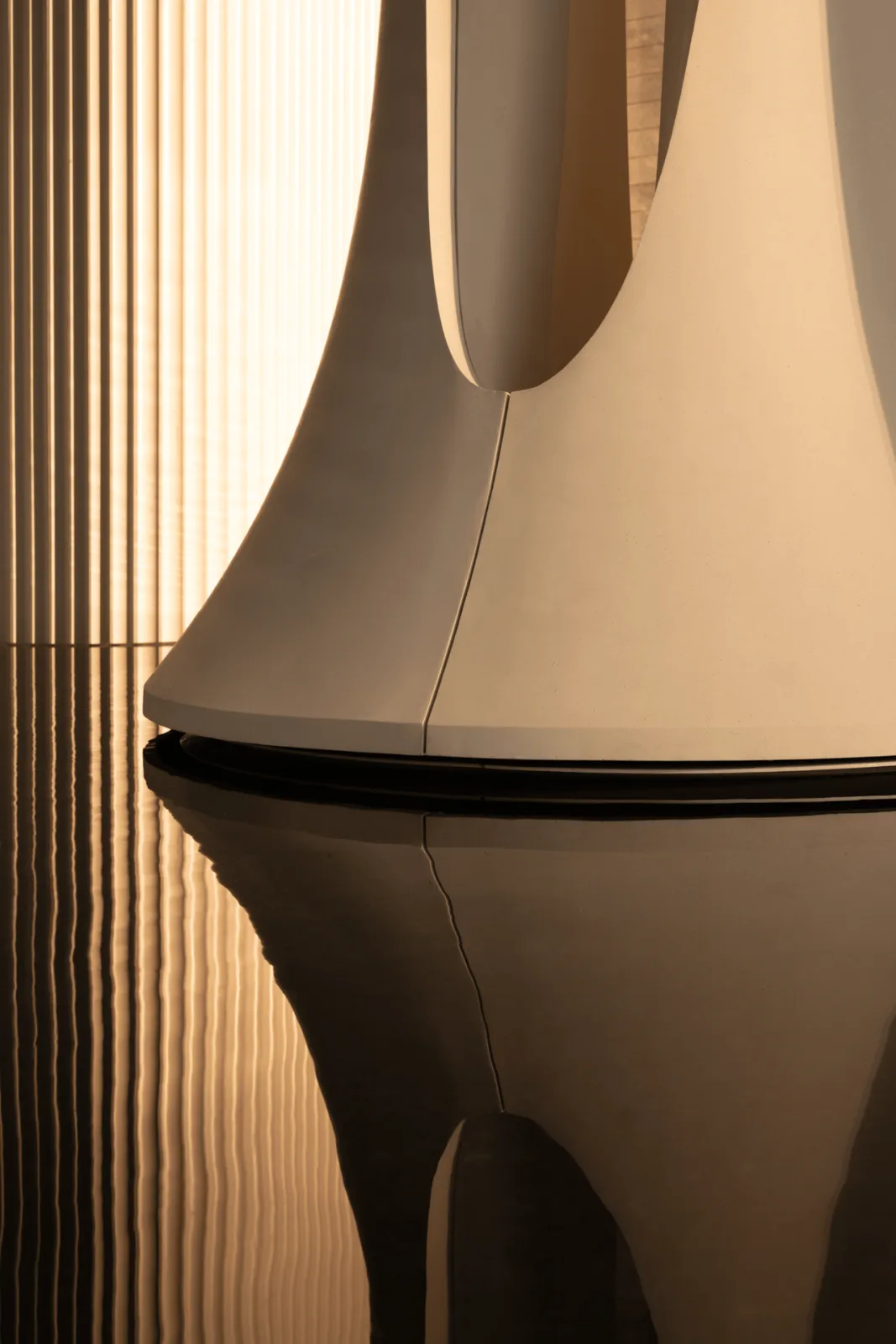
When designing the riverside architecture for Wuhan, we naturally drew inspiration from the Yangtze River’s water patterns and their cultural significance. The rippling waves inspired the rhythmic facade language, while glass curtain walls mirror the expansive river surface, recreating the shimmering effect of sparkling water.
Research revealed that the metal elements of the curtain wall echo the texture of “Ten Thousand Hectares of the Yangtze River” from Song Dynasty painter Ma Yuan’s Twelve Volumes of Water Painting. This unique link allows the historical imagery of the Yangtze River to be reinterpreted in a modern urban context.
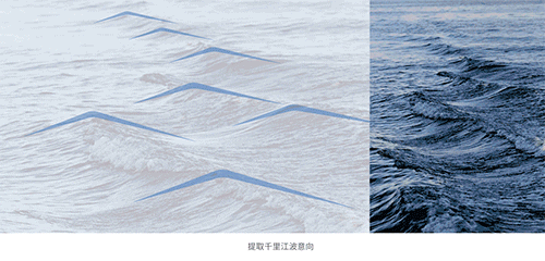
△ Facade concept
Xiangsheng: Centripetal Layout and Vitality Loop
The Y-shaped layout from the early urban design creates a stable, private relationship among the three towers on a single plot, forming a concentric enclosure.
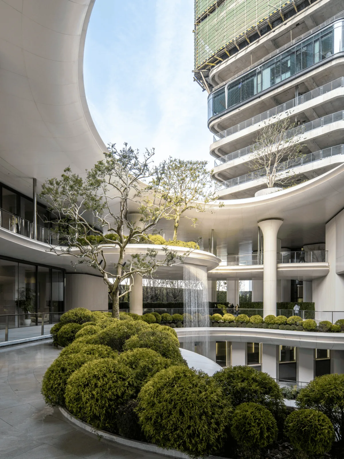
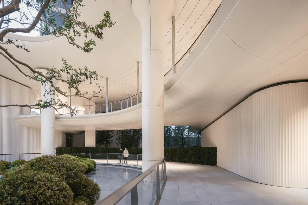
Centered on the landscaped courtyard, we designed two “vitality loops”: the waterfront green belt – Chuijiang pedestrian corridor – railway, and the cultural corridor forming the outer ring of the open block. These “rings of vitality” connect the park’s interior and exterior, gradually opening the space and effectively directing pedestrian flows with diverse functional needs.
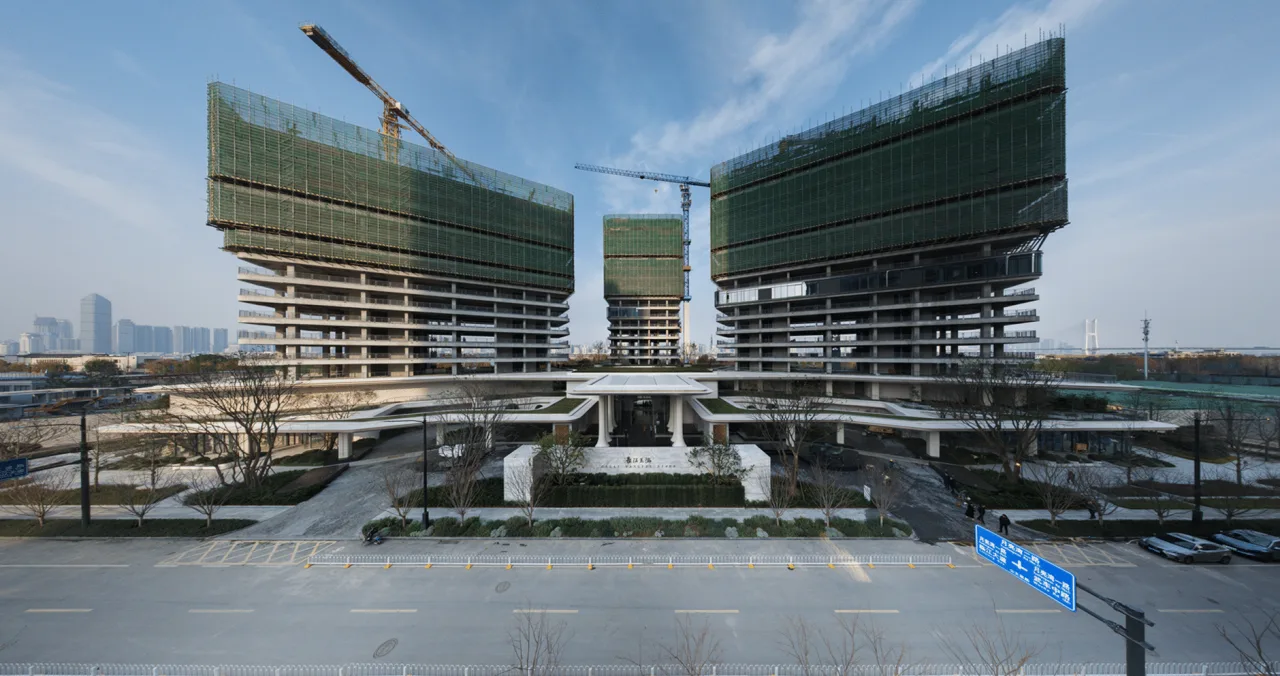
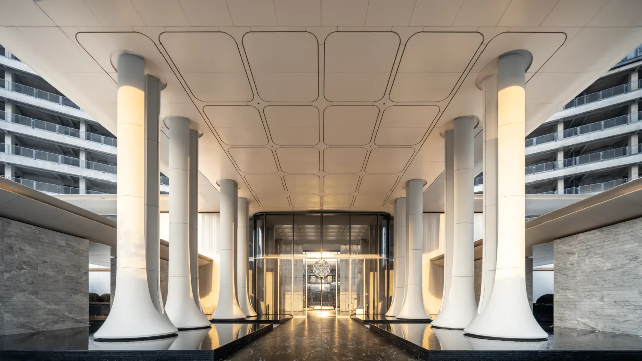
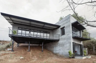
△ From design rendering to real-life scene
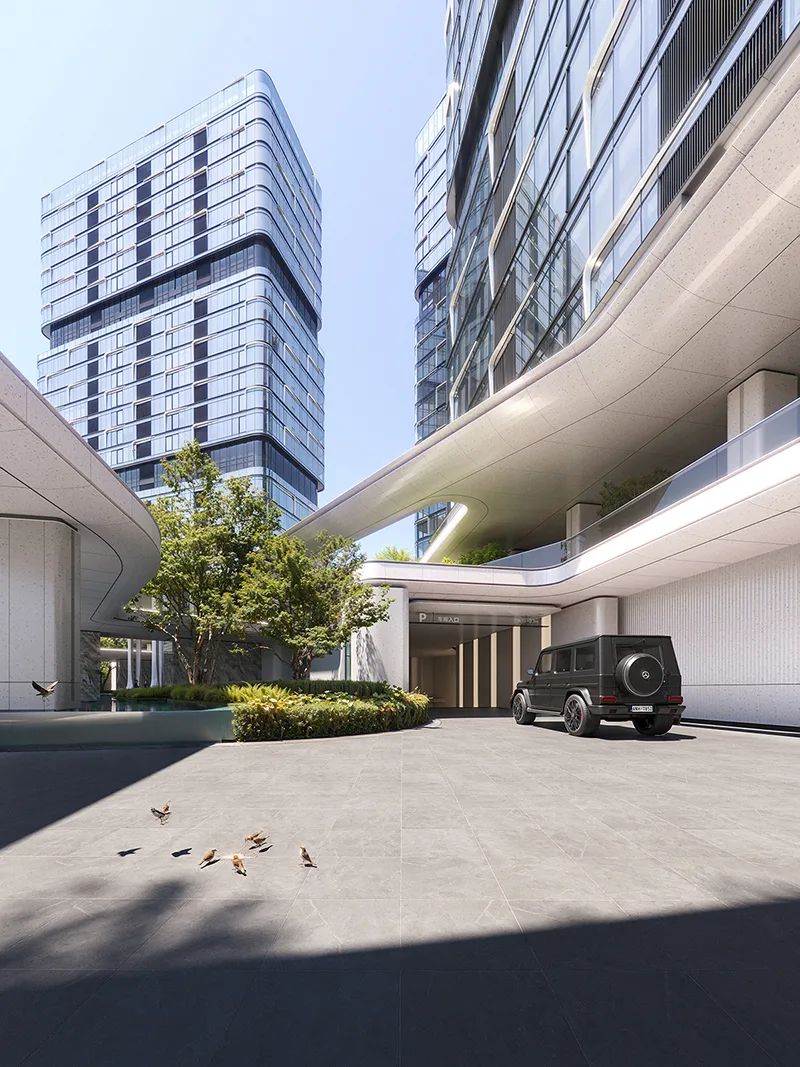
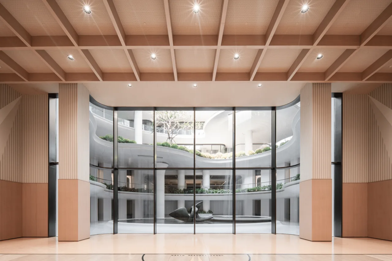
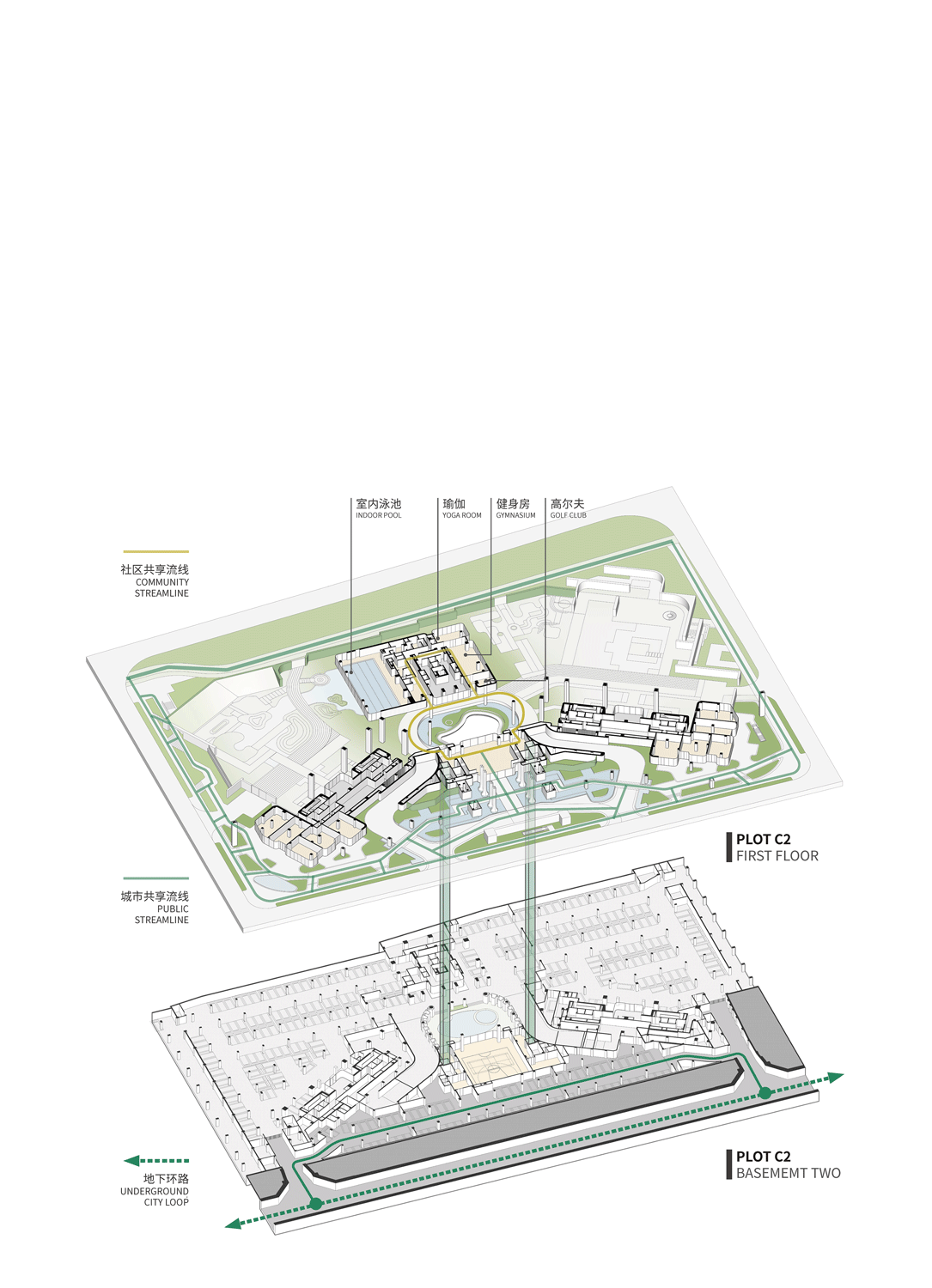
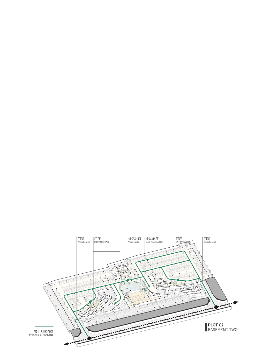
For example, in plot C2, the underground second-floor basement connects to the area’s underground ring road, freeing some parking spaces for city use. Urban residents can access shared functional spaces within the “Ring of Vitality” via public garages, underground multifunctional halls, or the art center’s main street entrance. The ground level incorporates commercial zones, a railway cultural corridor, and the Chuijiang pedestrian corridor shared with the city.
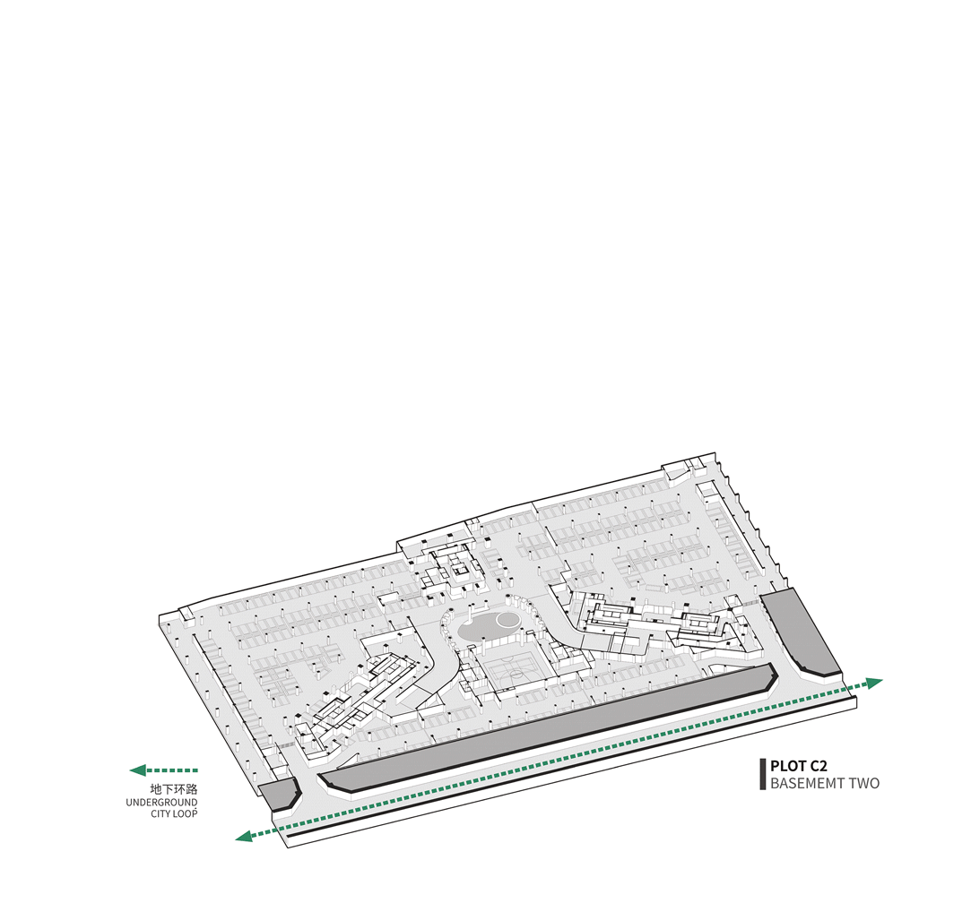
△ Urban open flow path
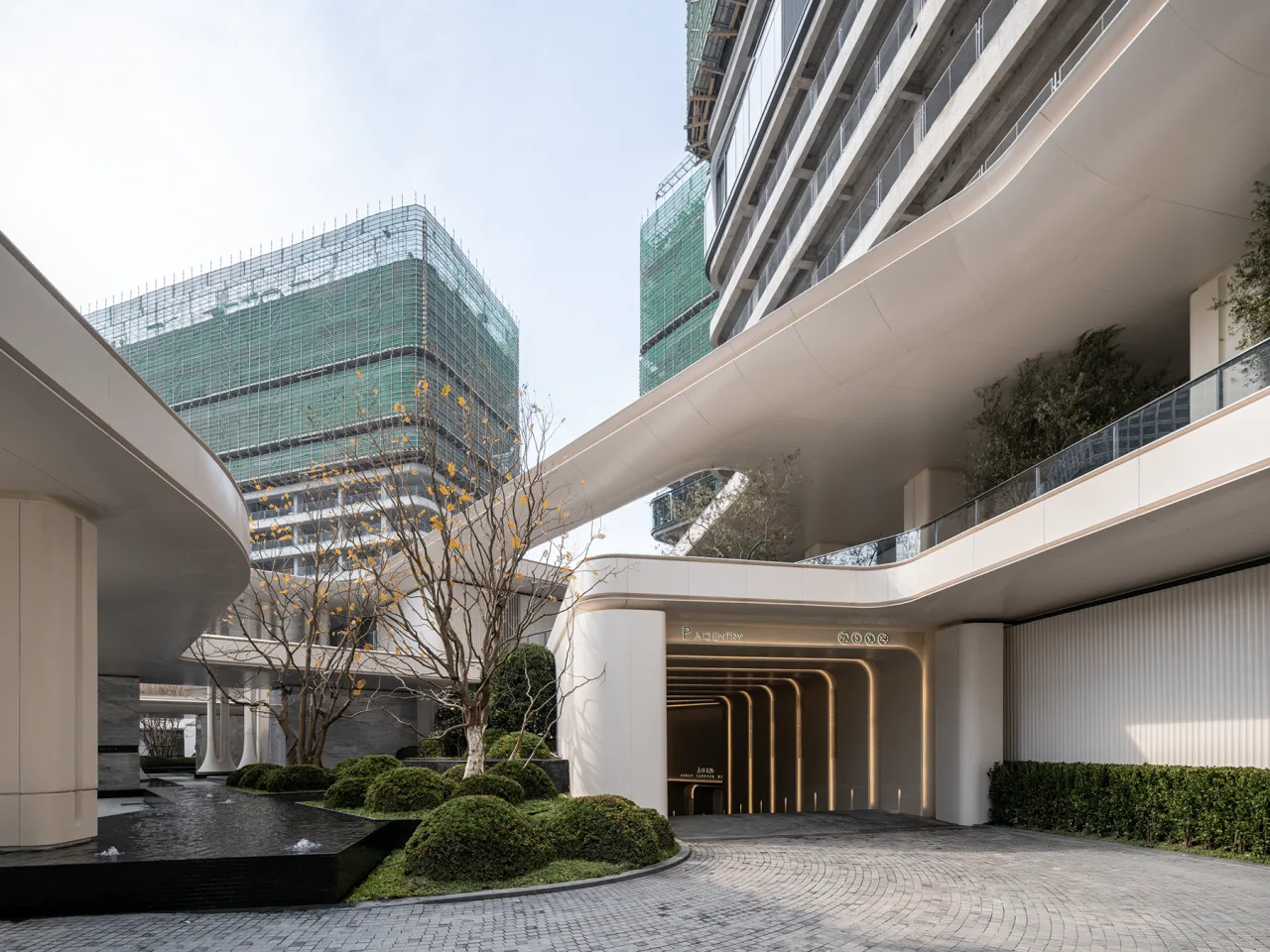
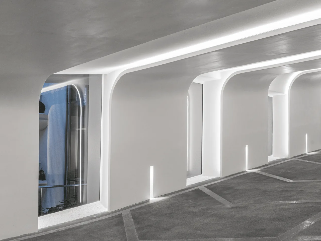
△ Parking lot entrances
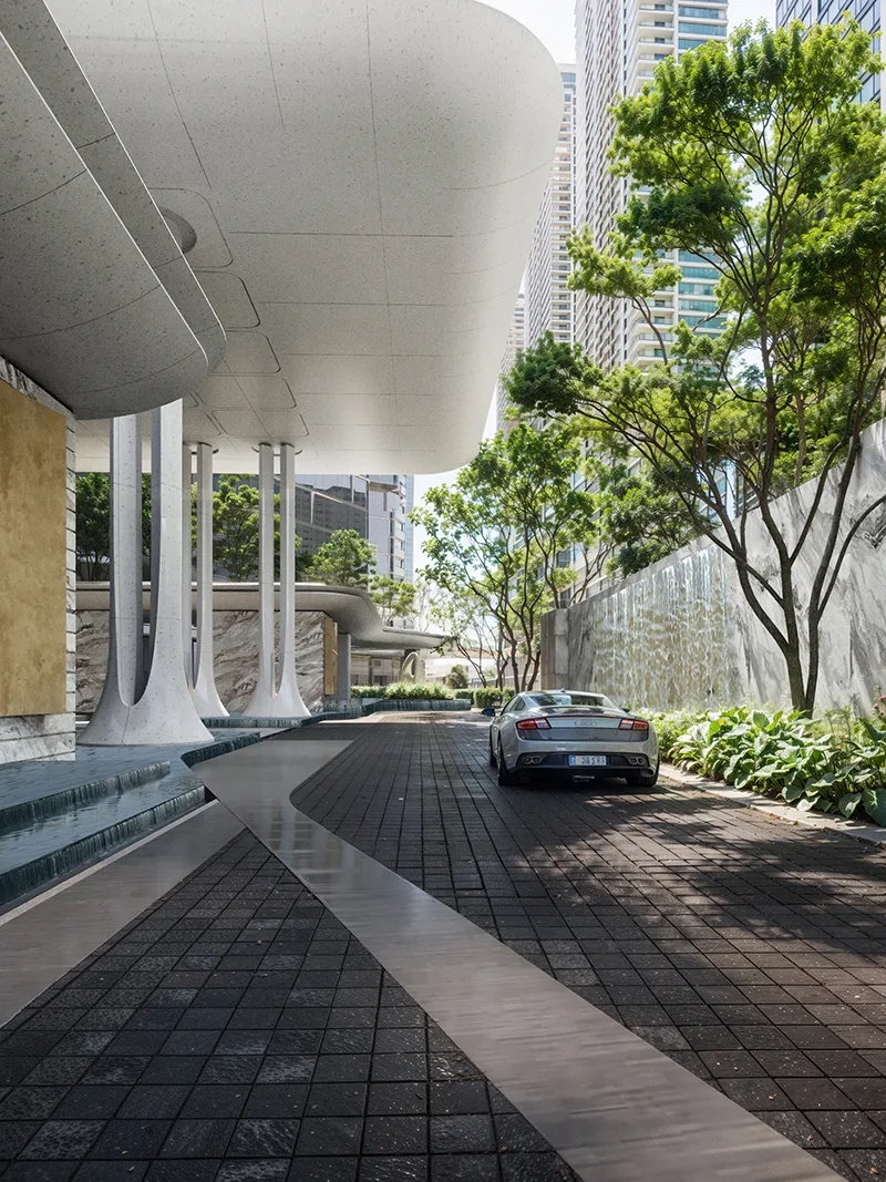
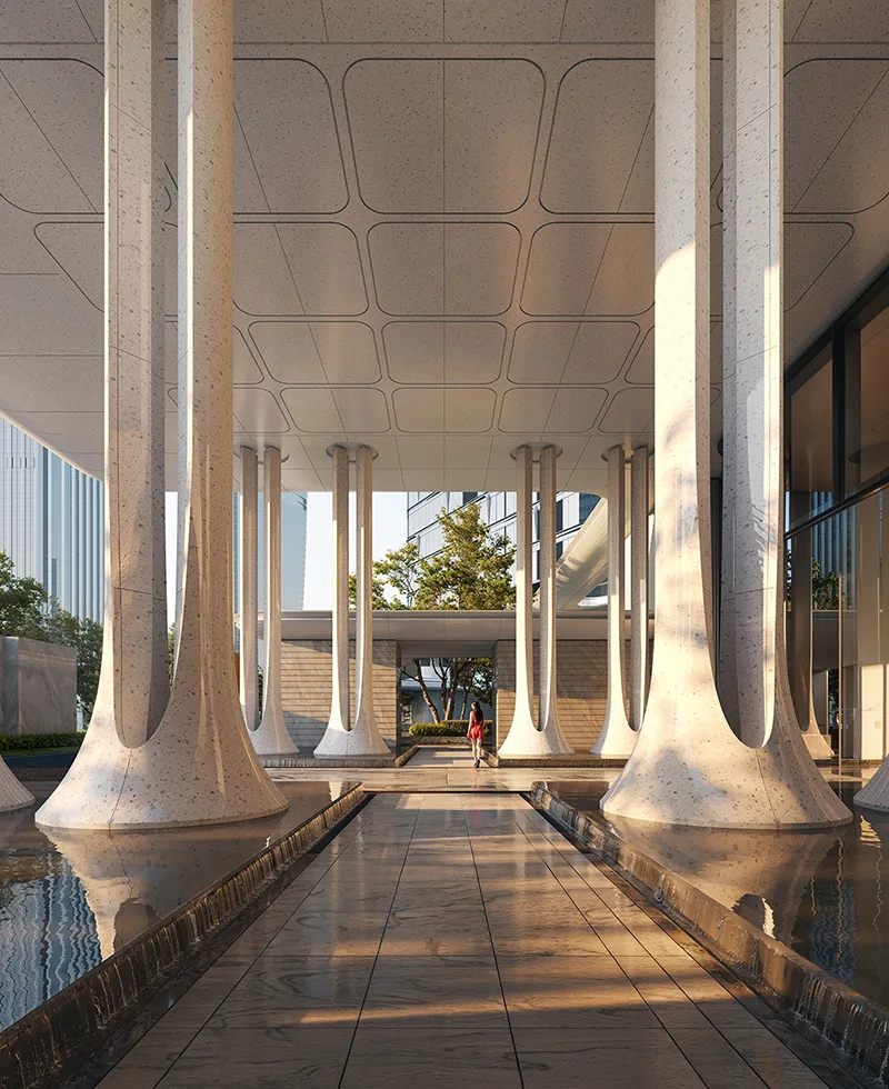
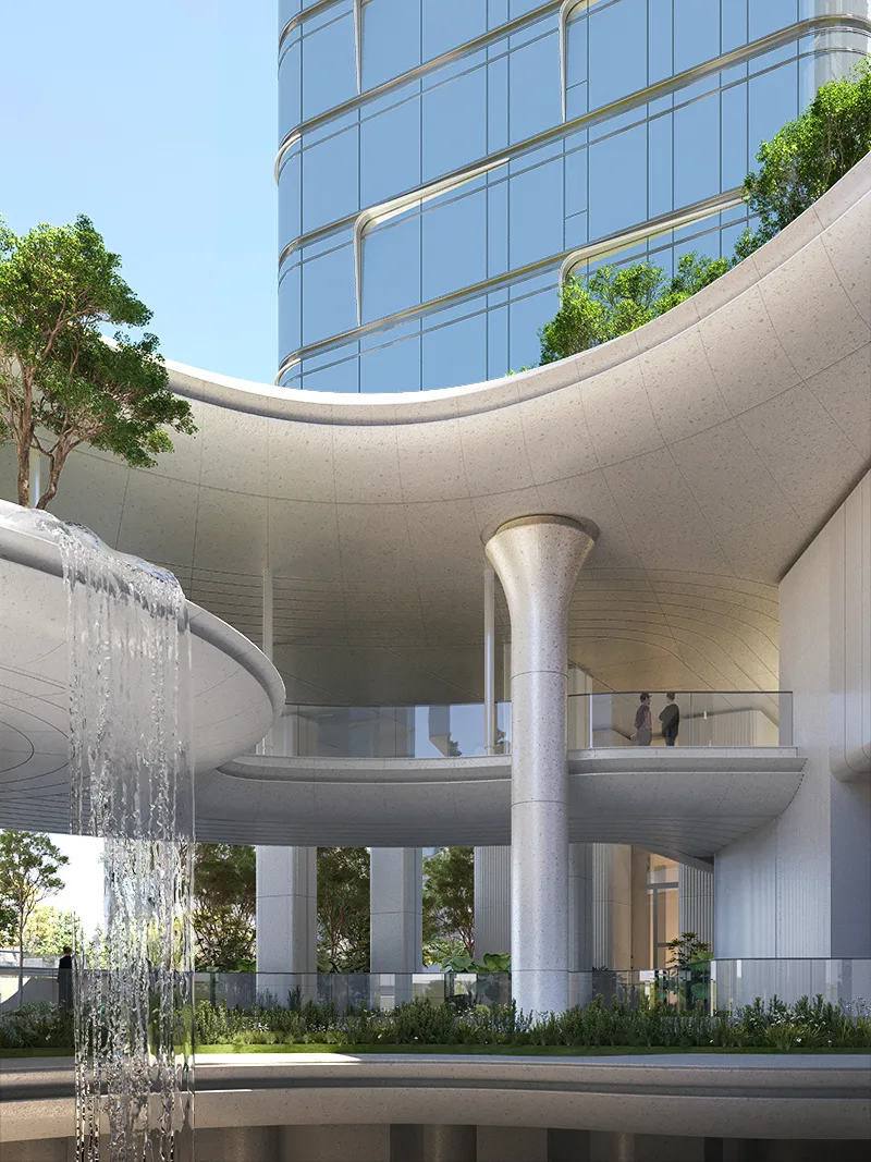
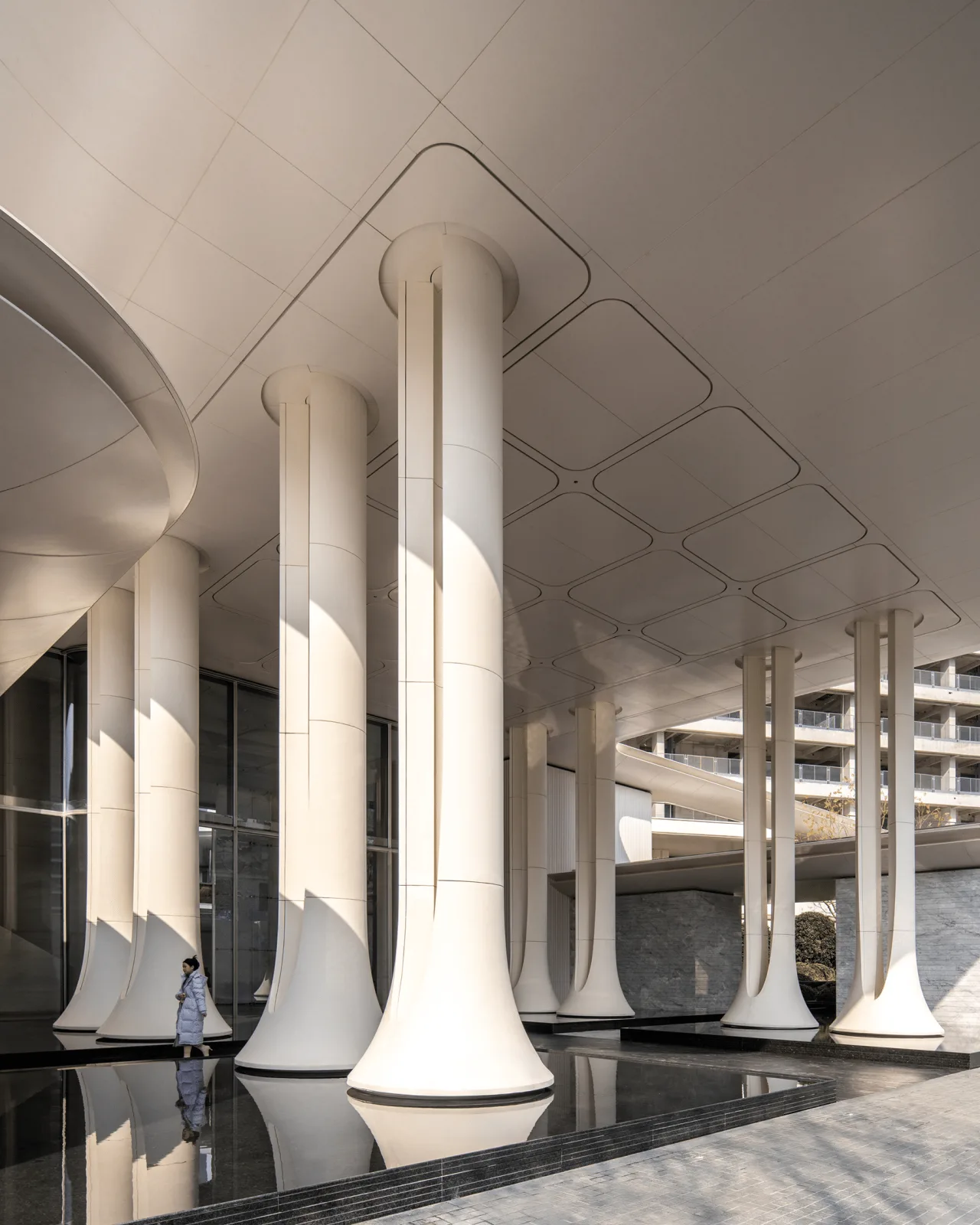
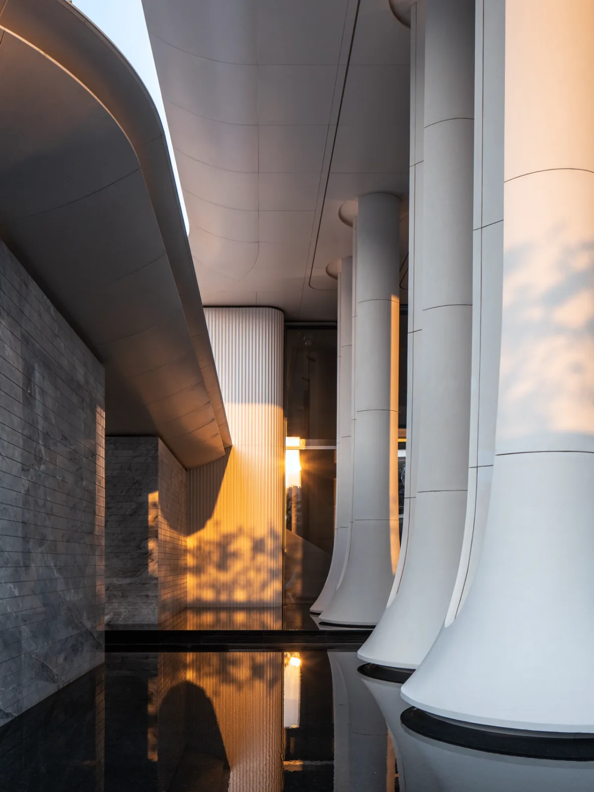
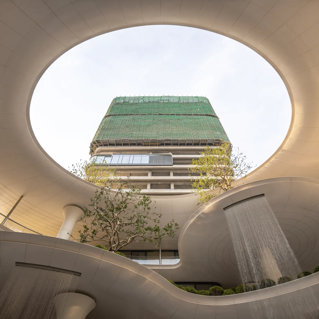
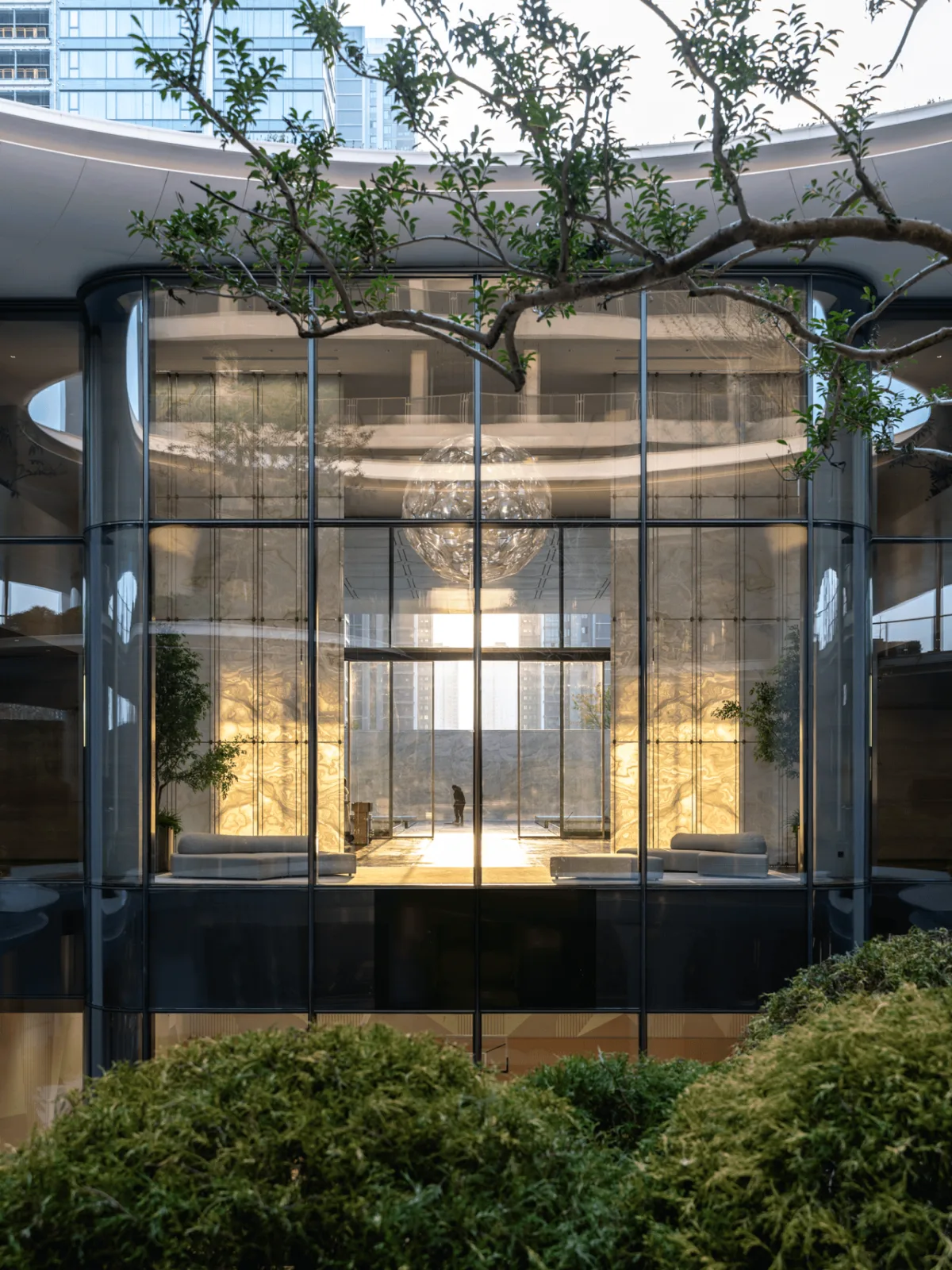
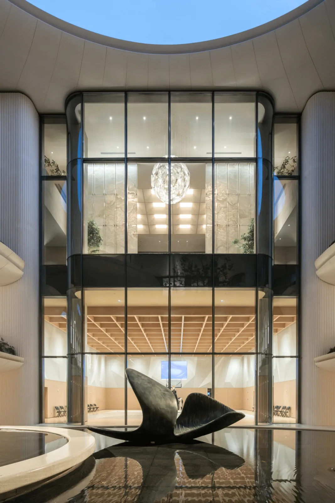
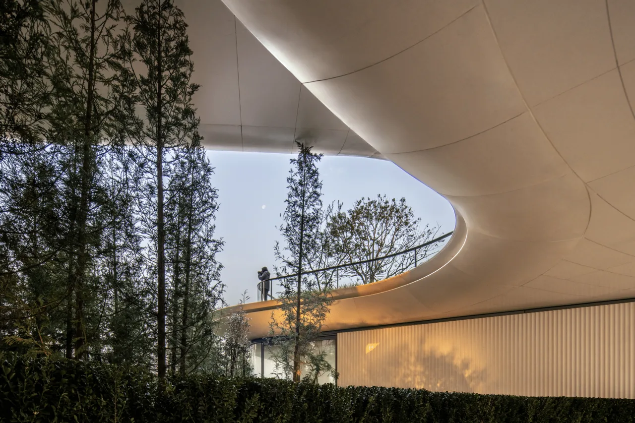
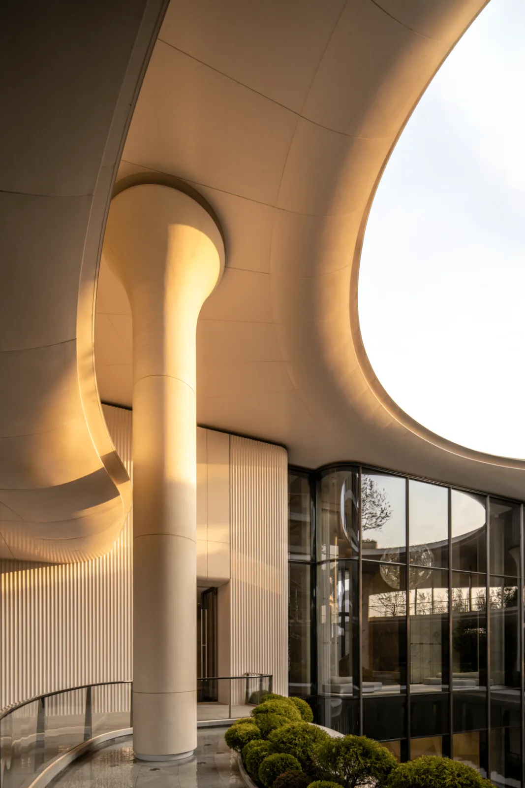
The art center’s main entrance is defined by eight white UHPC tree-shaped columns, creating a visually striking and iconic space, 10.5 meters tall.
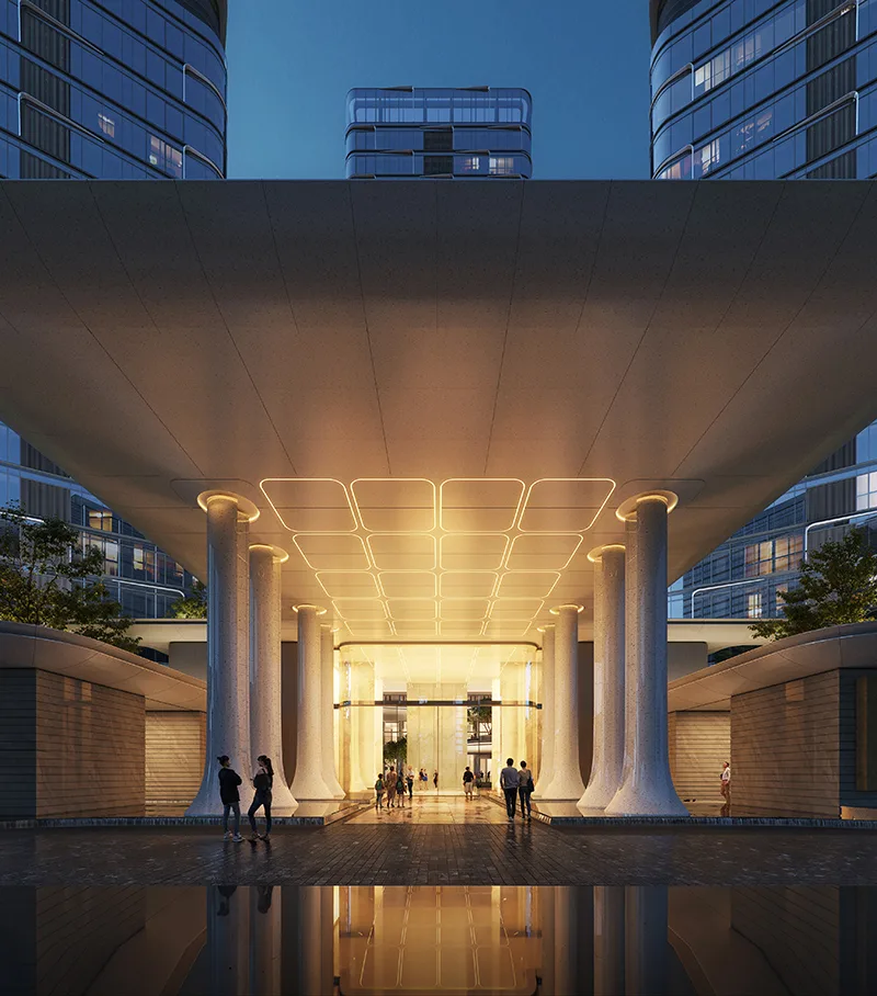
△ Design rendering
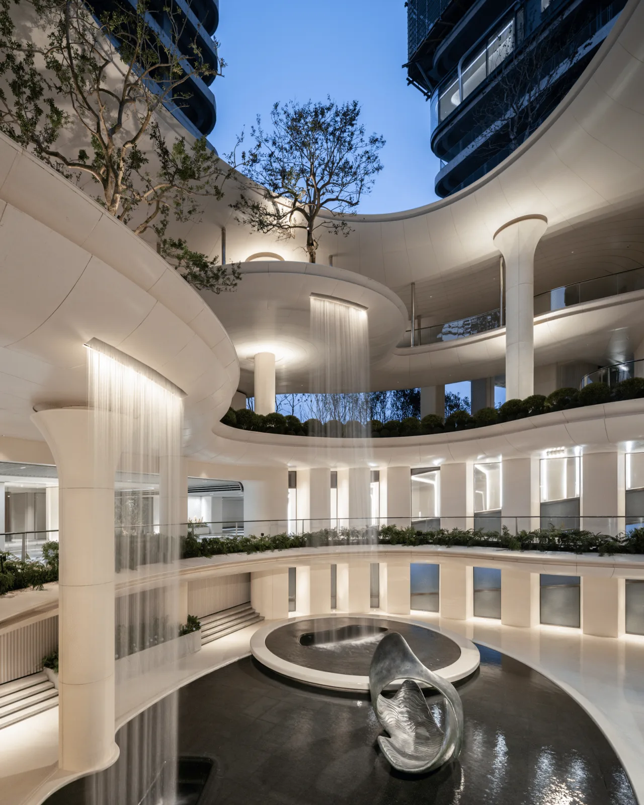
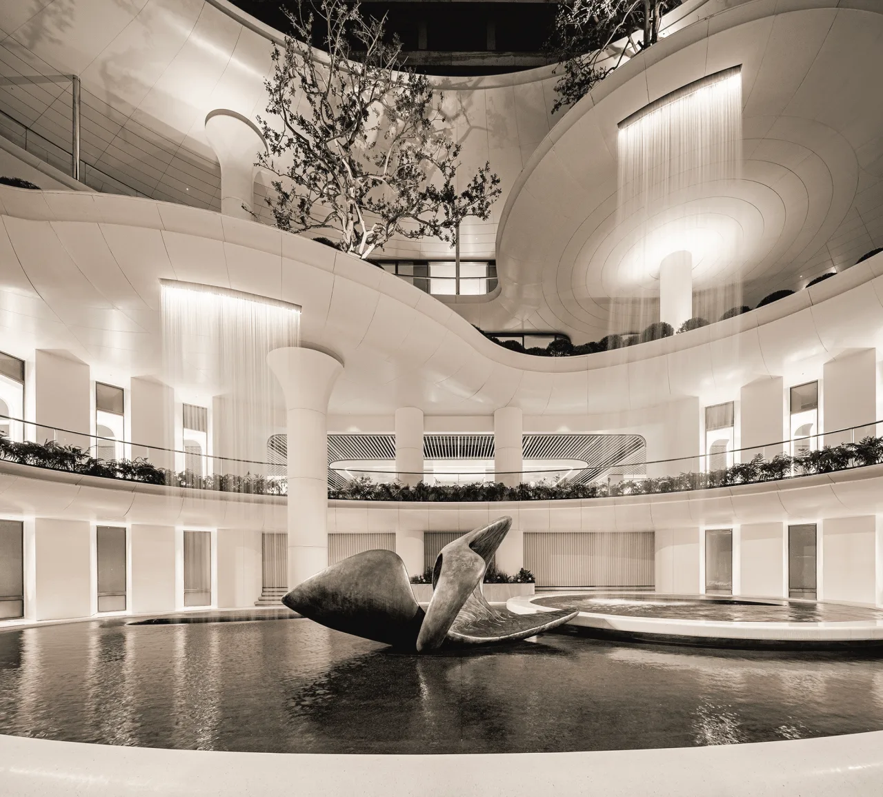
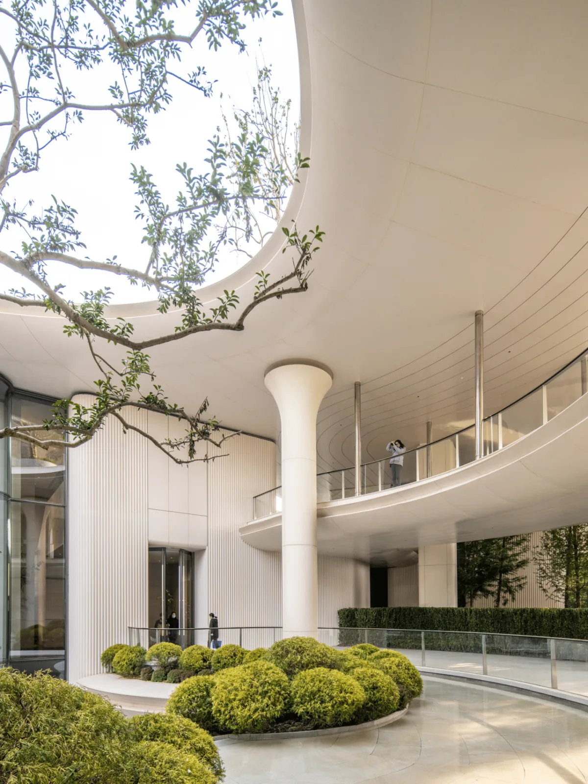
The central courtyard of the “Ring of Vitality” integrates lighting, landscaping, and pedestrian circulation. A circular path ensures efficient connectivity and smooth flow of people across all levels.
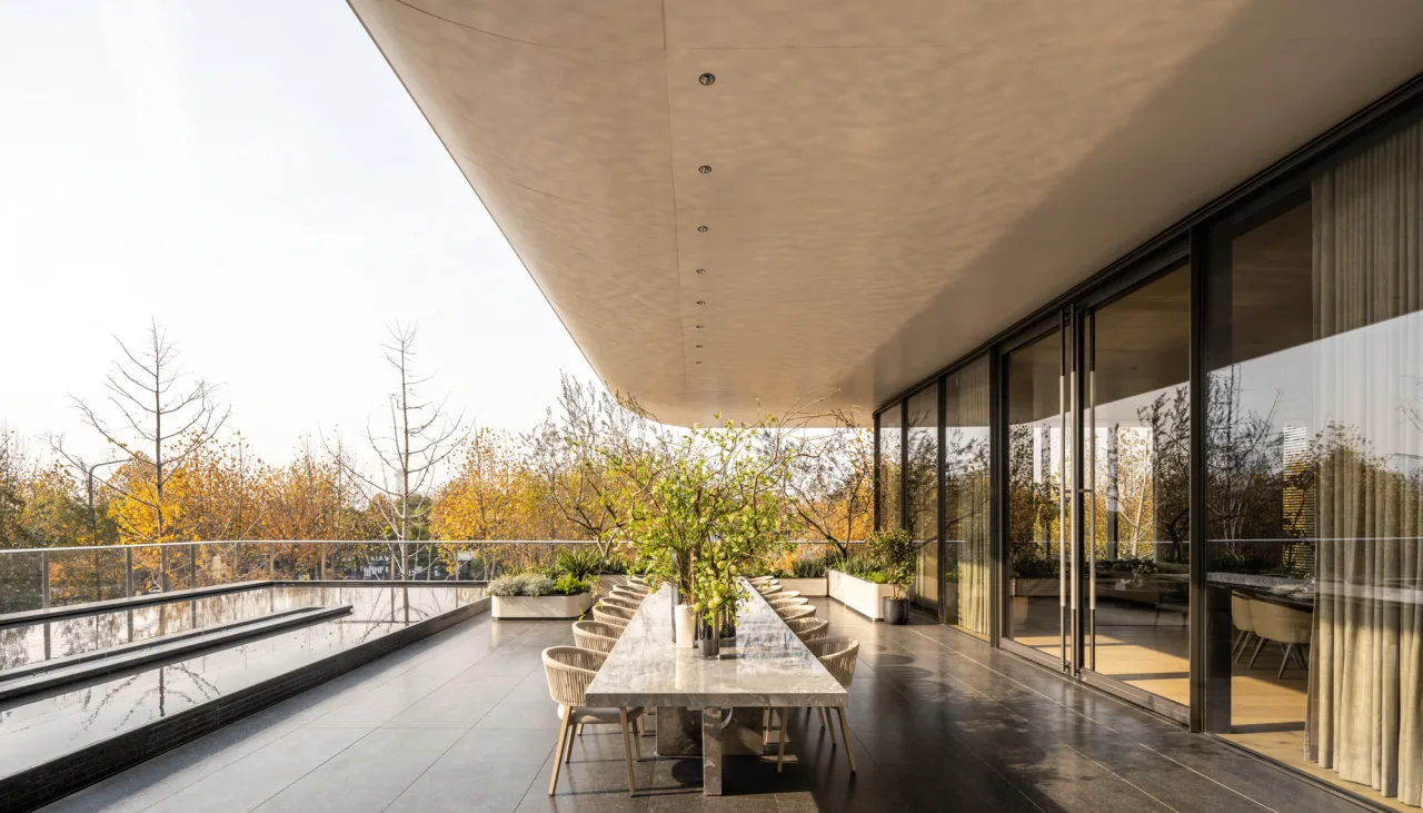
Multidimensional: From Three-Dimensional Space to Composite Experience
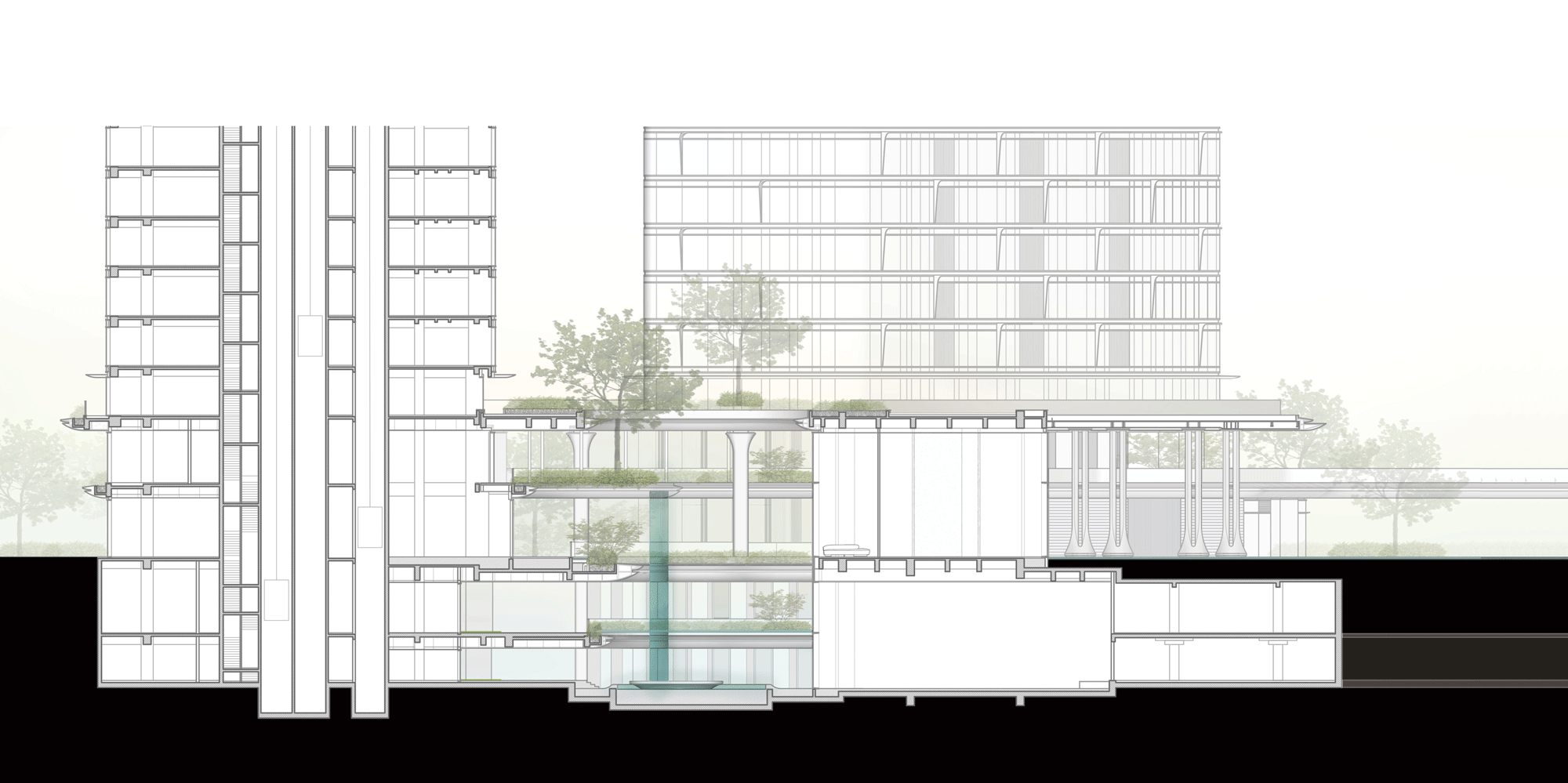
The spatial strategy of “three-dimensionality” addresses the challenge of multiple spatial layers—through aerial corridors, underground passages, and more. Facing complex demographics and business functions, a “multidimensional” approach offers a richer experience. By integrating mixed-use spaces such as urban living rooms, art centers, and commercial zones, we aim to cultivate a vibrant, 24/7 community that serves both residents and visitors with varied experiences and conveniences.
△ Profile analysis
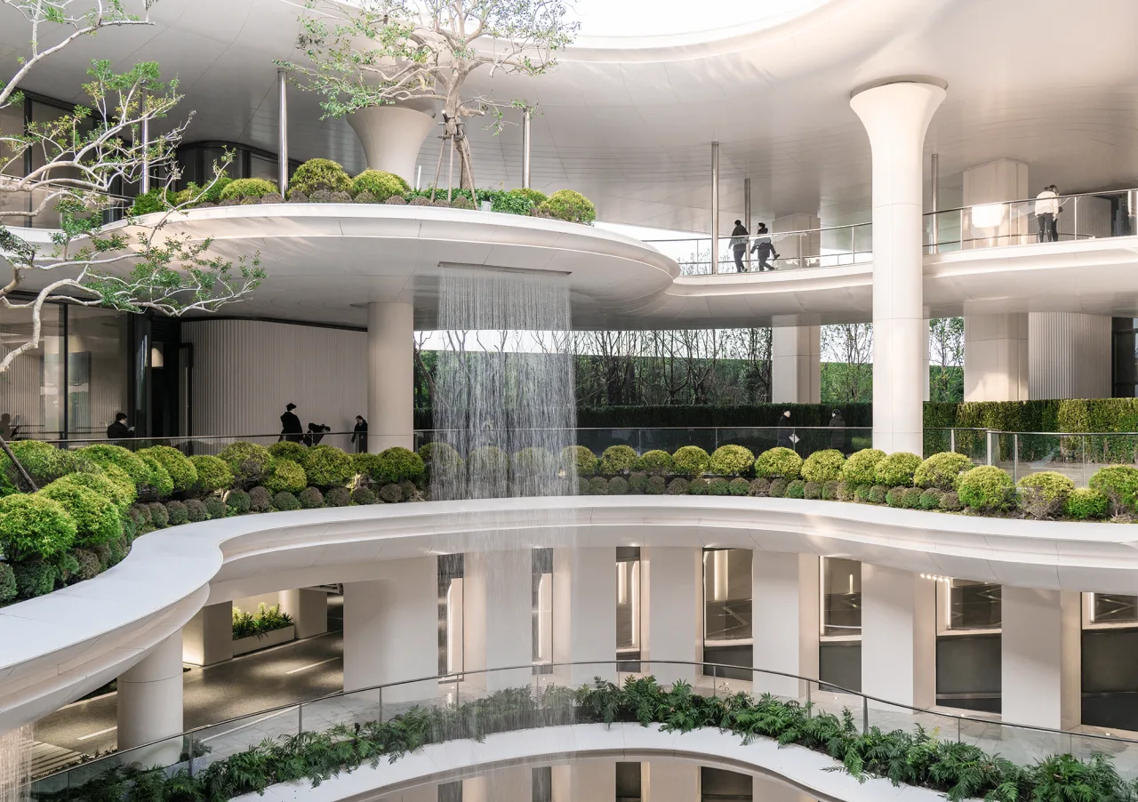
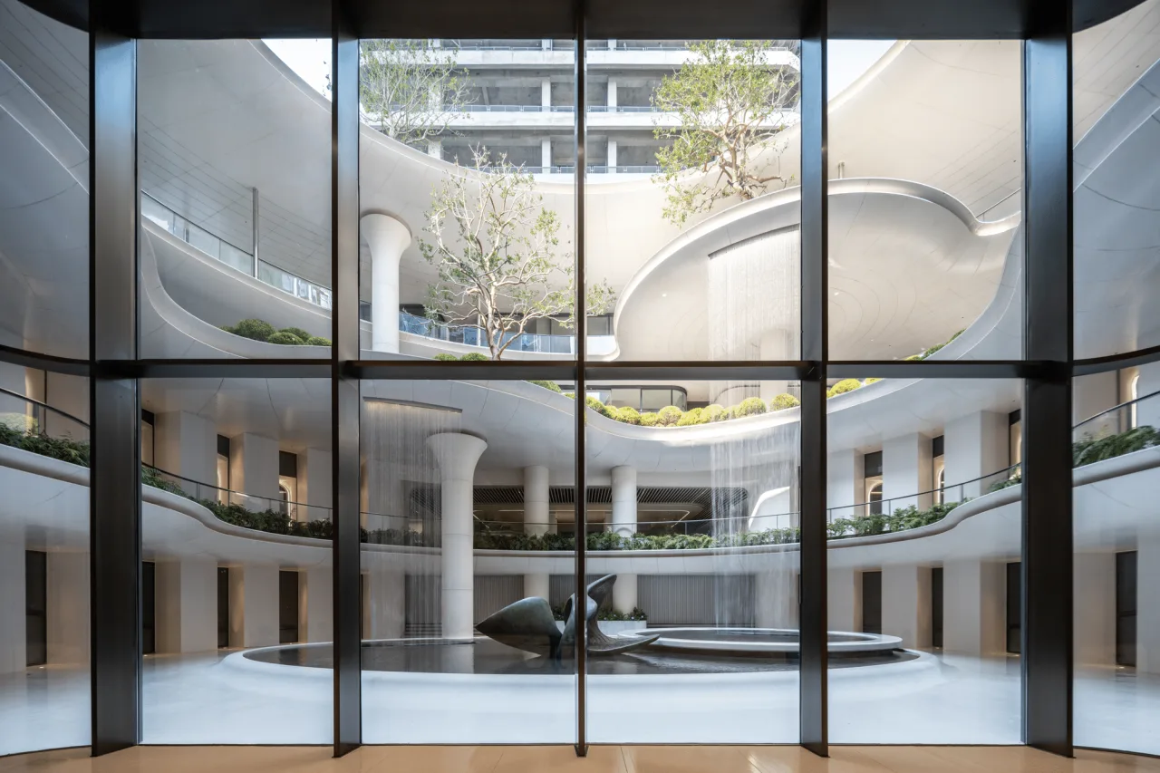
△ Central courtyard spanning four floors
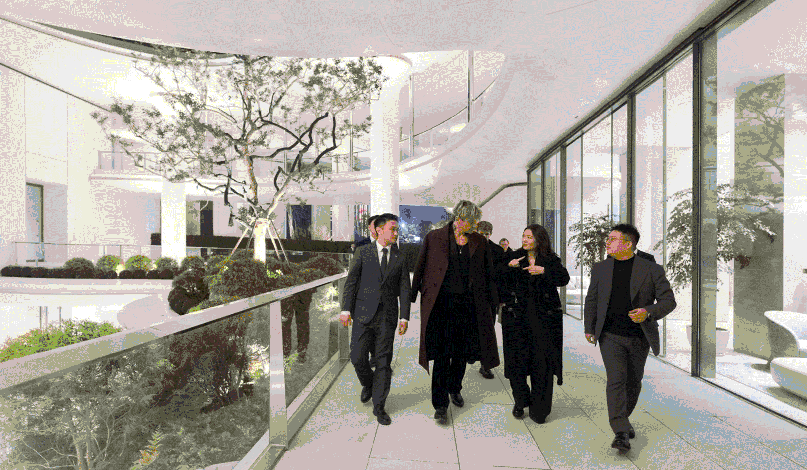
The atrium centers visually on multi-tiered waterfall landscapes and vertical greenery. It also houses spaces for art exhibitions, urban leisure, and social check-ins, resulting in an inclusive and vibrant public activity hub.
△ Wall material samples
Facilities such as the art center, multifunctional hall, gym, swimming pool, and reception rooms are distributed across levels from the basement to ground floor, fully accommodating a wide range of social and wellness needs.
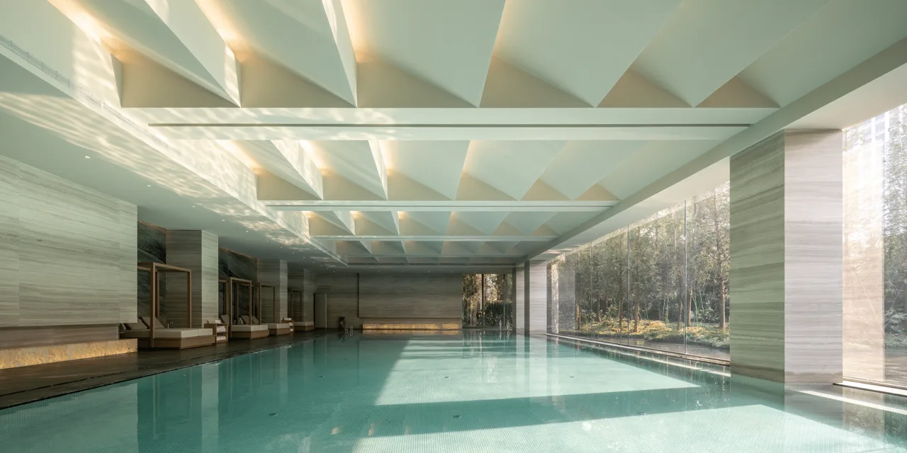
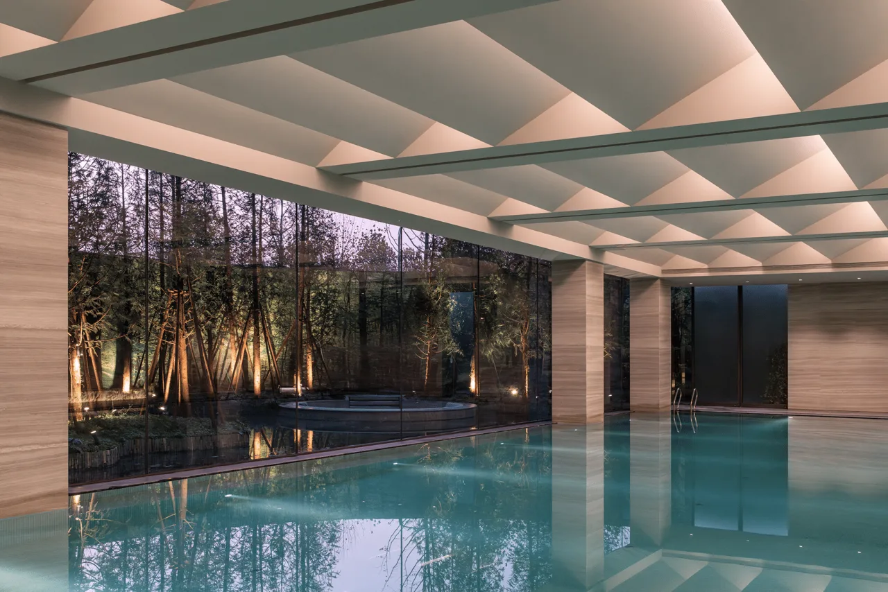
△ Pool area
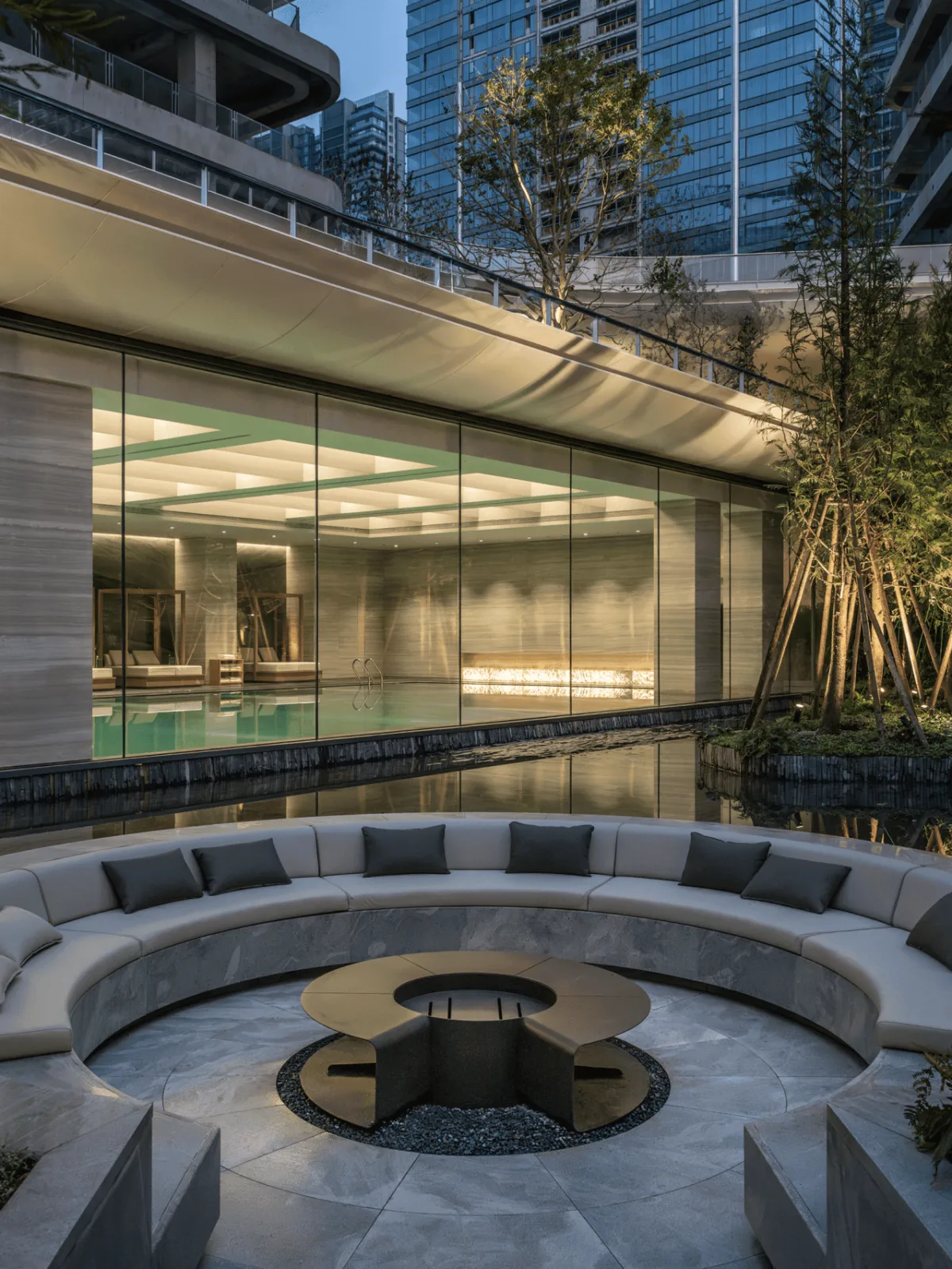
△ Outdoor space
△ Central courtyard spanning four floors
The atrium provides natural daylight to the underground second floor.
Publicness: Layered Openness
Balancing privacy and publicness presents a major design challenge in organizing functional relationships. Our solution is a multi-level open space system that defines the project’s unique public character.
“Publicness” here implies a hierarchical openness strategy. To meet the diverse needs of the site’s internal users, neighboring communities, and the wider city, we designed a tiered system of garden landscapes, public sky streets, and open green corridors. This approach balances and effectively responds to the expectations of each group.
Shared flow paths of the surrounding communities △ plot
△ Private flow paths within the site
Thanks to strong connections between interior spaces and external river views, the high-rise towers employ a multi-ribbed crossbeam cantilever structure. This allows a flexible and adaptable floor plan, providing elasticity for future, unforeseen uses.
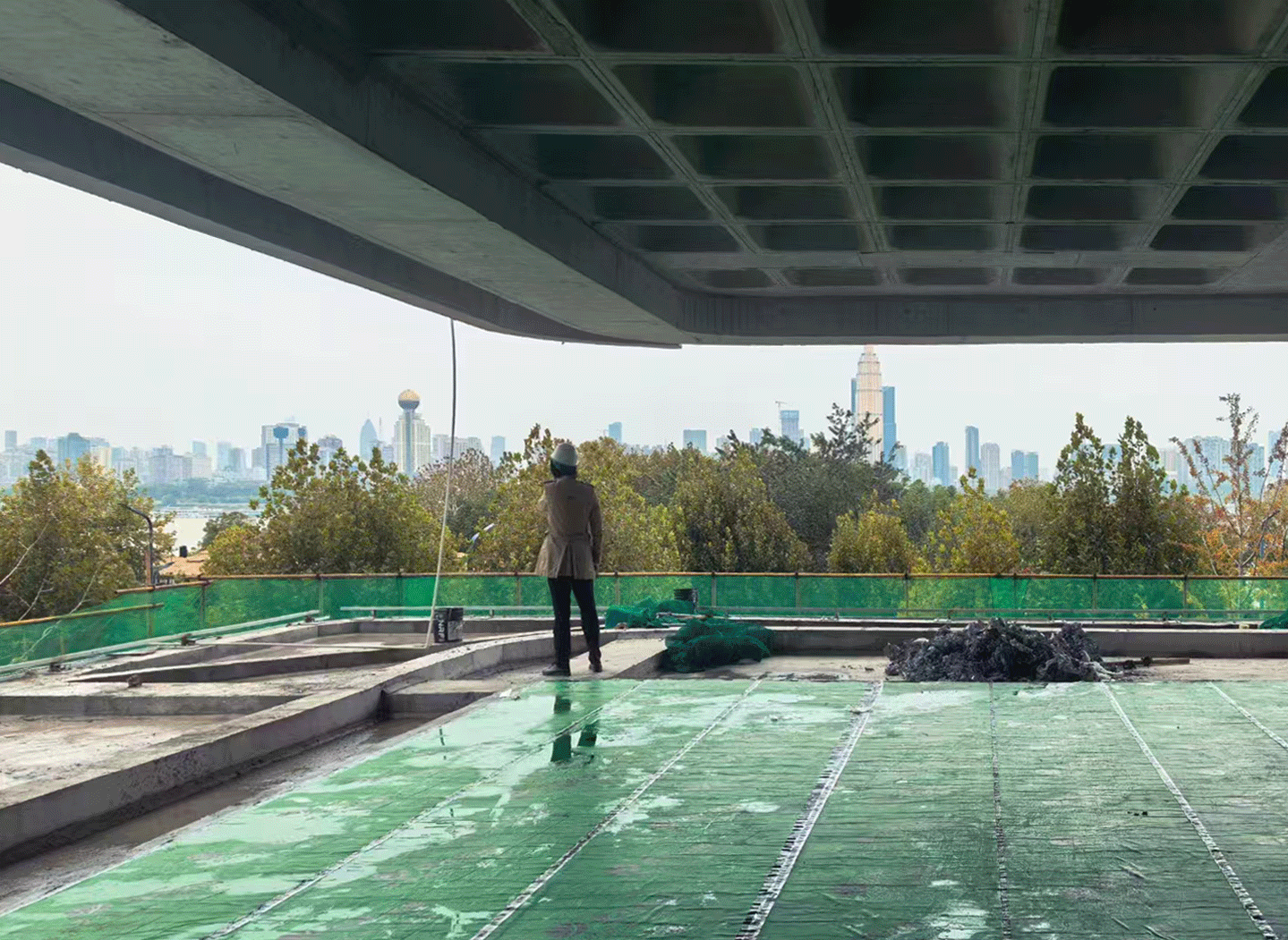
△ Construction site photos
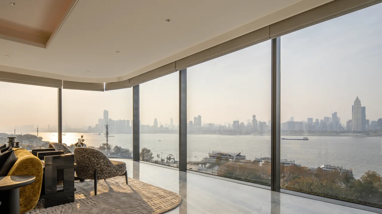
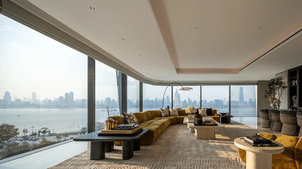
△ Indoor river view
The Y-shaped layout creates two open spaces at the street corners facing the river. By removing walls strategically, we’ve designed areas for both large-scale shared use and more intimate gatherings. The publicly accessible riverside views are shared with the city, while the high-quality park landscapes serve park users and nearby residents.
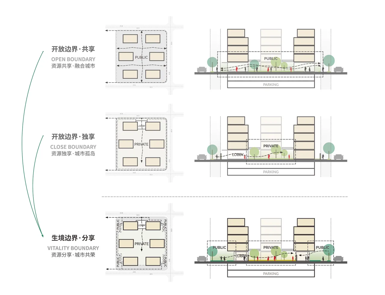
Boundary design with varying degrees of openness
A New Definition of Coordinates for Riverside Cities
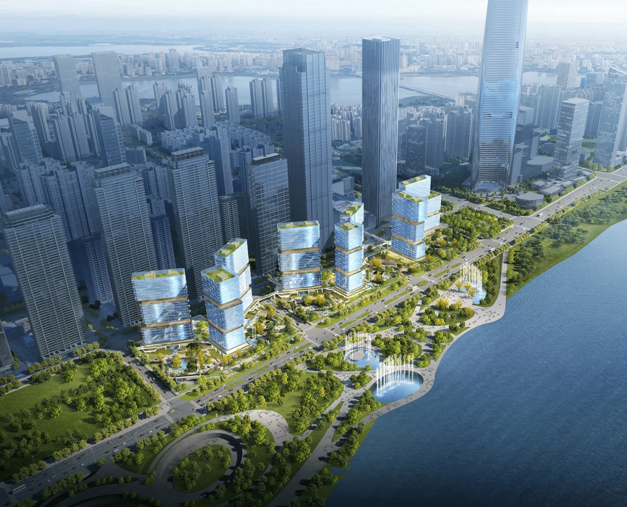
The Yangtze River waterfront carries deep historical significance and a unique geopolitical culture. As urbanization growth slows after rapid expansion, the role of urban coordinate architecture has evolved. It now serves not only as a symbol of city image or commercial hub but as a multidimensional, high-quality node for urban connectivity.
From the traditional concept of “shared coordinates” expressed through open forms to today’s “shared blocks” featuring multi-level openness, the Yangtze River Skyline emanates vibrant everyday life and urban memory as a new type of urban neighborhood. By integrating public art, commerce, culture, and living, it creates a forward-looking urban complex that not only offers new living spaces but also redefines the cultural meaning of “coordinates” in contemporary cities.
In early December, the art center opened with a landmark cultural event: a performance by world-renowned pianist Maxim. This marked an important milestone in establishing urban memory within the Yangtze River Skyline.
Maxim’s Concert
After a year and a half of exploration, the waterfront urban coordinate design is steadily materializing through ongoing construction. We look forward to Yangtze River Skyline continuing to foster rich, diverse lifestyles and urban memories—where city meets nature, culture, and the public.
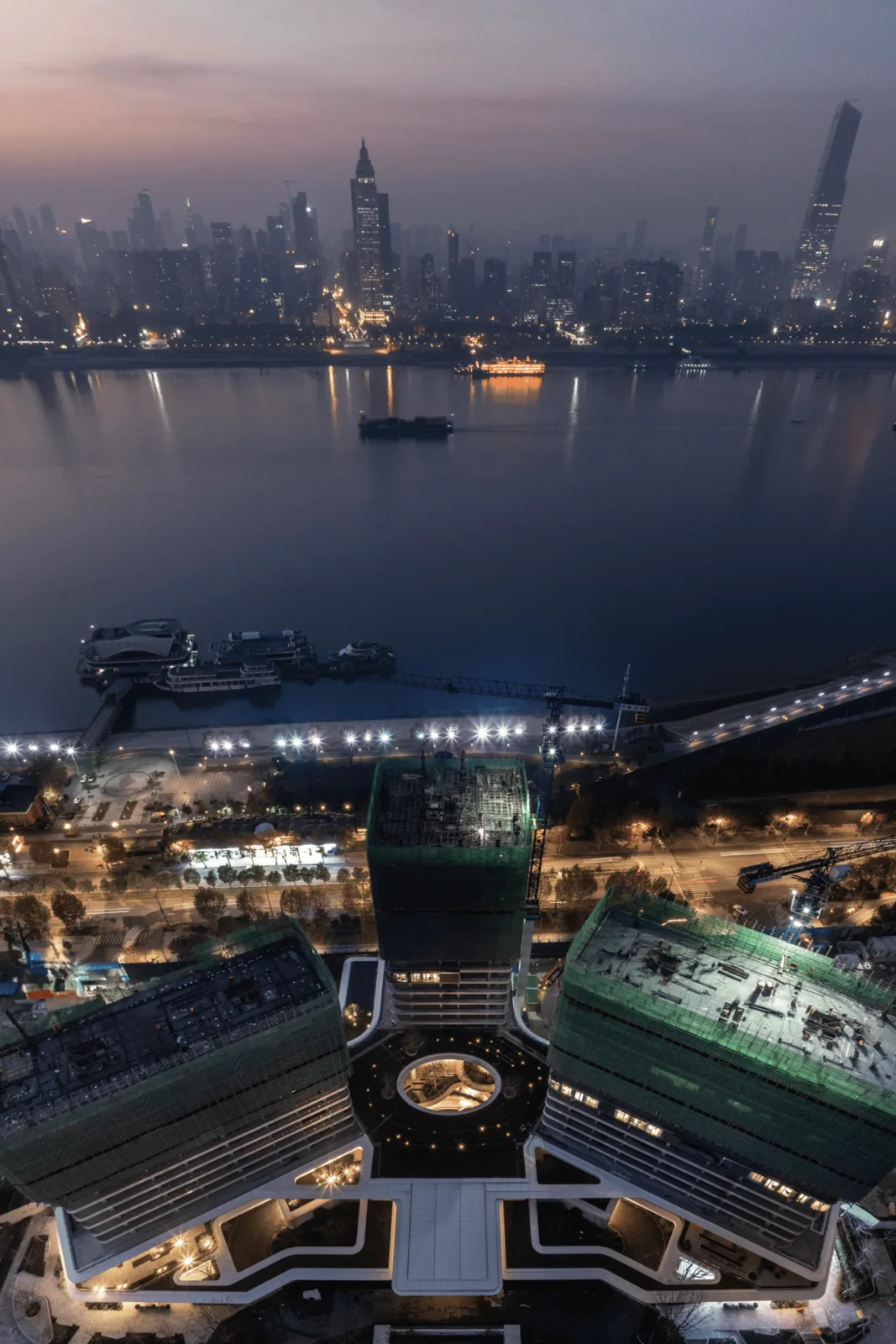
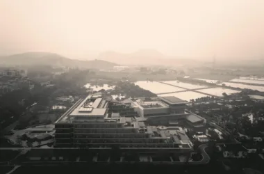
△ Construction site record
Project Information
- Project Name: Wuhan Yangtze River Skyline
- Architectural Design & Preliminary Design: Line+Architectural Firm
- Lead Architect / Project Creator: Zhu Peidong
- Design Team: Wu Haiwen, Zhou Yang, Deng Chao, Zhu Xiongfei, Zhang Qunchen, Sun Jin, Liu Hao
- Line Drawing: Du Mengying
- Owner: Yujiangkun (Wuhan) Real Estate Development Co., Ltd
- Interior Design: Yu Studio, Hong Kong Zhengzhong Design Firm (CCD)
- Landscape Design: Platform Elephant Design
- Curtain Wall Design: Shanghai Xima Engineering Consulting Co., Ltd
- Lighting Design: BPI Lighting Design
- Construction Drawing Design: Wuhan Zhenghua Architectural Design Co., Ltd
- Location: Wuhan, Hubei
- Building Area: 207,000 square meters
- Structure: Frame and steel structure
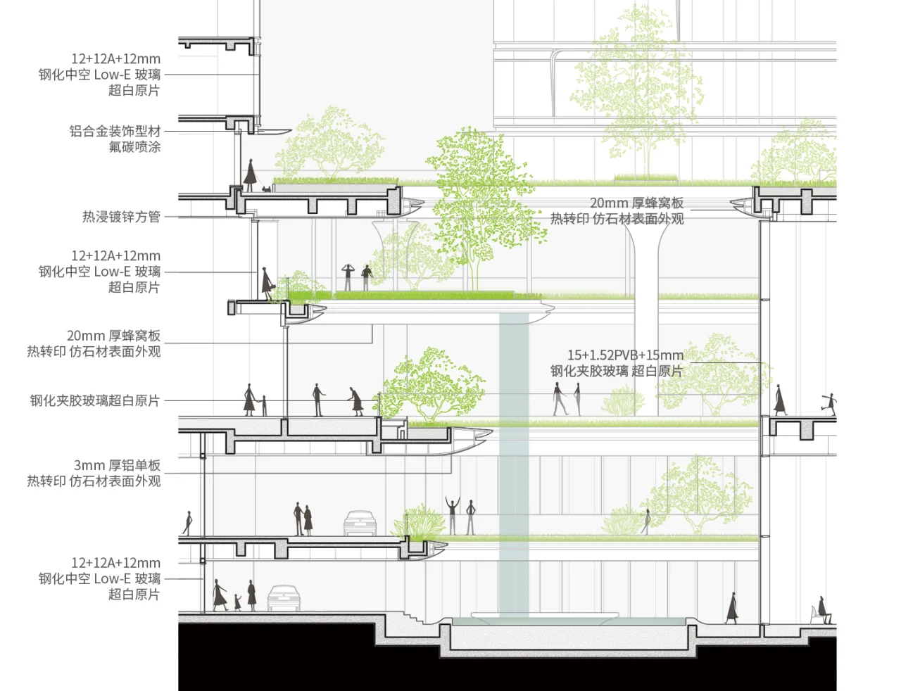
- Materials: UHPC, imitation stone aluminum panels, hollow LOW-E glass
- Photography: Chen Xi Studio line+


Must log in before commenting!
Sign Up