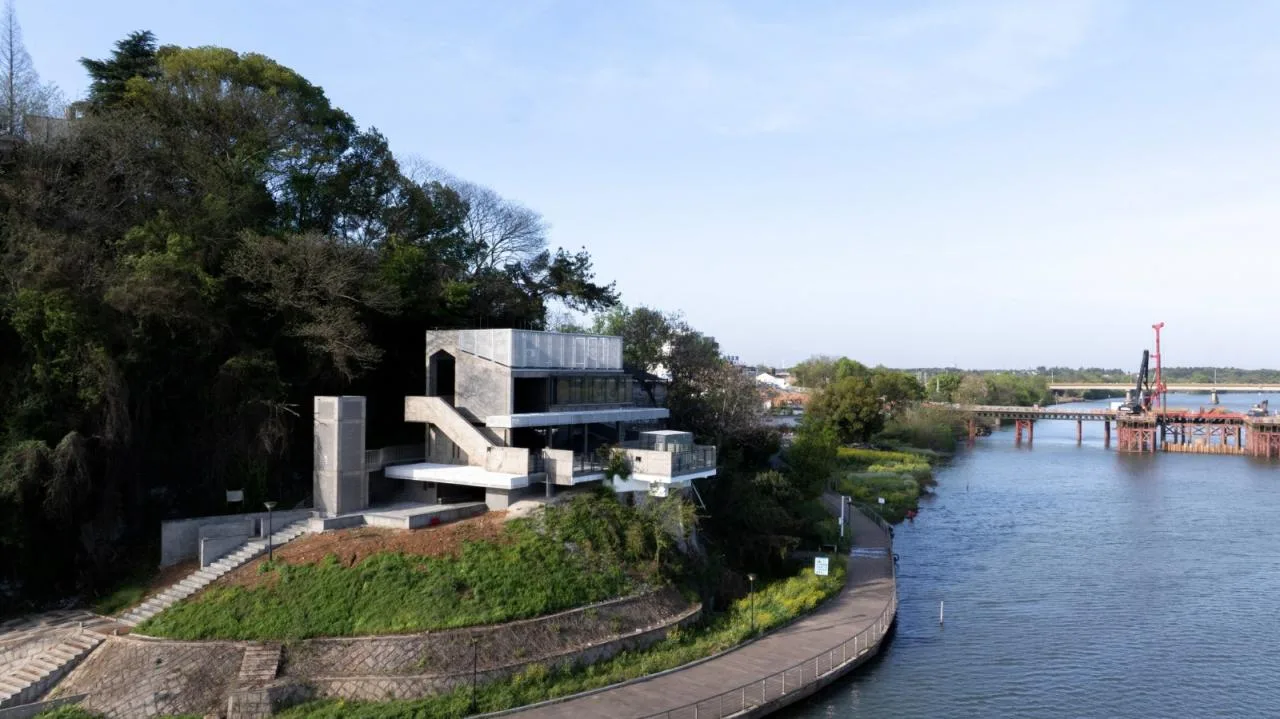
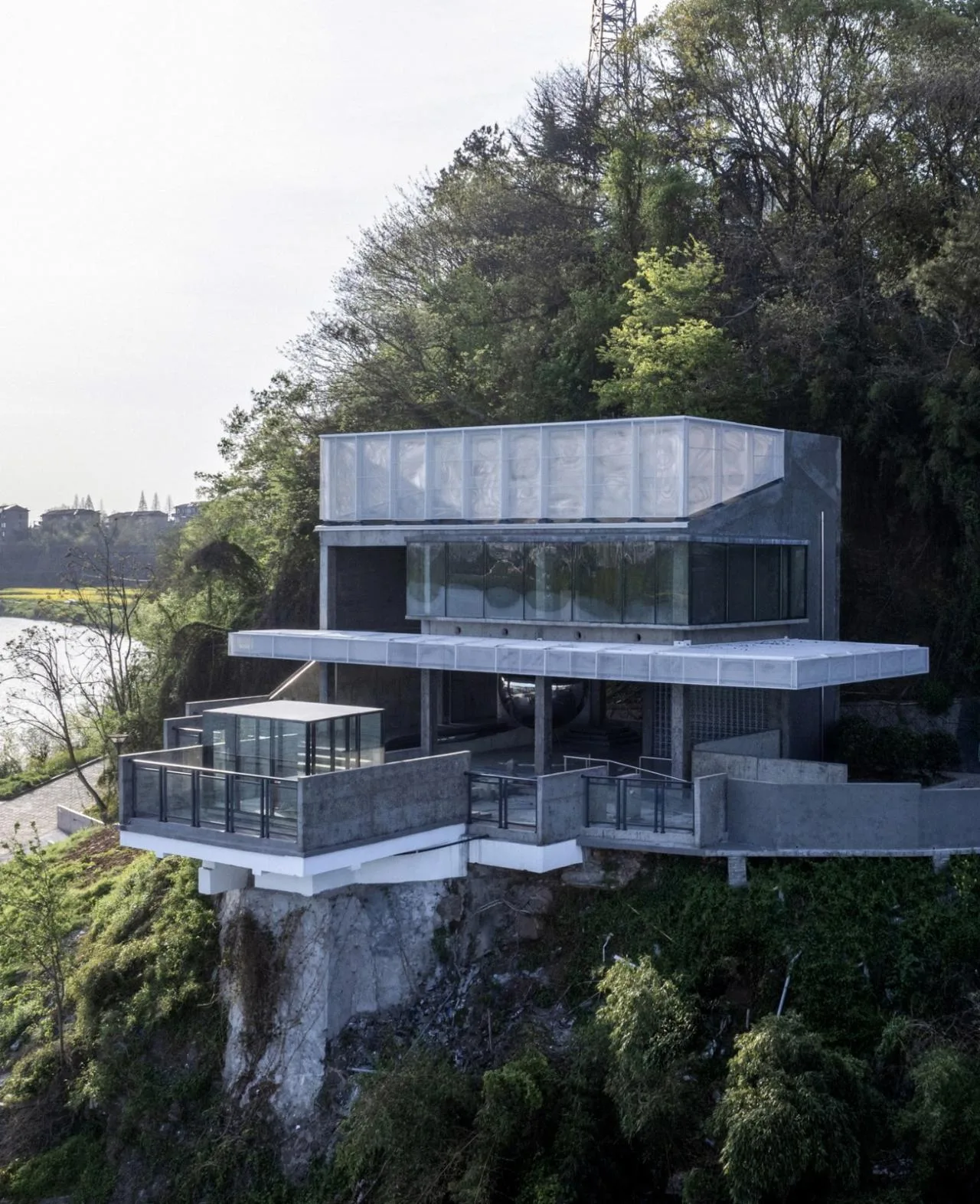
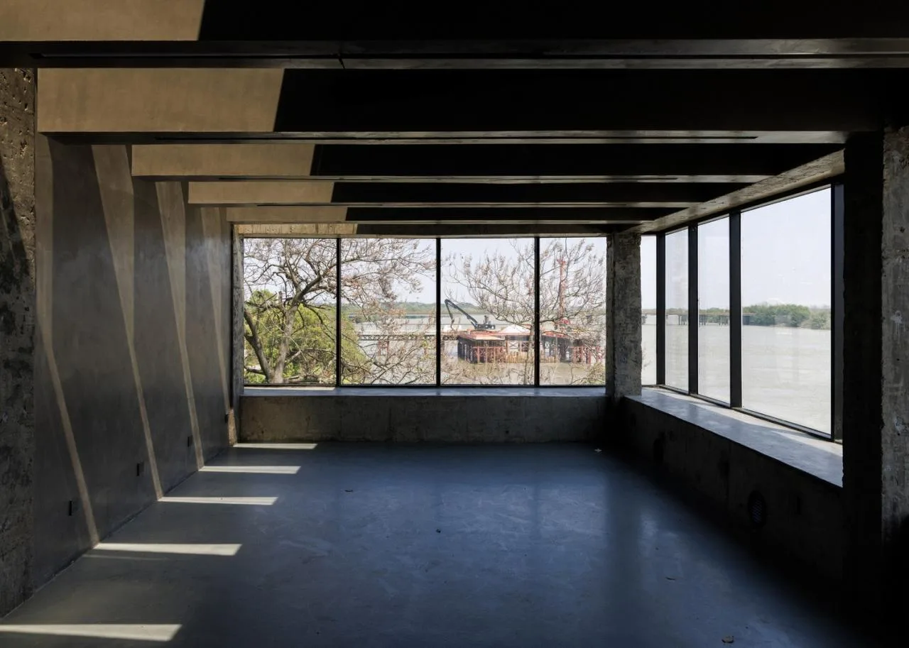
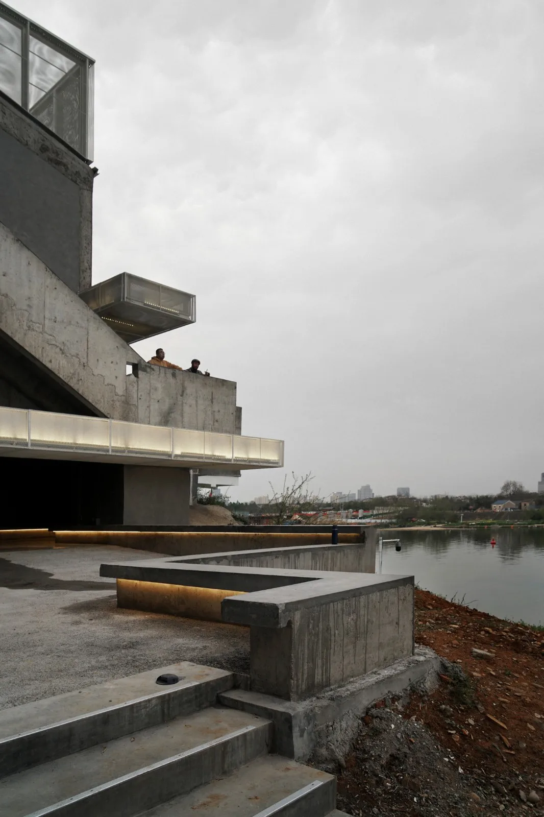
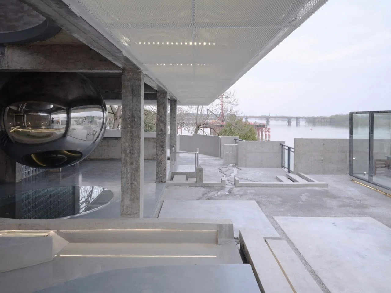
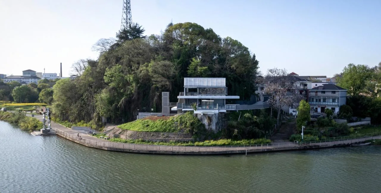
The Lingguan building, originally a water level station, has been transformed with a design featuring square blocks and staggered walls resting on a cliff overlooking the river. Historically, water level stations were not utilized effectively, creating an urgent need for a comprehensive update. The renovation aims to preserve the essential hydrological monitoring functions while enhancing public access, turning the building into a landmark that reflects the surrounding landscape.
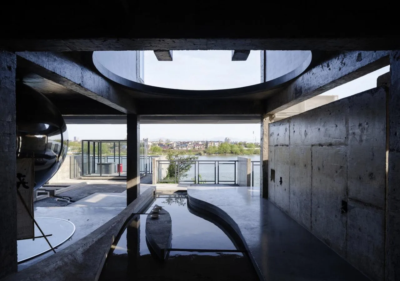
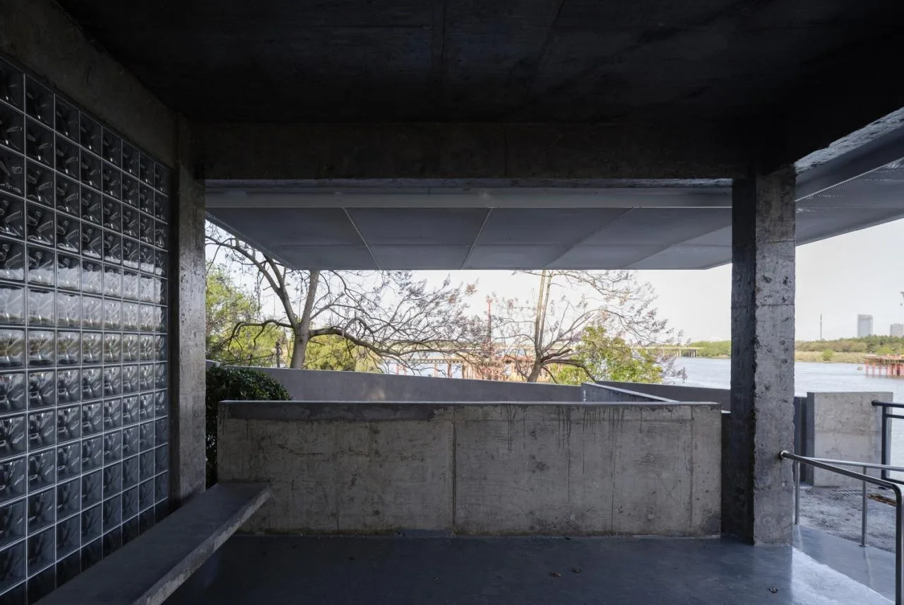
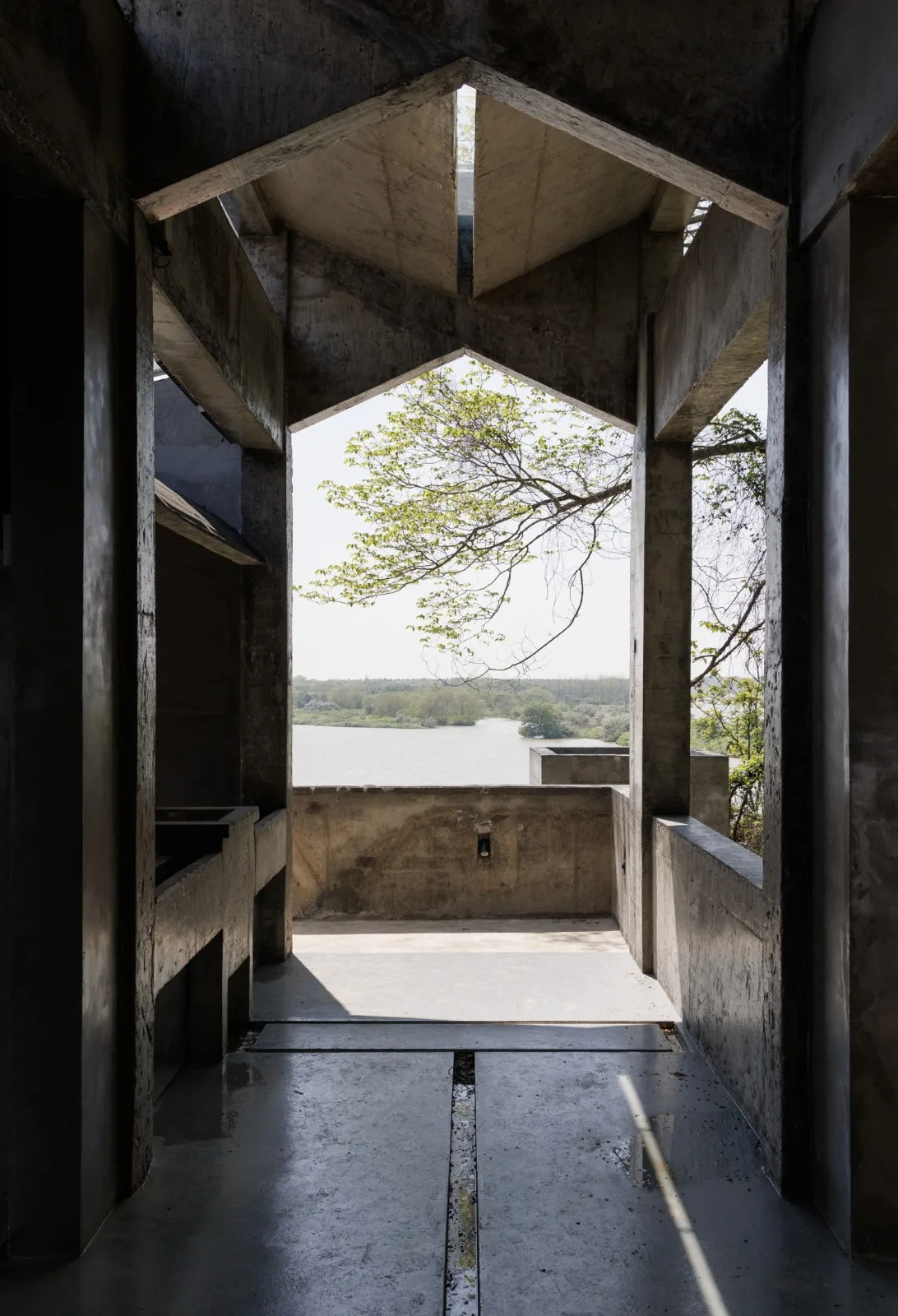
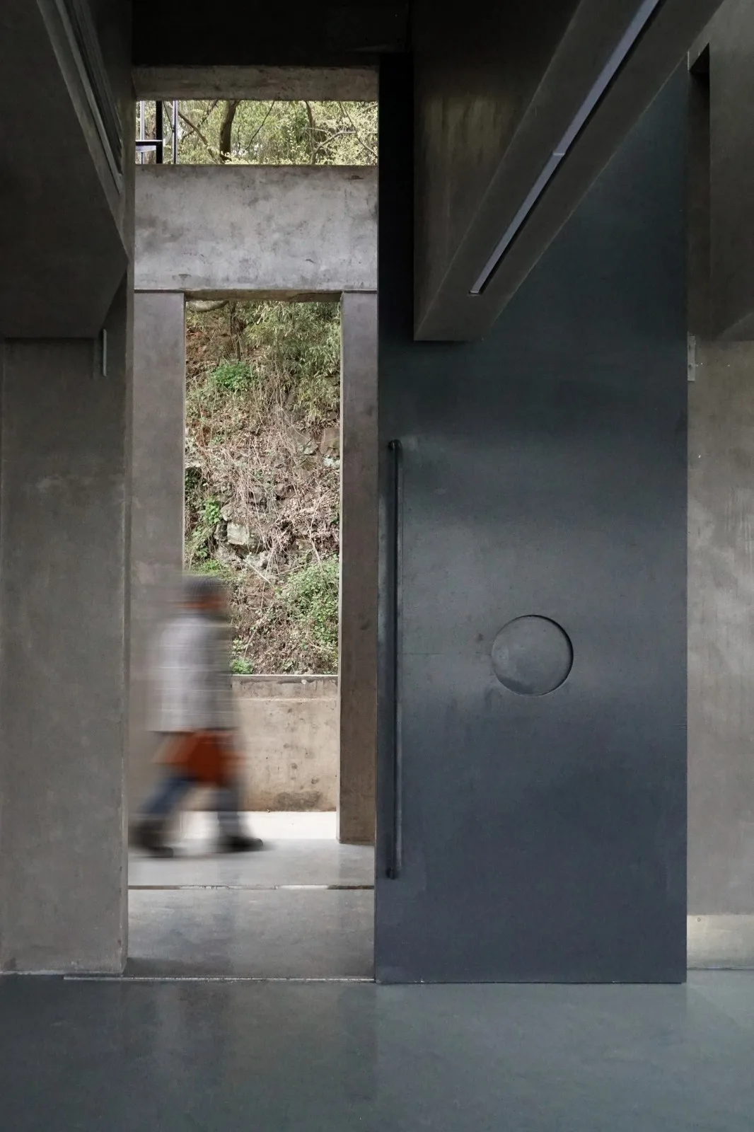
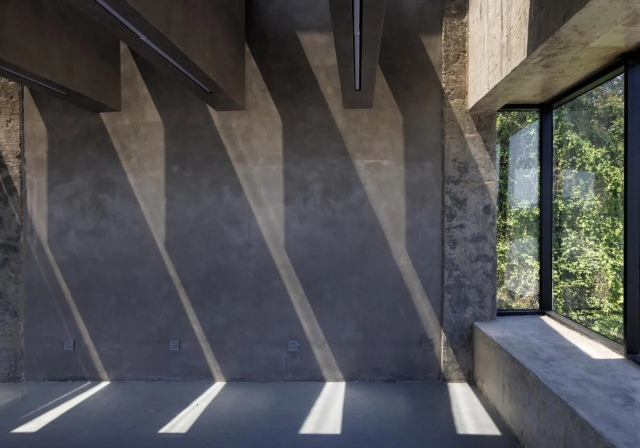
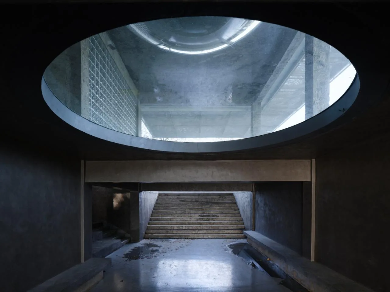
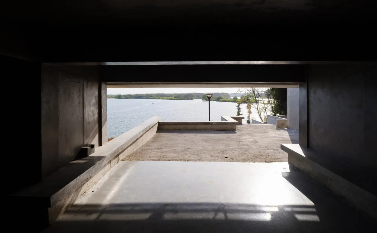
By removing most of the walls and opening up some floor slabs, natural landscapes and views now flow freely throughout the building. Rainwater is channeled from the roof through the interior to the courtyard, creating a water-themed exhibition hall and an unmanned, fully open recreational space. A public passage has been introduced beneath the building, connecting the riverbank to the mountain village. This passage provides convenient access for villagers to enjoy riverside activities, escape the heat, set up stalls, and conduct daily routines. Additionally, a classroom and a public restroom have been incorporated to serve visitors.
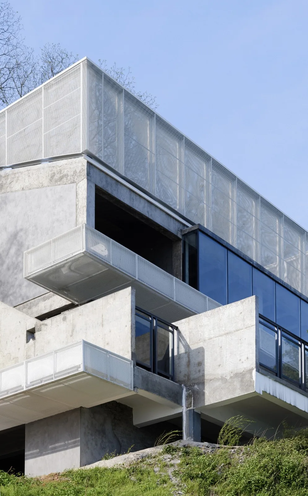
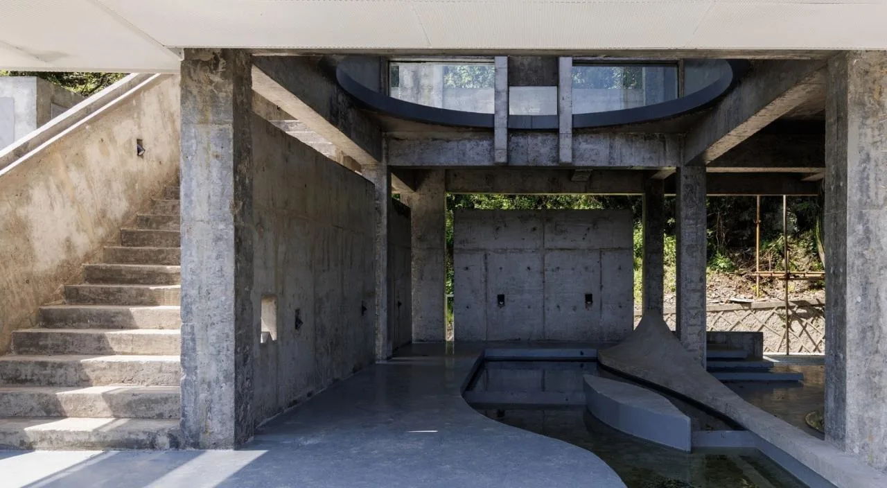
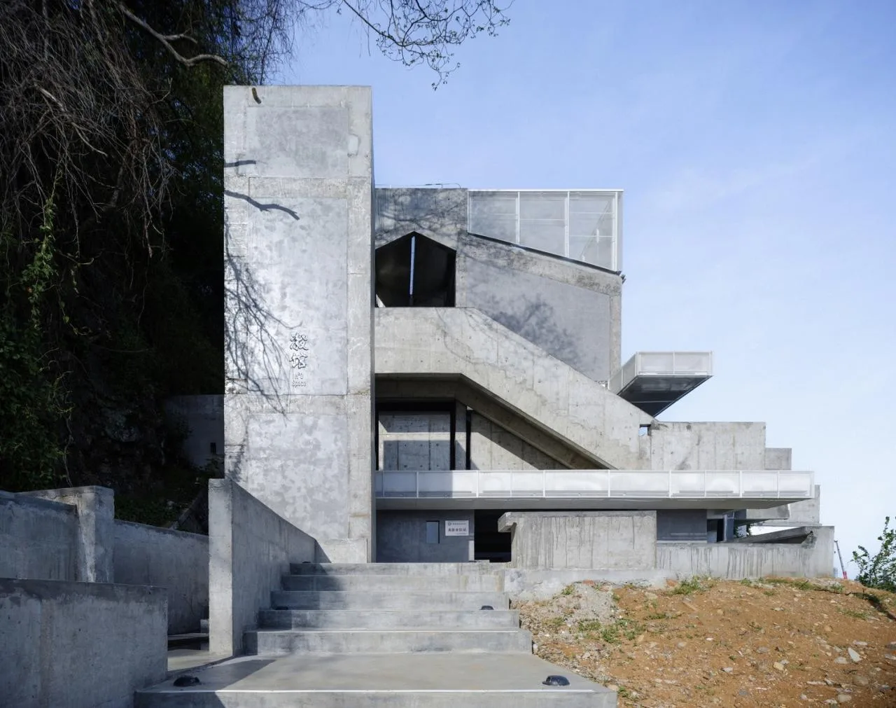
The renovation followed a ‘reverse reconstruction’ approach, treating demolition as reverse engineering. Decorative surfaces and non-load-bearing walls were removed to reveal the structural framework. New walls were built, flow lines extended, and spaces reorganized based on the orthogonal framework system. The combination of newly added concrete walls, stairs, and the existing framework redefined the building’s spatial composition. The sloping roof was filled with a faintly translucent white aluminum mesh, shaping the main outline as a square. Smaller squares on the main body mark all entry and exit points. These white aluminum mesh ‘fillers’ visually represent ‘implants,’ preserving the original building’s appearance while highlighting the new interventions.
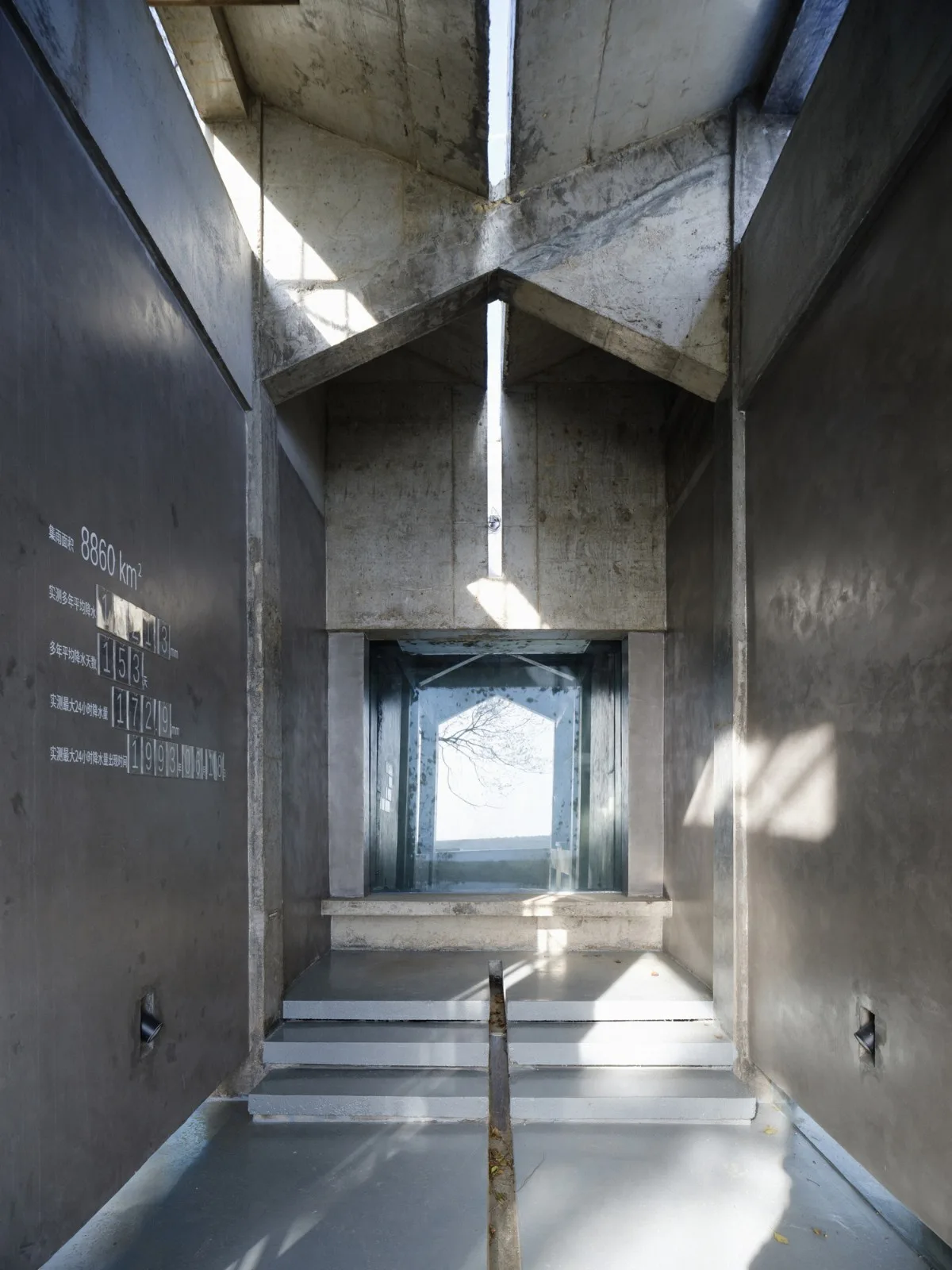
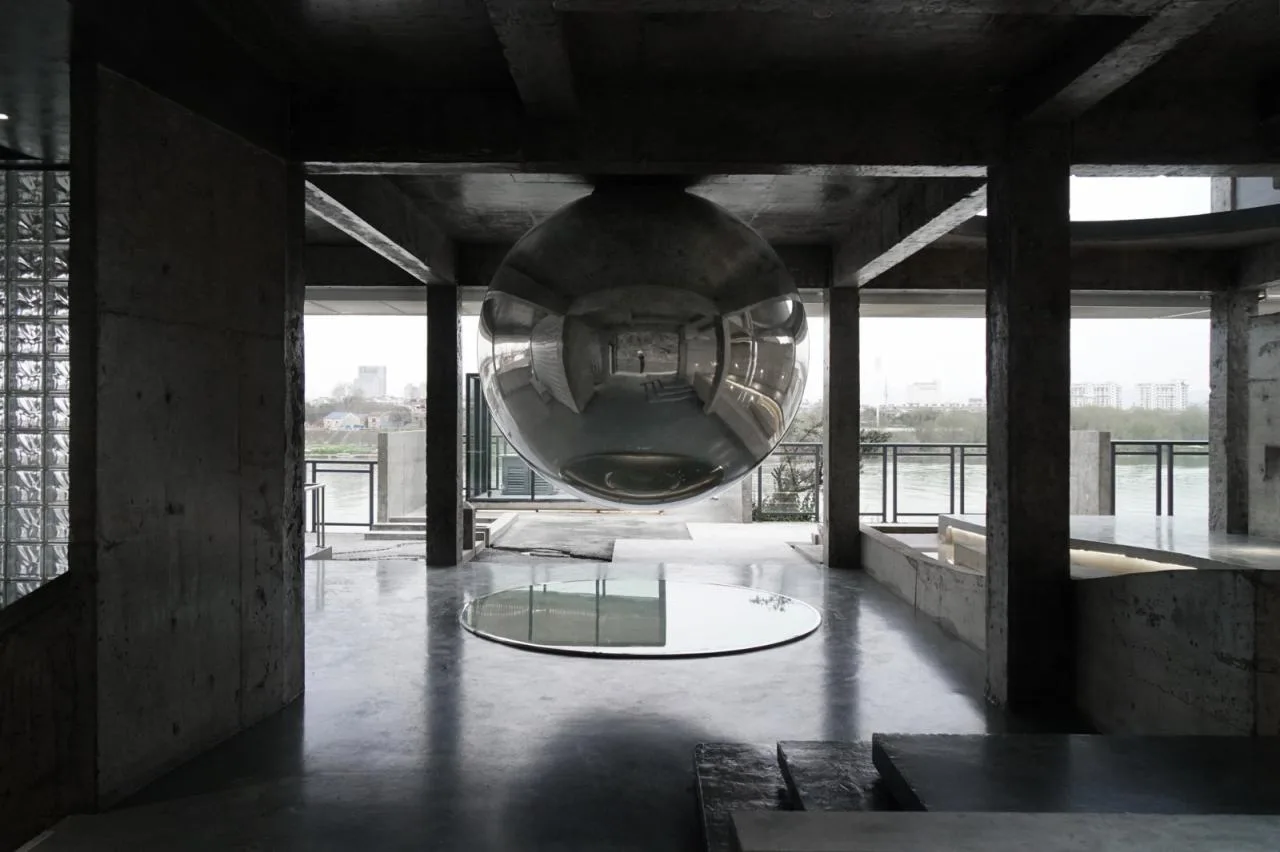
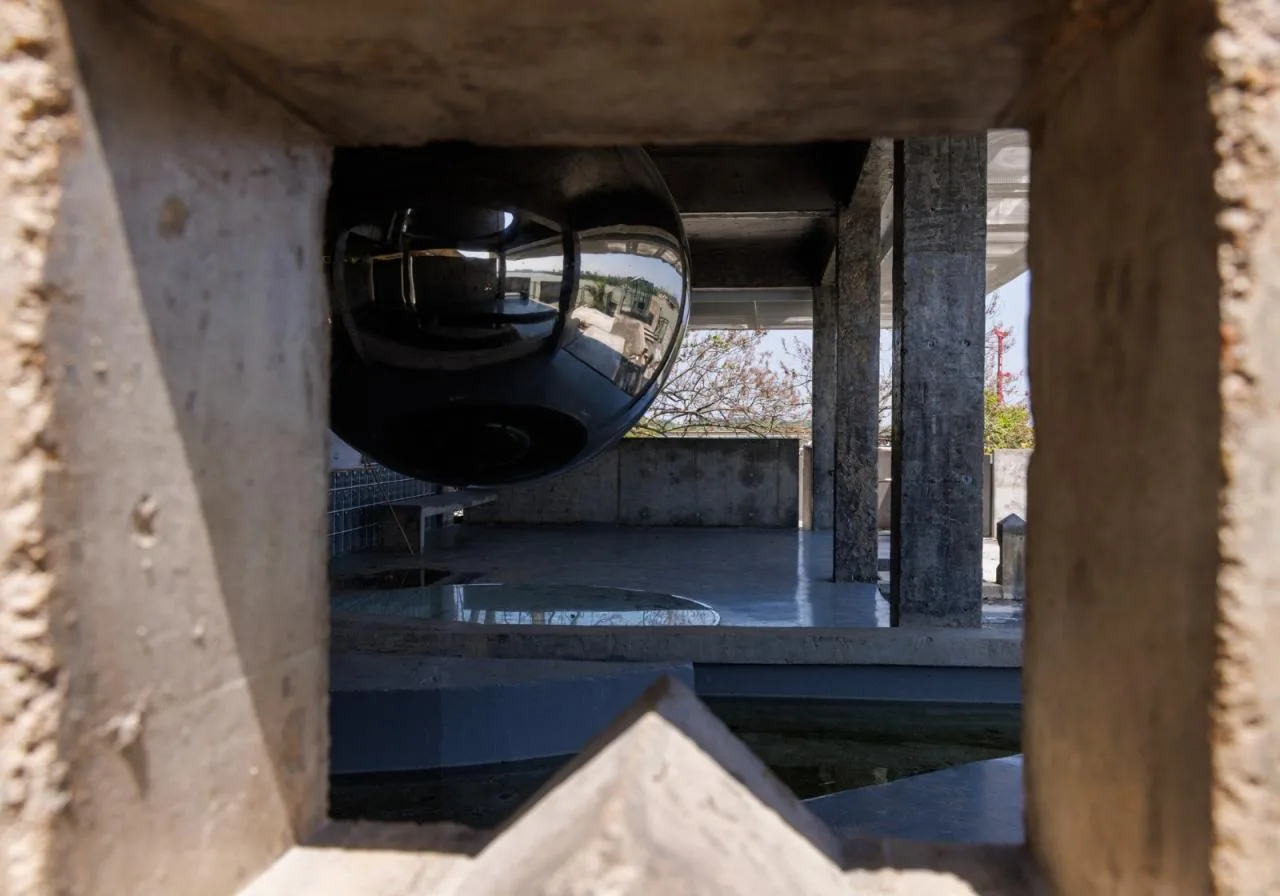
As an unmanned recreational space, the pavilion uses rainwater as a dynamic element, turning the building itself into a permanent exhibit. Rainwater is collected on the roof and funneled into the “Ten Cube Water” prism. From there, it flows along an open channel on the second floor, cascading into a water pool on the first floor that simulates the historic “Jiangxi Weir” water conservancy structure. Overflow water then fills the courtyard and flows into the Longyou Sand Table on the ground, which represents the contour of the nearby watershed. Aligning the obelisk on the sand table with the four openings in the courtyard’s low wall reveals the direction and distance to nearby water conservancy facilities along the Qujiang River. A floating sphere at the building’s center reflects the entire flowing water system, expanding the spatial experience into another dimension.
Project Drawings
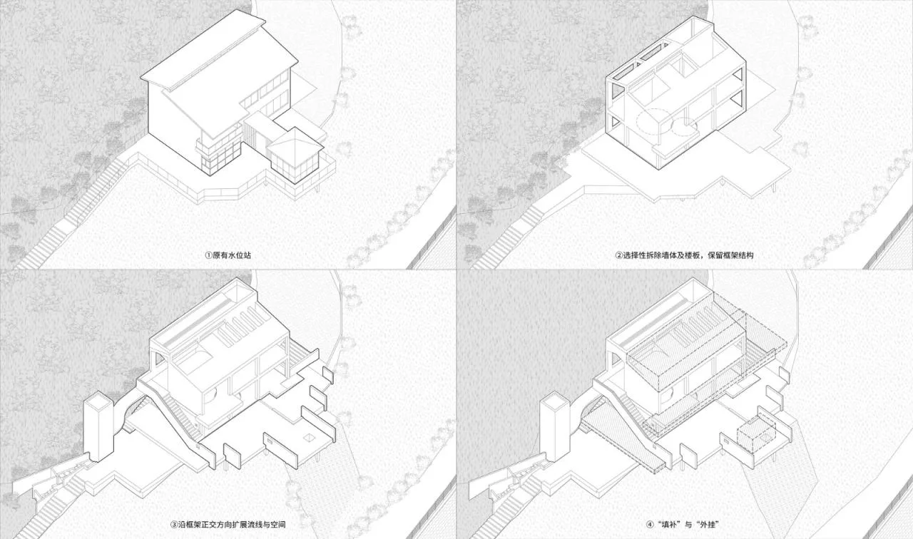
△ Project Generation Diagram
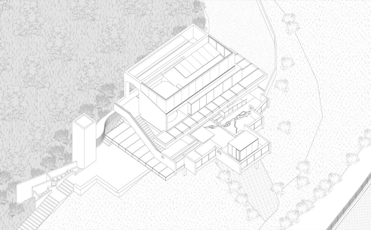
△ Project Axonometric Drawing
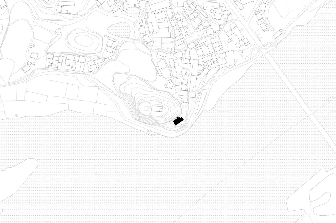
△ Location Diagram
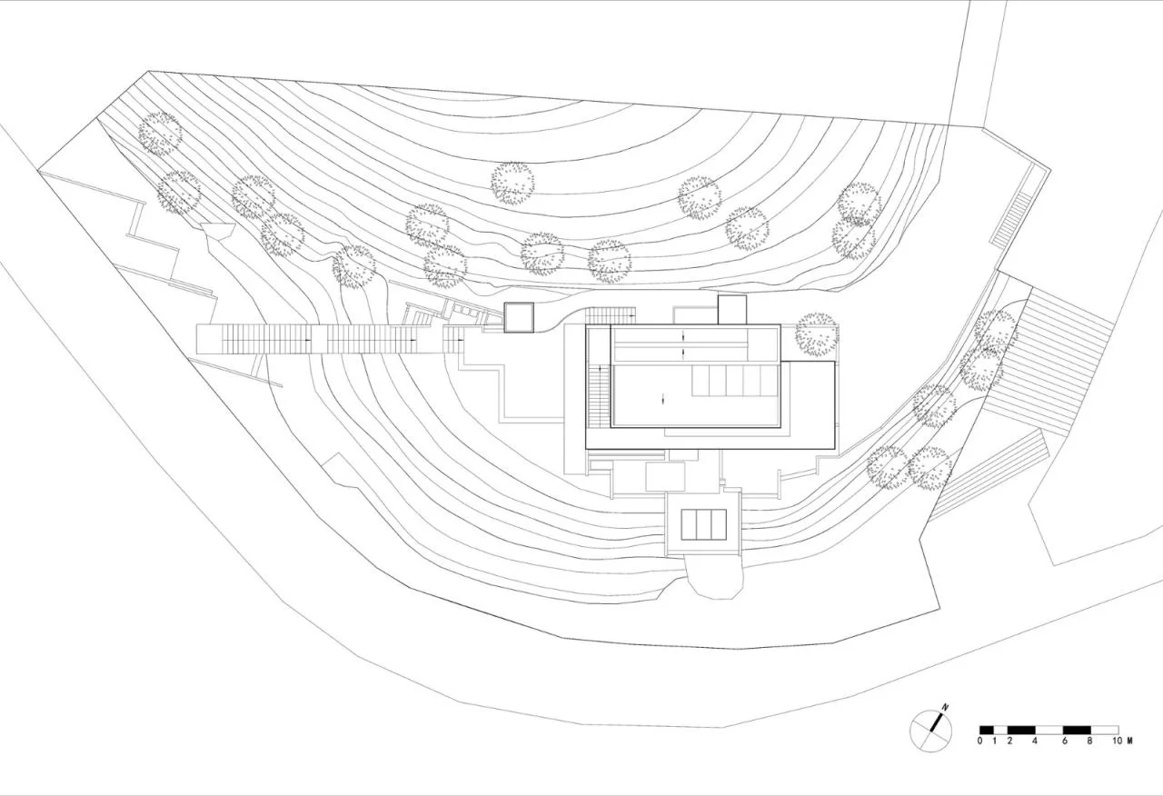
△ General Layout Plan
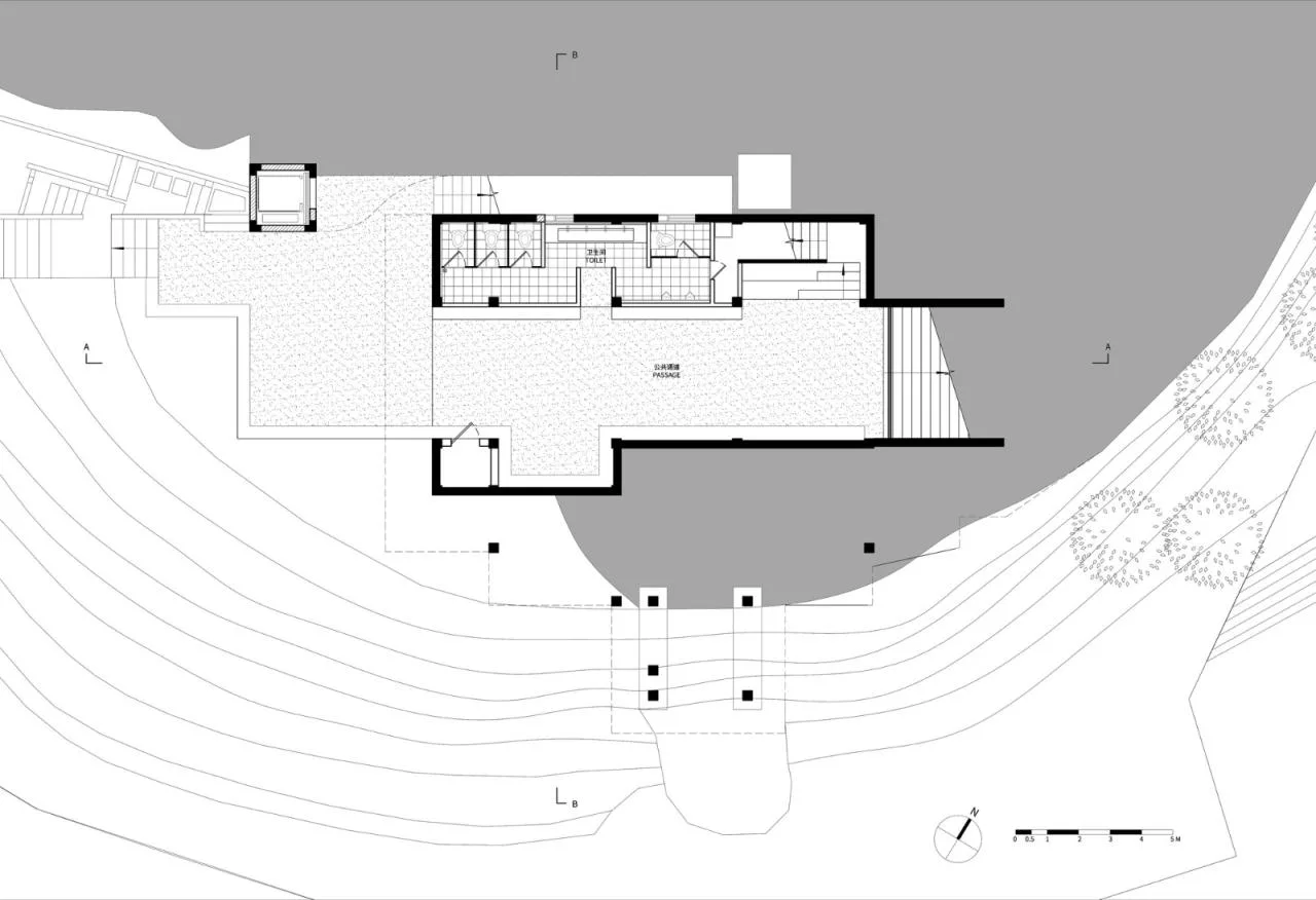
△ Basement Floor Plan
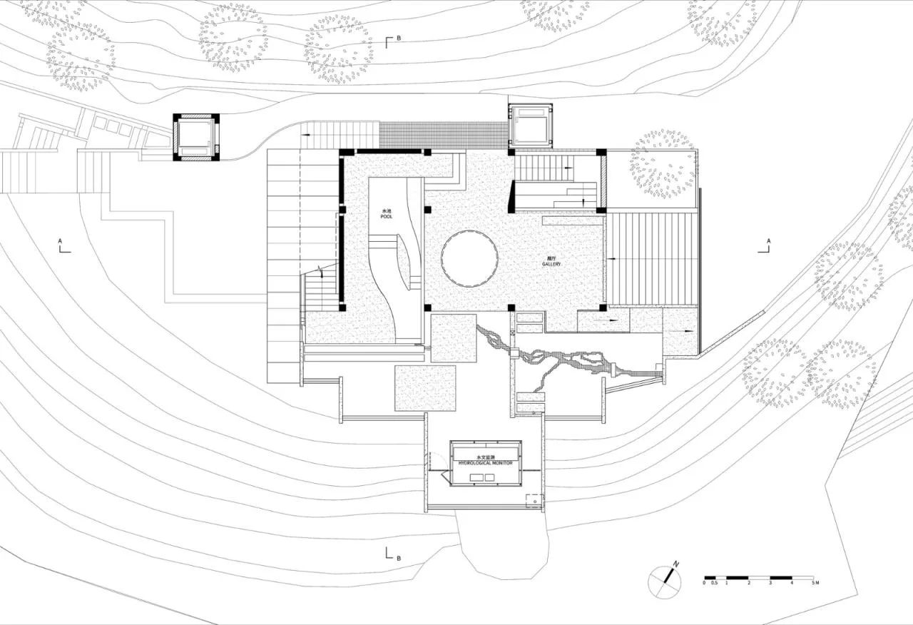
△ First Floor Plan
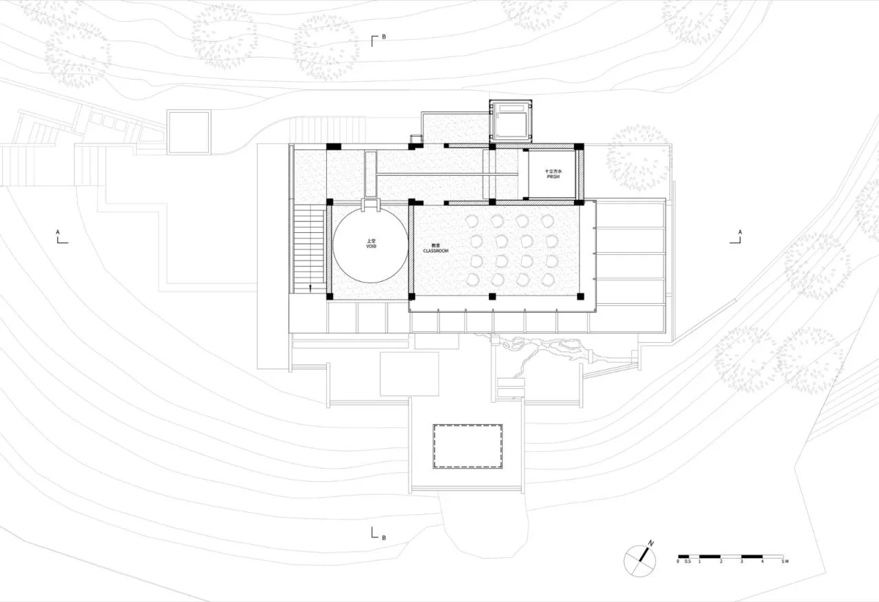
△ Second Floor Plan
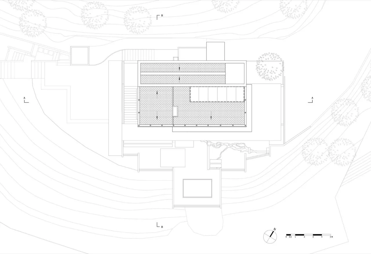
△ Roof Plan
△ Elevation Drawing
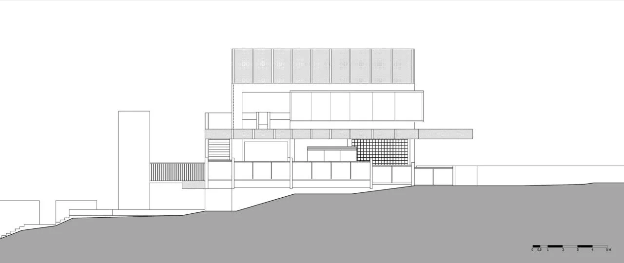
△ Elevation Drawing
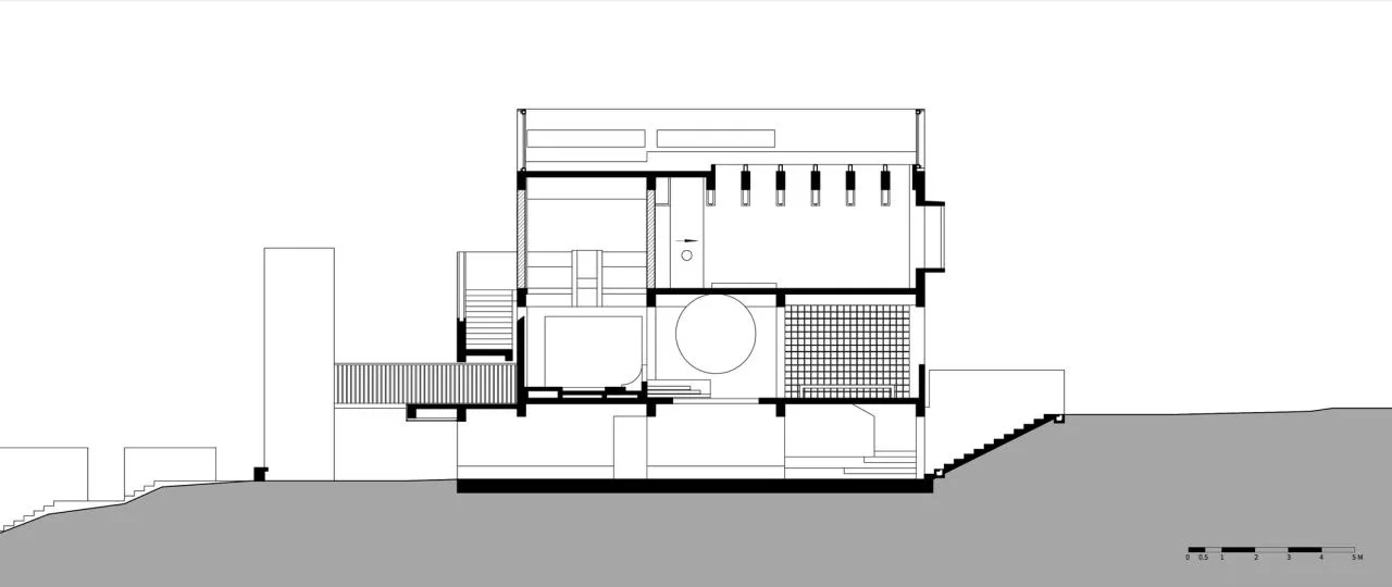
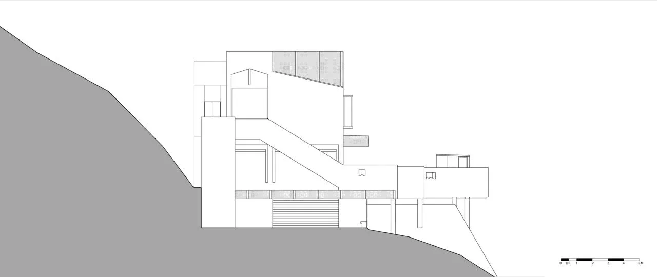
△ Section Diagram
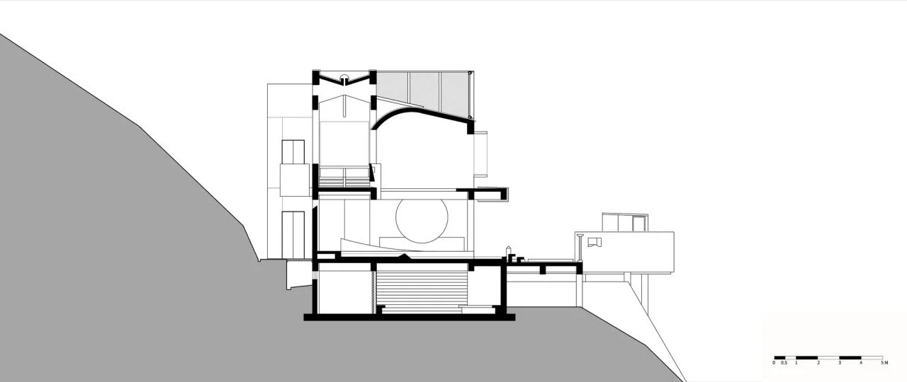
△ Section Diagram
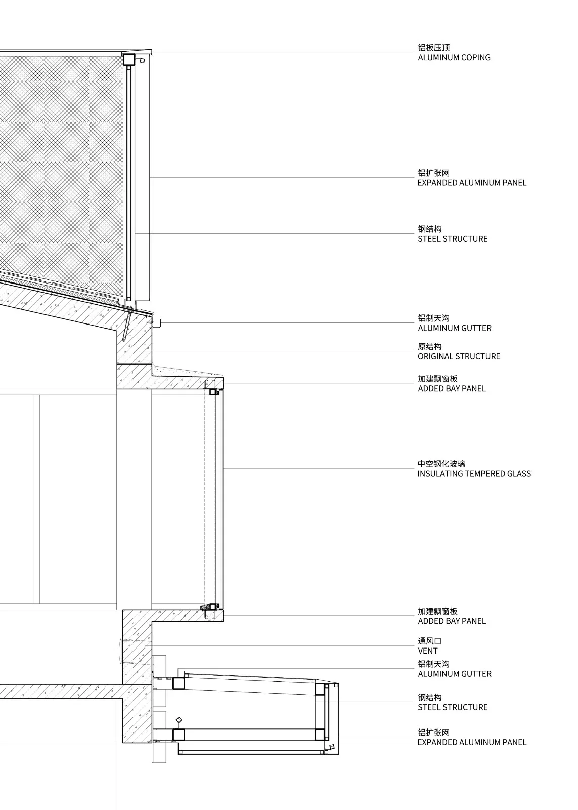
△ Detailed Structural Drawing
Project Information
Architect: Lushan Architectural Design (Shanghai) Firm
Area: 299 square meters
Year: 2024
Photographers: Liu Guowei, Zhou Xiaofu, Tian Fangfang
Lead Designer: Xue Chujin
Design Team: Zhang Beilei, Wu Hengzhi, Shi Liyang, Tao Jingyu, Wang Mingxing (Structure), Ding Rui (Structure)
Client: Longyou County People’s Government
Organizers: Longyou County Construction Management Center, Longyou County Transportation Investment Group Co., Ltd.
Co-initiators: China Urban Planning and Design Institute, Shanghai Fengyuzhu Culture Technology Co., Ltd., Shanghai Bilibili Technology Co., Ltd.
Structural Engineer: Shanghai Huajiang Architectural Design Co., Ltd.
Construction Contractor: Quzhou Boyuan Construction Co., Ltd.
Location: Longyou


Must log in before commenting!
Sign Up