Huawei Terminal’s new headquarters is located in Dongguan City, Guangdong Province, spanning an area of 12 square kilometers and featuring a 13-kilometer-long tram line. The design of the tram lines and stations incorporates spillway channels, reservoirs, bridges, and hills. Given the owner’s high standards for bridge models and surrounding landscapes, traditional two-dimensional designs were insufficient to meet these demands. As a result, the design team opted to utilize BIM technology to fulfill the owner’s requirements.
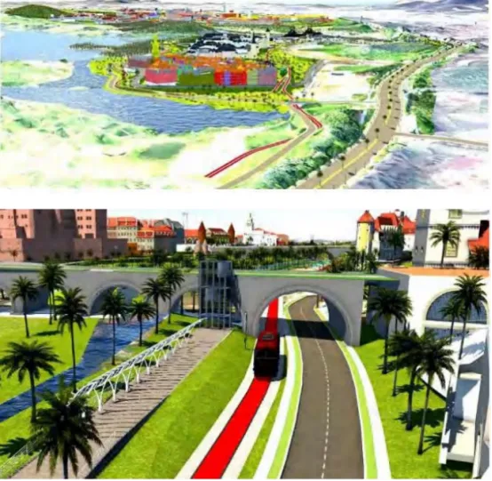
By employing advanced drones to capture high-precision data, the team was able to save significant time on-site measurements and data processing. The drone data facilitated the creation of terrain models, point cloud models, and 3D models. Integrating GIS data into InfraWorks allowed the team to simulate realistic scenes, which served as the foundation for designing the tram routes, as illustrated below. Detailed route design, including planning, vertical alignment, and cross-sectional views, was completed using Civil3D. The route data was then exported to InfraWorks for review and optimization. This combination of Civil3D and InfraWorks enhanced both the accuracy and reliability of the design.
Additionally, SubassemblyComposer was utilized to model the track cross-section, incorporating essential components such as the roadbed, slopes, roadside drainage systems, flood discharge channels, and fire escape routes. Revit was employed to detail reinforcement structures, while Inventor was used for designing the track system itself. The seamless exchange of data between these software platforms significantly boosted the efficiency of the design process.
To provide an immersive experience for the property owners, the design team captured the site and its surroundings, simulating living conditions across different times of day, night, and even through the four seasons, accounting for climate changes. By combining VR with BIM, they delivered a realistic visual experience that allows stakeholders to fully appreciate the project’s environment.


Must log in before commenting!
Sign Up