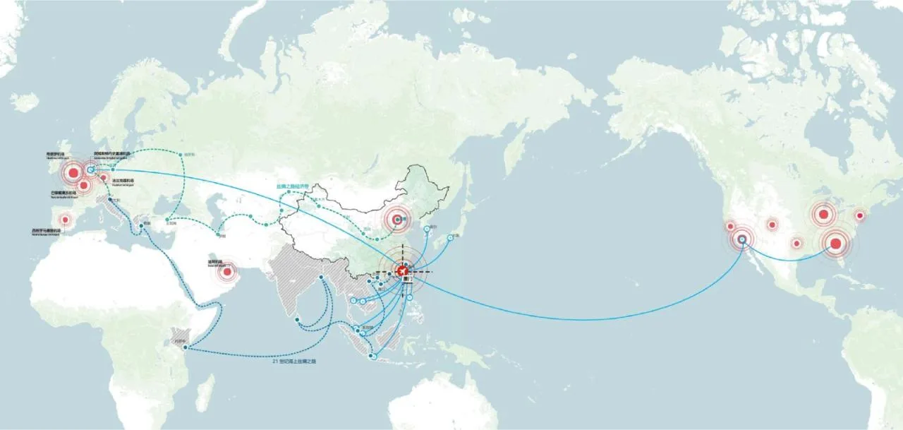
From the natural habitat of egrets to the modern seaside gardens, Xiamen exudes a poetic charm that distinguishes it from other coastal cities. Beyond its beauty, the city holds significant economic development potential. As a key hub on the Belt and Road initiative, with the upcoming Xiang’an International Airport in the south, Xiamen will serve as a vital link connecting central and southern coastal cities, becoming the gateway and vibrant communication hub of the Maritime Silk Road. Recently, the UPDIS and Aedas consortium won an international urban design competition focused on the area surrounding Xiang’an Airport.
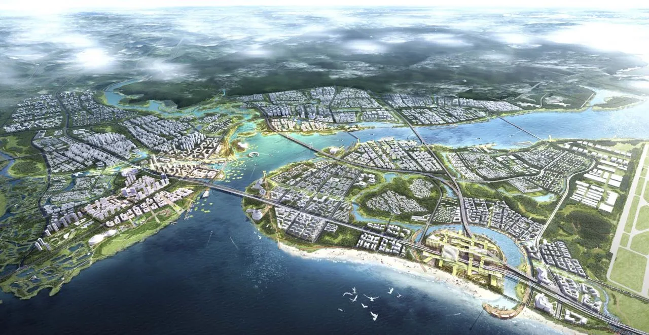
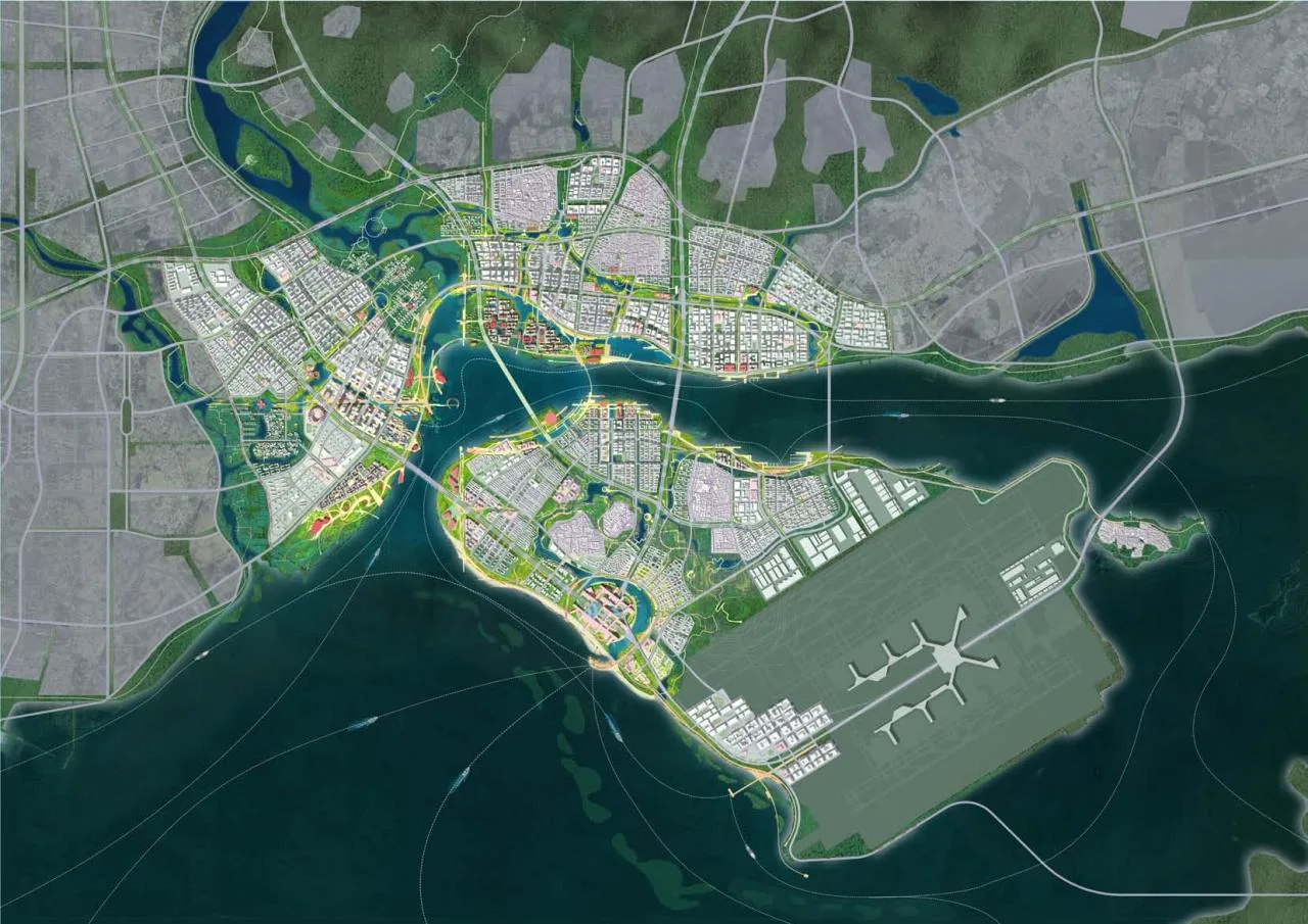
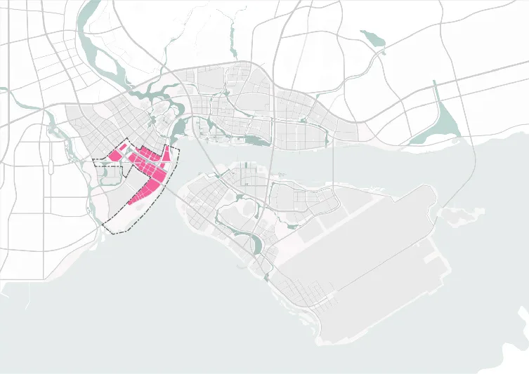
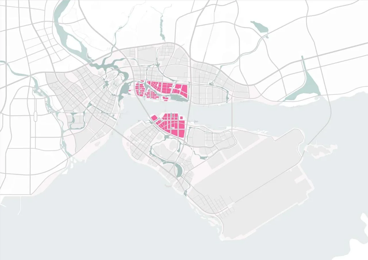
The project covers approximately 62 square kilometers, stretching north to Xiang’an South Road, south to the airport boundary, east to the administrative edge of Xiang’an District, and west to the Gangcha waters. It includes Lianhe River, Caicuo, Dadeng, the airport manufacturing zone, Xiaodeng Island, as well as bays, mudflats, islands, and wetlands that offer a rich ecological landscape. Key design areas are planned independently beyond the overall urban framework.
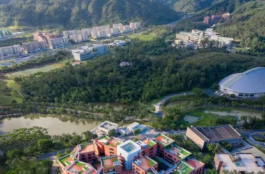
△ Project Location
The area is vast and diverse.
According to Qian Li, director of Aedas, “Xiang’an Airport will be a crucial connection between Xiamen, its surrounding regions, and the world. This zone will become a new gateway for Xiamen. The design challenge is to balance natural landscapes with urban development while preserving Xiamen’s cultural identity, overcoming spatial constraints from the airport environment and village heritage, enhancing linkages between areas, and establishing key zones that act as pivotal supports for island and mainland development. The goal is to embody the essence of a future international airport.”
Foundational Logic and Overall Planning
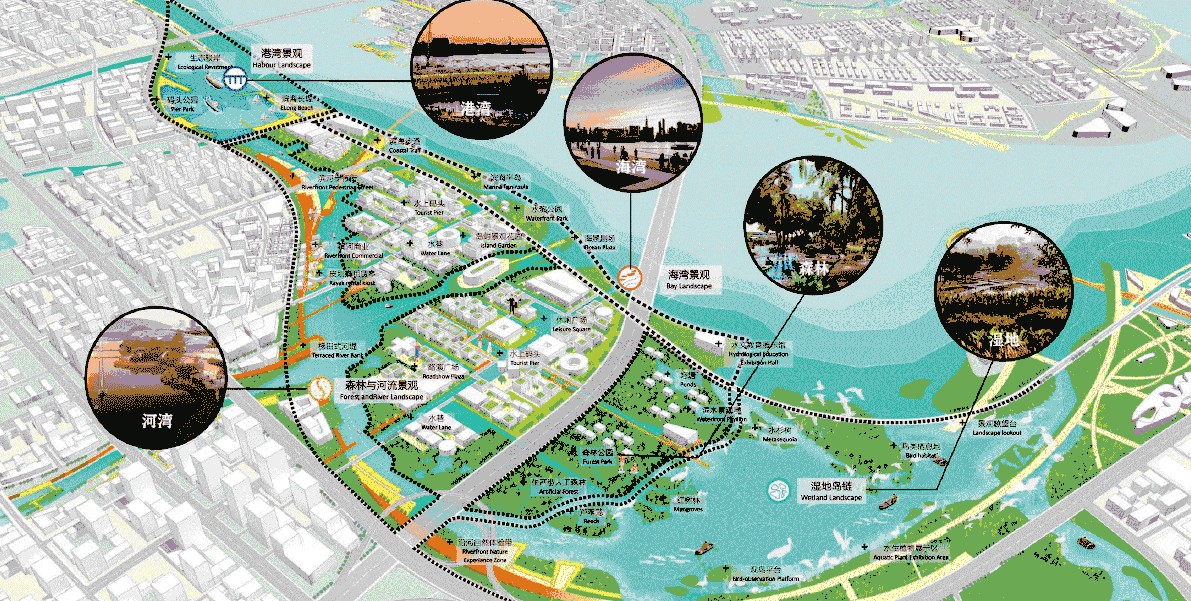
The design divides the area into three parts by the bay, using this natural feature as the central axis. The concept envisions a “sea city” space composed of one bay, three cities, and a ring road connecting six districts. The vision is to build a “Sea Silk Living Room” and a “Beautiful Sea City,” emphasizing “sea views, greenery, culture, and lifestyle.” Four innovative foundational principles guide the design: prioritizing ecological relationships with the sea, a centralized urban mode, intimate scales with limited public sightlines, and highlighting Xiamen’s distinct high-contrast characteristics. These principles translate into four major spatial strategies for the overall plan.
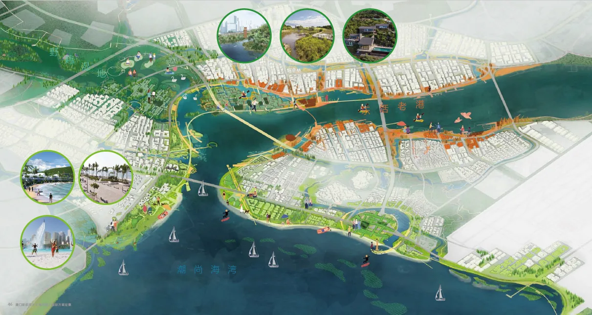
A Bay with Three Colors, Coexisting with Mountains and Sea
The design integrates landscape and function to create an immersive natural experience. It preserves mountain and sea habitats, reserves ecological hinterlands, reconstructs ecological corridors between mountains and sea, and combines blue-green ecological frameworks with forests, waterways, and wetlands to build resilient urban environments.
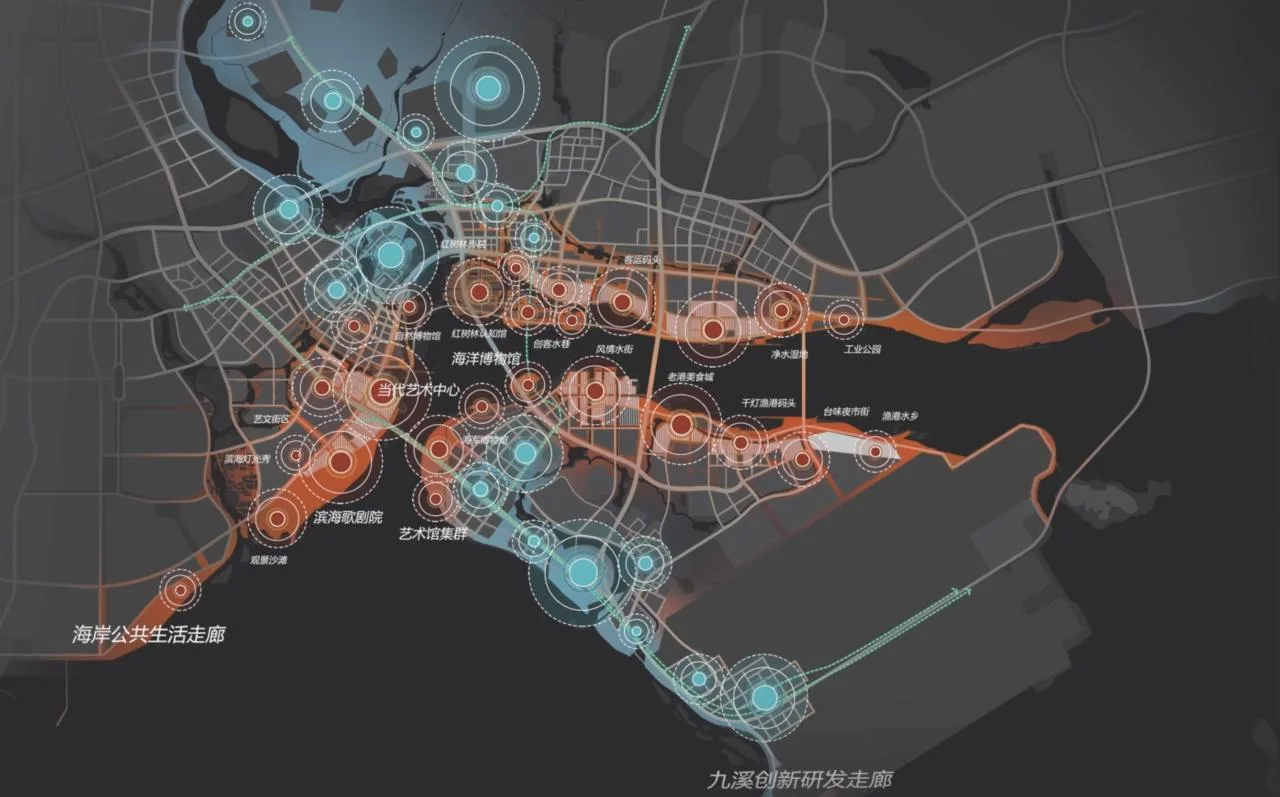
Super Cross, Creative Corridor
Centered on a core spatial structure, the design incorporates strategic landscapes and a mix of fast and slow transportation. It creates a north-south Jiuxi Innovation R&D Corridor that combines a landscape axis with innovation spaces, alongside an east-west coastal public living corridor that hosts arts exhibitions and recreational activities.
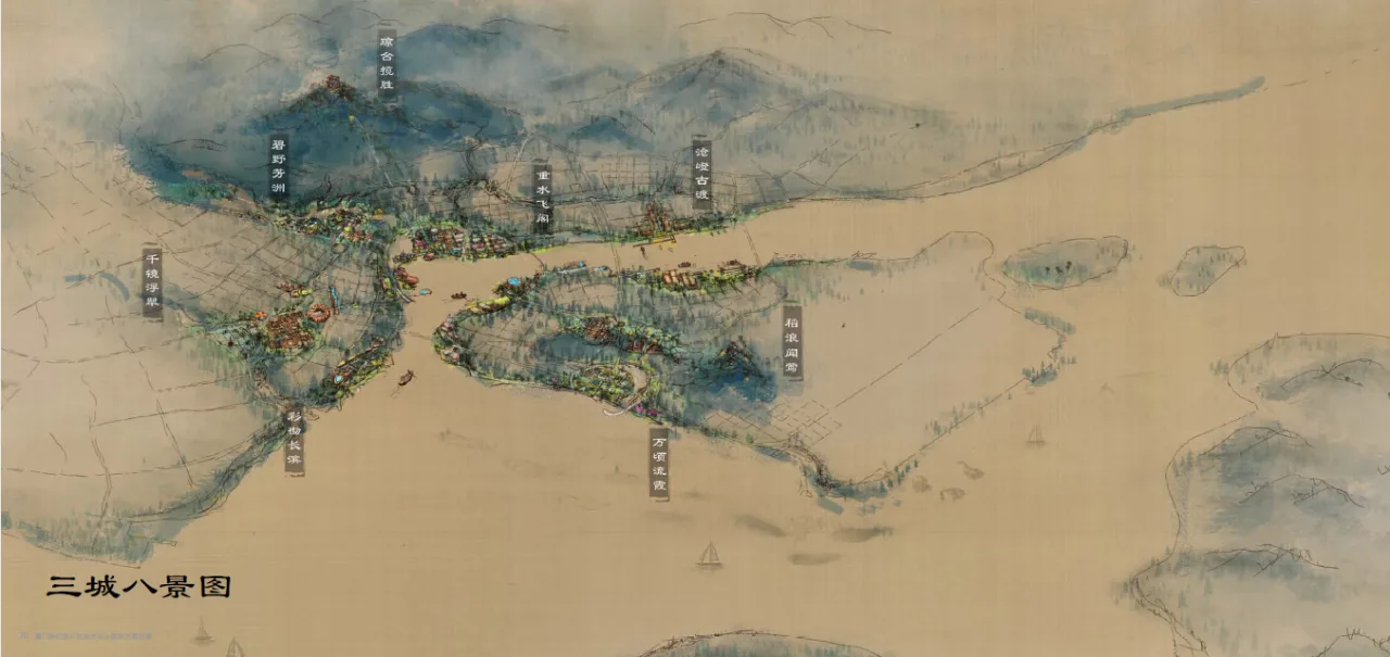
Three Cities and Eight Scenic Spots: Haiyun Scenic City
Based on a compact, livable layout and grounded in the mountain and sea landscape, the plan shapes three distinct zones: Bay Heart Coastal City, Chuanxia Water City, and Sea Flower City. These areas feature eight scenic spots imbued with rich traditional cultural significance.

Dual-Layered Coastline and Seafood Lifestyle
The coastline is designed with dual layers: the inner layer preserves historical and cultural memories, while the outer layer features high-quality public buildings and diverse public spaces. This creates a seafood lifestyle that blends avant-garde fashion with cultural heritage.
Key Areas
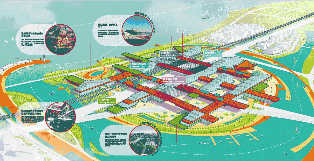
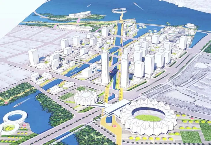
Within the “One Bay, Three Cities” spatial pattern, three key zones are planned across the island and mainland areas: the “Airport Headquarters Island and Future Coast Park,” the “Central Business Green Valley and Coastal Cultural and Art Zone,” and the “Bay Science and Technology Innovation Settlement and Water Community.” These zones serve as vital support structures for the functional development of each area.
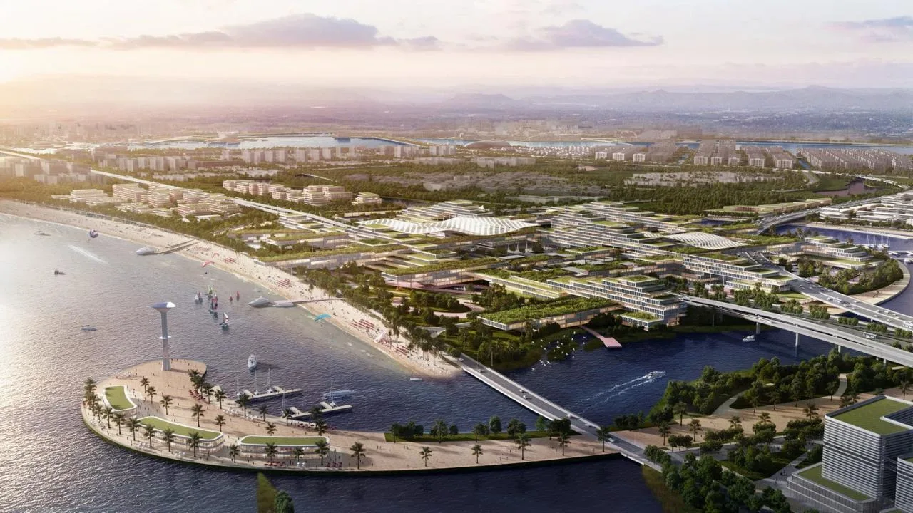
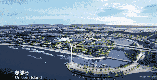
Airport Headquarters Island and Future Coastal Park
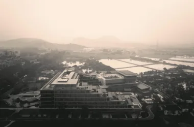
Located on the western coast of Dadeng Island, this zone is planned as a model for future office and lifestyle development based on the Transit-Oriented Development (TOD) concept. It will support airport office operations and Taiwan-Xiamen cooperation through integrated industrial and urban services. The design leverages the natural layout to create a unique spatial structure of “one bay, one island, and one belt,” with the Super Headquarters Island serving as the TOD hub. Various transportation modes ensure strong connectivity with surrounding clusters, including the Binhai Office Block, Taixia Innovation Strait Town, Scientific Research Office Block, and startup settlements. Together, they form a future office ecosystem centered around a Super Block core.
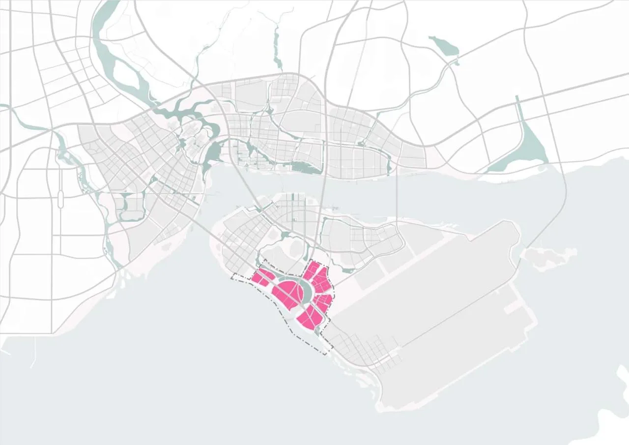
△ Location of the Area
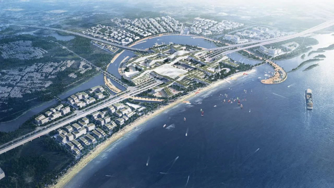
△ Aerial View of the Area
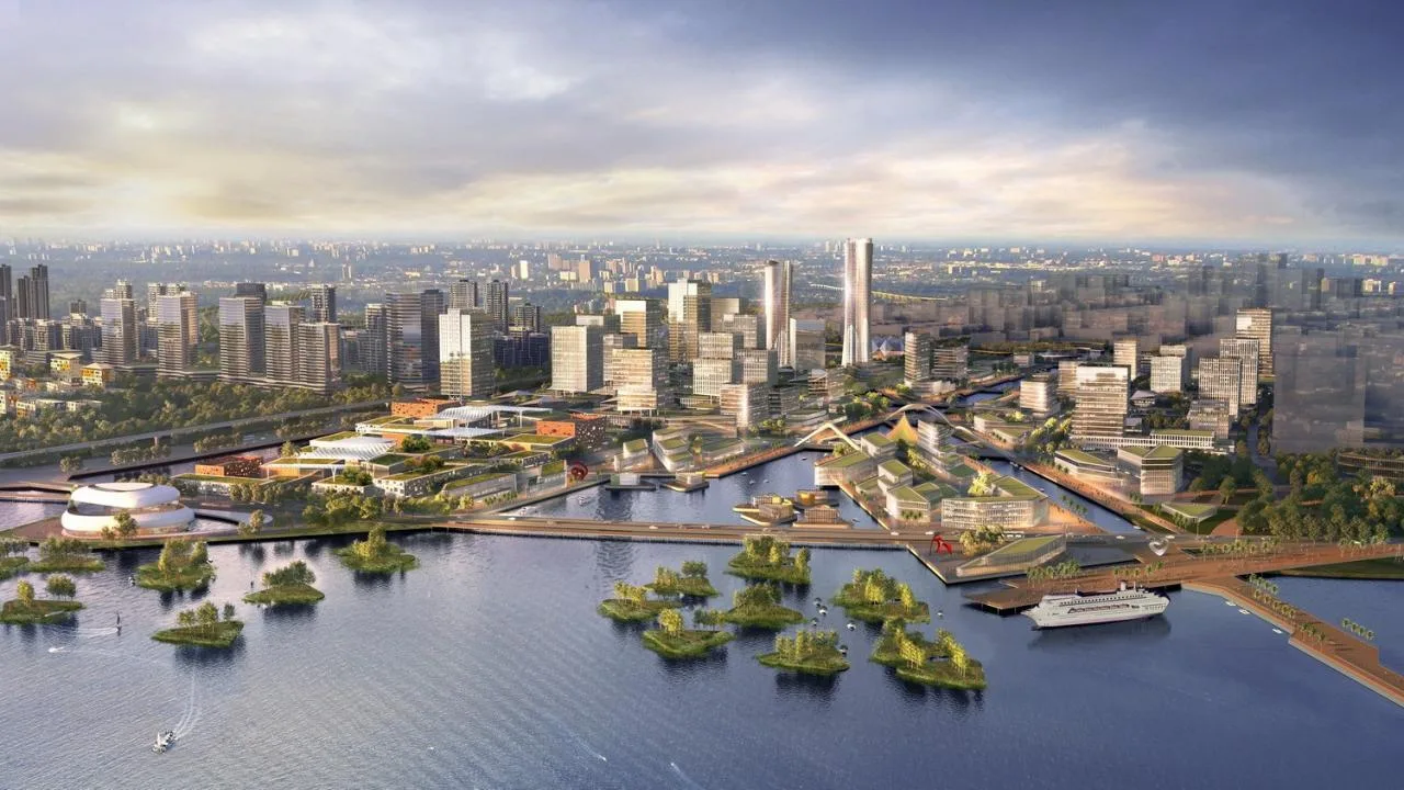
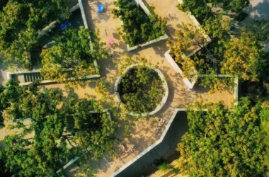
Due to airport height restrictions and coastal ecological restoration efforts, the park adopts a low-rise, flat development approach, replacing vertical towers with horizontally connected shared spaces. The urban skyline is designed with setback-style buildings that create a wave-like effect, maximizing the use of coastal landscape resources. To protect local habitats, the design incorporates multi-level and multi-dimensional landscaping through rooftop greening, setback planting, sunken plazas, and diverse waterfront zones, delivering a rich and immersive waterfront experience.
Low-intensity, flat expansion development
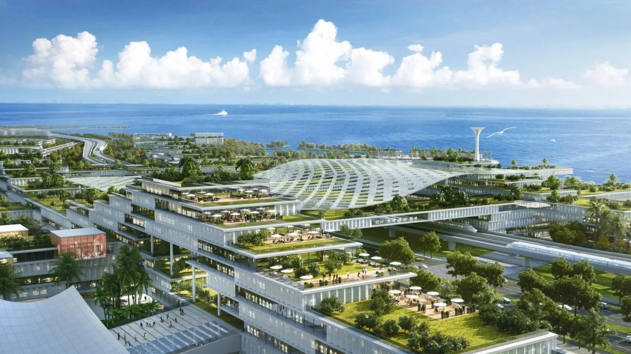
A soft, naturally varied urban skyline
△ Rich waterfront experience
Balancing Urban Development and Ecology
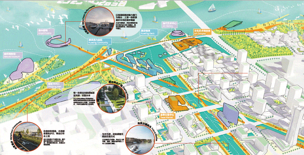
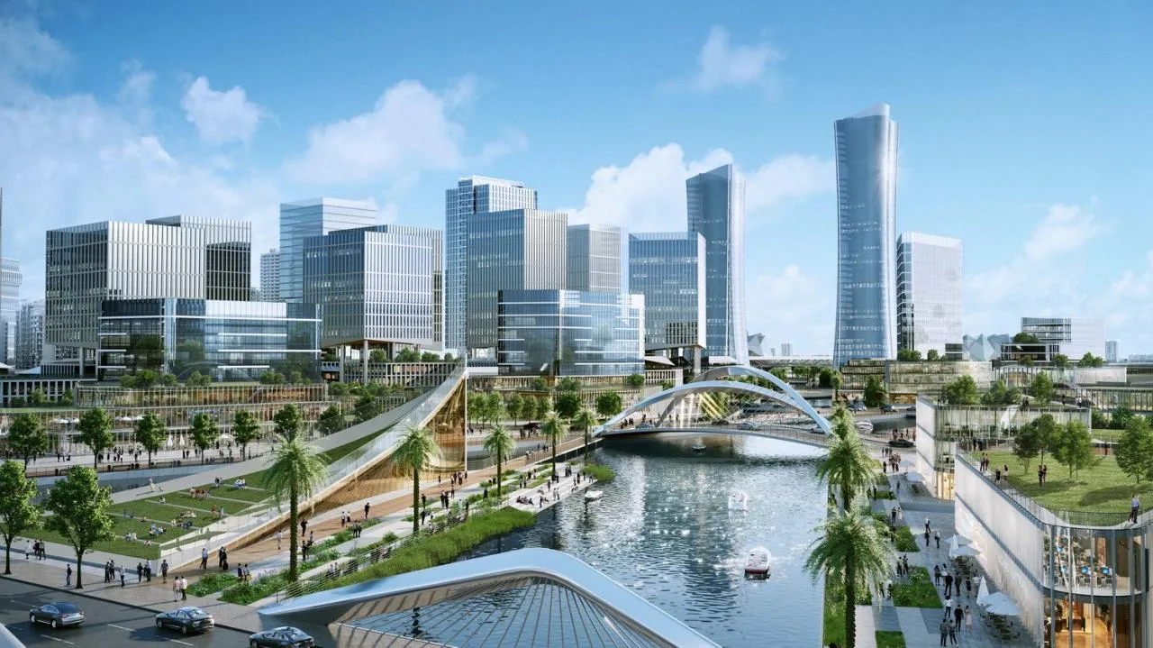
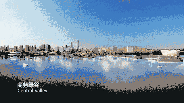
Central Business Green Valley and Binhai Cultural and Art Zone
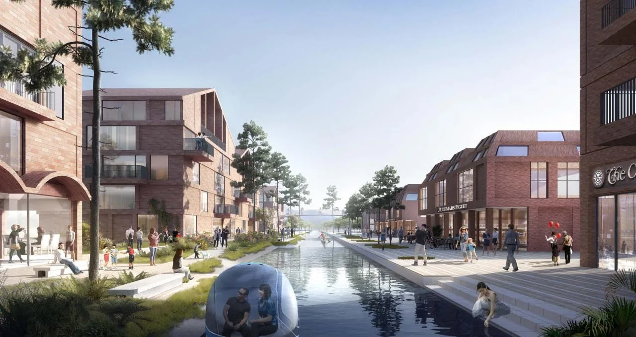
Situated along the western coast, this cluster serves as a business green valley and a vibrant cultural and artistic seaside district. It features a multi-layered development blending the urban fabric with natural coastal elements, establishing a world-class coastal business and cultural hub. The spatial structure is defined by “two axes, one belt, and multiple zones,” with business and financial areas flanking central service and public corridors. A coastal ecological belt faces the bay, dotted with cultural, artistic, commercial, and recreational zones. Visual corridors and axis systems tightly link the urban core to the coastline. Seamless integration of rail, public transit, water transport, and a three-dimensional slow traffic network ensures efficient connectivity.
△ Location of the Area
The architectural layout balances density, with lower plot ratios near natural elements such as mountains and sea, creating smooth transitions between urban and ecological spaces. Water serves as the project’s heartbeat, shaping the business green valley with abundant water ecology and green open spaces. The design embraces the concept of a sponge city featuring permeable water circulation. Traditional Chinese elements blend with modern architecture, incorporating Minnan residential features to create distinctive streetscapes. Streets, alleys, and public squares showcase Xiamen’s unique marine economic culture.
△ Well-proportioned building layout
△ Integrating urban life with scenic views
△ Showcasing marine economy and culture
△ Smooth transition between natural ecology and urban areas
△ Water ecology and green open spaces
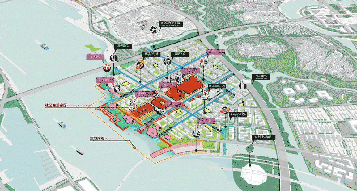
Bay Science and Technology Innovation Settlement and Water Community
Located south of Binhai East Avenue and north of Dadeng Island, this cluster comprises two areas less than 500 meters apart, facing each other across the sea. The vision is to create an integrated maritime work community that blends green ecology with smart technology. The structural layout features “two belts, three islands, and three cores,” establishing a coastal leisure belt and a trendy waterfront belt on either side of the sea. These belts connect three islands—Liangxi Sci-Tech Innovation Island and Haiyang Community Island—achieving seamless integration of entertainment, leisure, work, and living. Core zones on each island ensure shared services within the region.
△ Location of the Area
Each island centers around a water plaza, with multiple water lanes extending outward that replace urban roads as channels for communication and innovation. The design creates an inner bay and distinctive piers, with buildings lining the water to offer residents multiple perspectives of the coastal scenery. Maximizing green boundary values, the plan establishes a network of leisure walking paths, including forest boardwalks, wetland trails, seaside promenades, and water lane pathways. This extends the mountain-sea network and creates a natural landscape where water and greenery intertwine.
Buildings integrated with water
△ Natural landscape merging water and greenery
A Smart Transportation Network Integrating Sea, Land, and Air
Qian Li summarizes, “Our goal is to explore the core characteristics of Xiamen’s high aesthetic value and use the relationships between sea and city, centralized urban modes, form scales, and cultural identity as foundations for shaping the new airport area’s logic. We aim to create an ultimate water city that opens to the sea and develop a world-class, iconic landmark.”
Project Information
Project: International Urban Design Competition for Xiamen New Airport Area
Location: Xiamen, China
Overall Urban Design and Key Area Urban Design: Shenzhen Urban Planning and Design Institute Co., Ltd. and Aedas Consortium
Host: Xiamen Airport Area Command Center, Xiamen Natural Resources and Planning Bureau
Organizer: Xiamen Land Development Center
Planned Land Area: 62 square kilometers
Aedas Lead Designer: Qian Li, Director


Must log in before commenting!
Sign Up