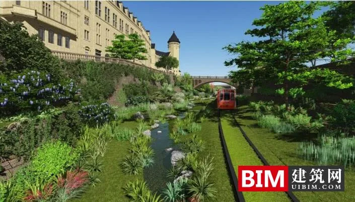
Shenzhen Songshan Lake Park Tram
The new Huawei Terminal headquarters is located in Dongguan City, Guangdong Province, covering an area of 12 square kilometers and featuring a 13-kilometer-long tram line. This project involves coordinating multiple elements such as spillways, reservoirs, bridges, and hills.
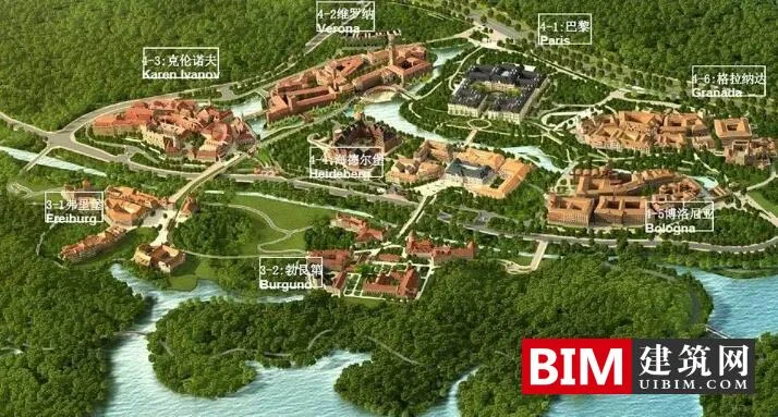
Huawei’s Songshan Lake base draws inspiration from 12 world-famous, beloved cities and regions, employing modular construction technology to create an industrial park that reflects classic architecture. Iconic buildings, central squares, venues, and architectural complexes are interconnected, harmonizing with the surrounding environment to embody the artistic concept of “seamless integration.”
The entire project is managed directly on the BIM platform, eliminating manual modeling steps and reducing labor and resource waste by nearly 50%.
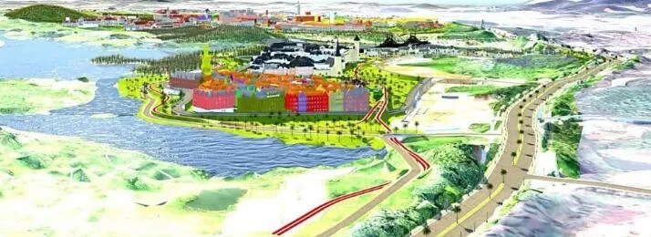
Conceptual view of the Huawei Terminal Co., Ltd. Songshan Lake headquarters developed in InfraWorks
Project Objectives
- Create an industrial park with a beautiful environment and ecological intelligence.
- Use innovative methods to visually present effects, introduce solutions, and enhance communication.
- Design within a realistic virtual environment to improve quality.
- Integrate designs from various stakeholders.
- Connect BIM with information systems and online services for construction management, quality assurance, and safety control.
Unique Challenges
This project required coordinating existing spillway channels, reservoirs, bridges, and hills, while integrating them with ongoing tram station construction. The owners imposed strict requirements on bridge models and surrounding landscapes. Traditional graphic design and visualization methods lacked interactive capabilities and failed to meet these demands. Therefore, the team adopted BIM and reported directly to the owner.
Integrated Design Workflow
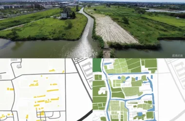
The team utilized advanced UAVs (unmanned aerial vehicles) to capture high-precision data, significantly reducing on-site processing time. UAVs supported various design stages by helping create terrain models, point cloud models, and 3D models.
GIS data was incorporated into InfraWorks to simulate real-world scenes, providing a foundation for route design. Detailed route planning, including horizontal and vertical alignments and cross-sections, was completed using Civil 3D. The route data was then exported back to InfraWorks for review and optimization.
During preliminary design, the team identified that the tram route crossing the hills resulted in high costs, an uncomfortable ride, and damage to green vegetation. Comprehensive modifications were made accordingly. The integration of Civil 3D and InfraWorks enhanced design accuracy and reliability.
Using Subassembly Composer, the team modeled cross-sections incorporating roadbeds, slopes, roadside drainage, flood discharge systems, fire escape channels, and flood discharge areas. Revit was used for steel bar detailing, while Inventor contributed to track system design. By referencing data across design systems, overall workflow efficiency was greatly improved.
Integrating BIM with GIS
Given the large multidisciplinary design team—including lines, landscapes, bridges, buildings, drainage, electrical systems, and GIS—the project required integrating NIKKEN SEKKEI LTD’s designs with those from other international agencies. InfraWorks facilitated seamless BIM and GIS integration, enabling teams to design based on GIS data and easily share models with collaborators. This significantly enhanced communication and decision-making.
By leveraging InfraWorks and BIM360, the team could access project data anytime and anywhere under license agreements, optimizing project quality and decision-making. Access to real-time, up-to-date information and integrated models from a single source boosted operational reliability and efficiency by nearly 30%.
Optimizing Design Through Simulation and Analysis
Traffic simulation was employed to analyze park traffic flow and waiting times, identifying the required road capacity. Mobile simulation helped pinpoint congestion hotspots, enabling designers to optimize the road network and reduce traffic jams.
During complex node construction, conflicts between steel bars were reported from the site. The team used 3D laser scanning to capture existing steel bar data, reconstructing it within the model. This enabled design and construction teams to collaborate on resolving conflicts, smoothing construction processes and improving overall project quality.
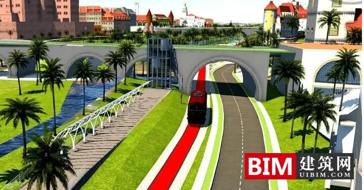
Landscape presentation in InfraWorks using BIM and UAV models
Immersive experience provided through virtual reality technology
To capture the site and its surroundings, an immersive experience was created that not only showcases detailed design views but also simulates living conditions during day and night, as well as through all four seasons of climate change. Combining VR with BIM allows clients to experience the design realistically, encouraging designers and users to explore and optimize solutions collaboratively, thereby enhancing stakeholder cooperation.


Must log in before commenting!
Sign Up