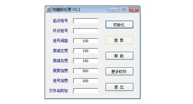
The AutoCAD Ground Model Preprocessing Program helps users trim topographic maps based on specified pile number intervals and left and right distances. This reduces the number of points needed to create a ground model efficiently. The software is free, green, and fully functional, so you can use it without any restrictions.
Usage Instructions
1. Download and extract the decompression software;
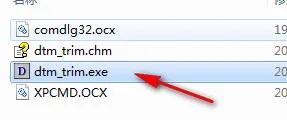
2. Run the dtm_trim.exe file to start using the program.


Must log in before commenting!
Sign Up