“The coordinates of a city are shaped not only by its visual form but also by the public attributes of urban life it fosters.” – Zhu Peidong
Wuhan Yangtze River Center
Coordinates of Future Waterfront Cities
Situated on the prime waterfront along Wuhan’s Wuchang Inner Ring Road, the Wuhan Yangtze River Center boasts a strategic location directly facing key CBD areas, including the Wuhan Municipal Government and the Bund Financial Center. This position offers a superior geographical advantage and significant urban influence.
The Wuchang Binjiang Business District, where the Center resides, anchors the core of the Yangtze River axis and is recognized in Wuhan’s “14th Five Year Plan” as a “deepening international metropolis image display area along the Yangtze River.” It is envisioned as a high-end business district, driven by a headquarters economy and supported by clusters of international finance and information consulting industries.
△ Urban Location Analysis
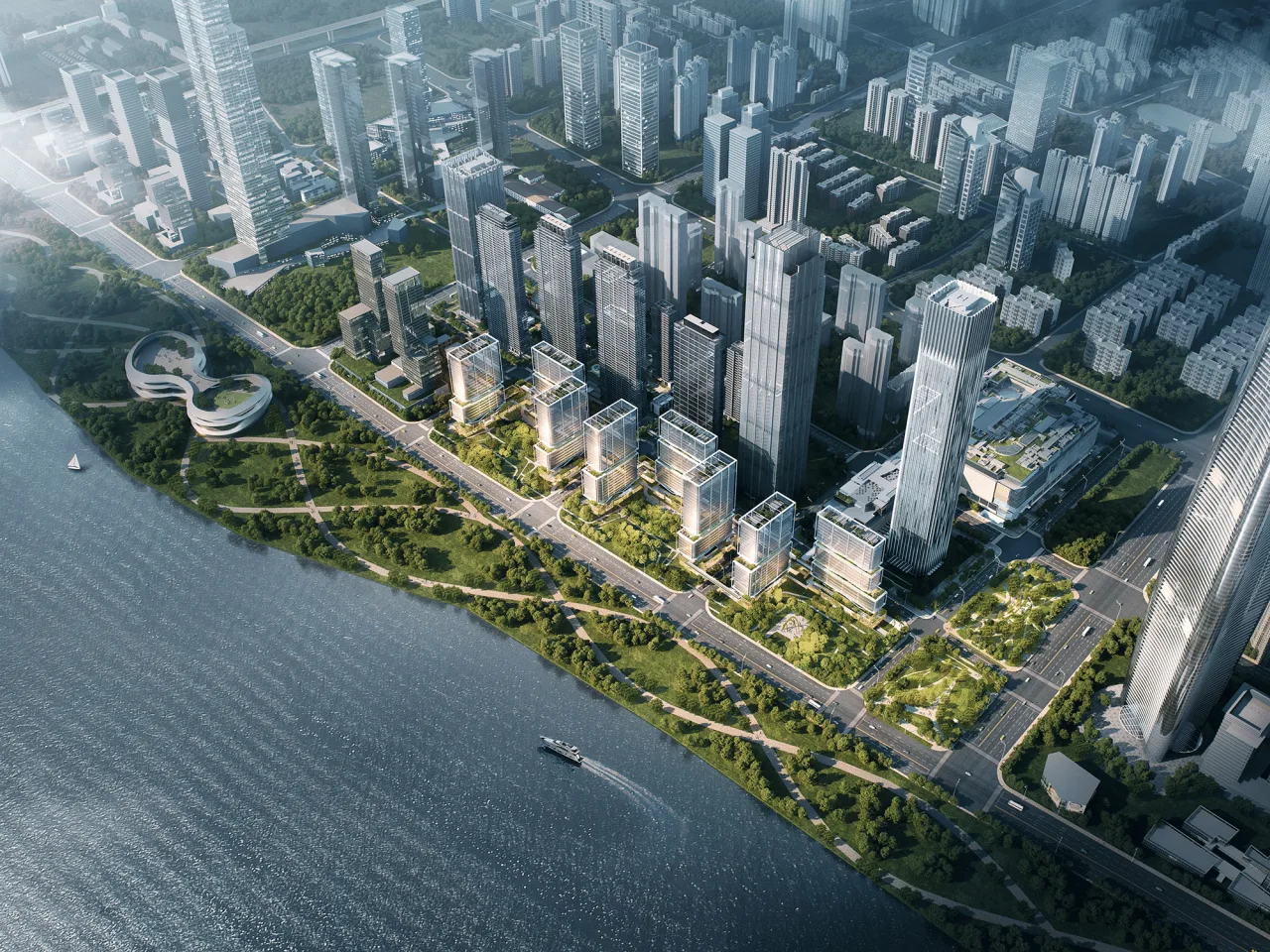
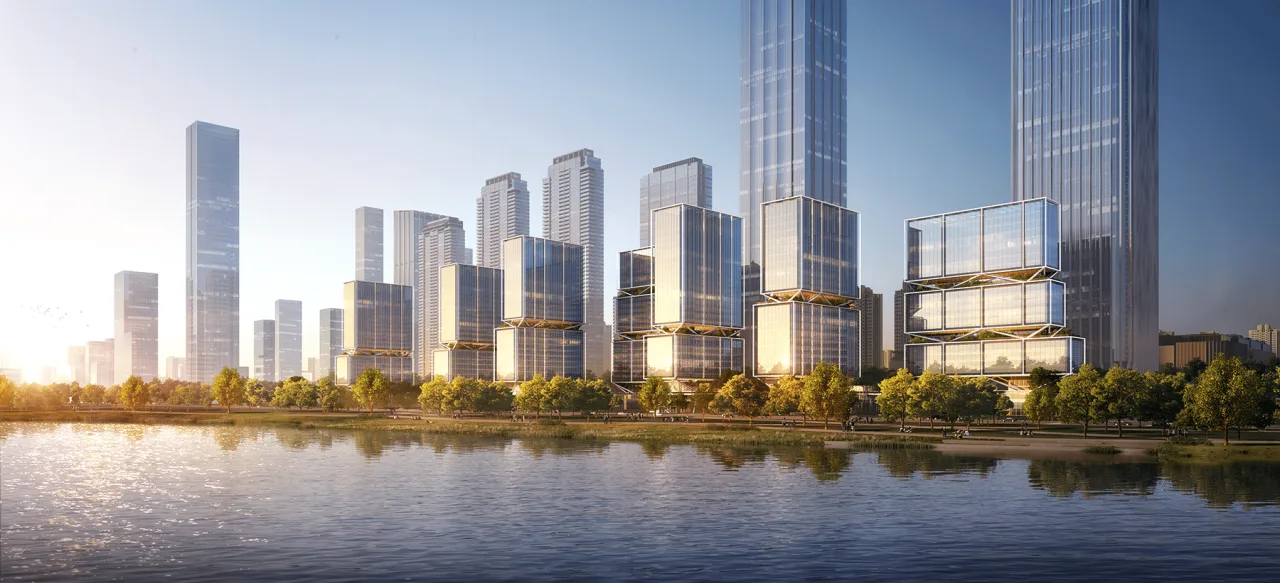
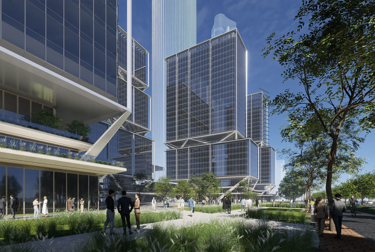
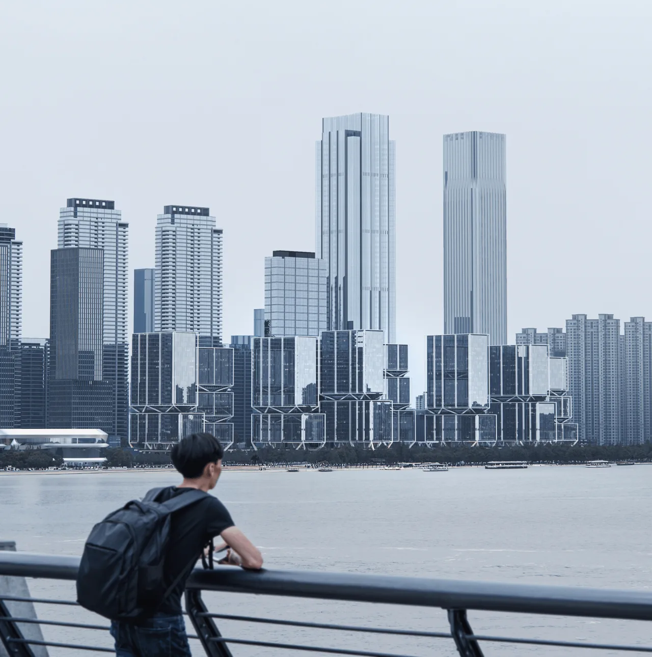
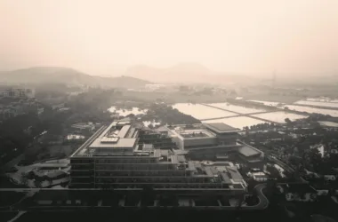
△ Aerial View of the Project
The Yangtze River Center covers a total construction land area of 194,000 square meters. It includes a 380-meter super high-rise tower housing offices, commercial shopping centers, luxury residences, and other functions developed in phases. Plot C remains the last undeveloped strip along the riverfront and serves as the most prominent urban interface of the Yangtze River Center.
This plot is divided into three subplots—two rectangular and one L-shaped—separated by two urban roads, representing a critical opportunity for urban expression along the river.
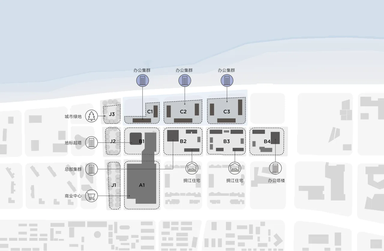
Analysis of the Yangtze River Center’s Planning
As the river-facing core of the entire Yangtze River Center, Plot C holds the potential to become the defining urban landmark of Wuchang CBD and a dynamic catalyst for regional development. To this end, the project has invited renowned domestic and international institutions to contribute design proposals.
The competition brief emphasized key design requirements: to create a high-energy urban coordinate building capped at 100 meters in height, incorporating visual corridors, skyline variation, and panel design elements.
Line+ co-founder and lead architect Zhu Peidong was invited to participate in the “Wuhan Yangtze River Center C Block Project International Competition.” As the sole local design firm in this global contest, Line+ competed alongside two internationally acclaimed avant-garde firms, focusing on the open-ended concept of “waterfront city coordinates.”
△ Project Video
Defining Coordinates
Open Community, Urban Gathering Space
Traditional landmark buildings often rely on imposing height or scale, combined with symbolic or commemorative architectural language to express a city’s or enterprise’s ambitions. However, the essence of modern cities lies in creating peaceful and fulfilling living and working environments for citizens.
Unlike static urban landmarks, contemporary coordinate architecture should serve not only as spatial markers but also as vibrant hubs of urban life. It must be an open, inviting gathering place for citizens—a dynamic node that enhances visual identity while fostering diverse social and cultural interactions.
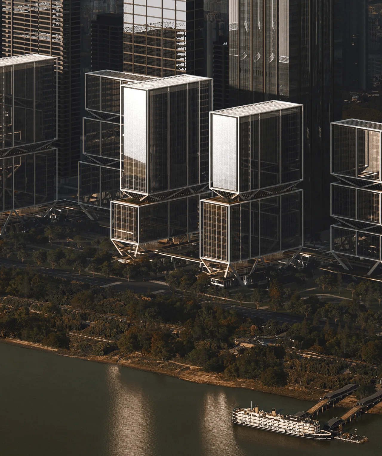
To realize this vision, we propose a “group” layout strategy that breaks the mass into smaller components, respecting height and volume constraints while better integrating with the urban grid and the Yangtze River waterfront environment.
This cluster approach amplifies the multi-layered visual experience of the coordinate buildings through collective imagery, encouraging a relaxed community atmosphere and diverse patterns of public engagement.
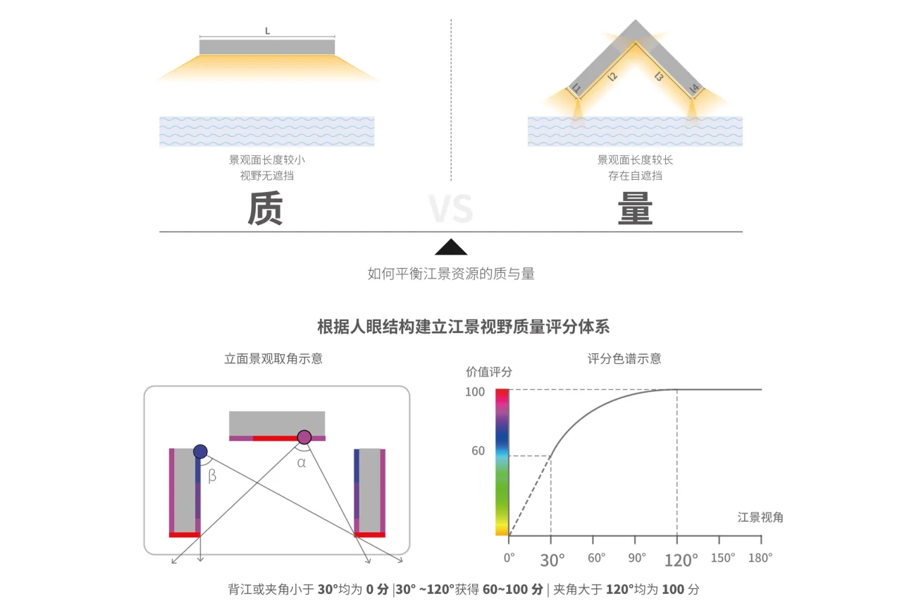
With nearly 600 meters of waterfront along Wuchang Bay, the site presents a significant design challenge: how to optimize layout to maximize views of both the river and the city.
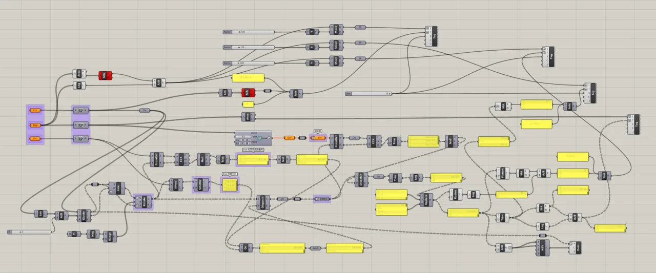
We developed a river view evaluation system based on human visual perception, balancing factors such as building articulation, quality and quantity of river views, development capacity, building heights, and urban visual corridors.
After considering these inputs, we finalized a “double U-shaped + L-shaped” layout scheme.
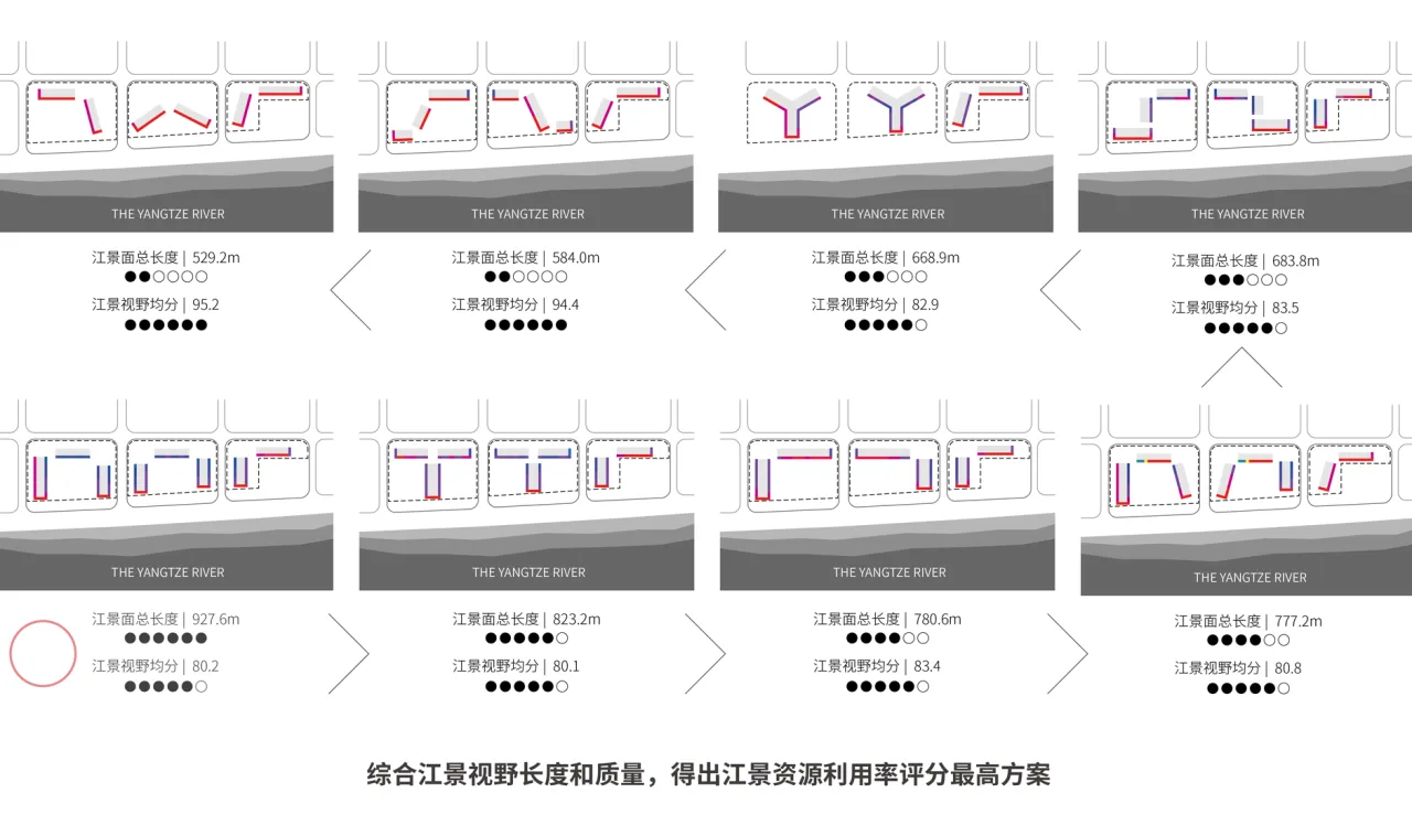
△ Layout Scheme Analysis
△ Layout Plan Model Photo
This design not only establishes strong visual corridors for neighboring buildings and maximizes river views within the site, but also creates three public waterfront oasis parks framed by eight high-rise towers along the river, injecting new vitality into the urban fabric.
△ Site Layout Analysis
Coordinating Urban Elements
Grid, Three-Dimensional, Suspension, Openness
Addressing the shaping of waterfront city coordinates under the “urban agglomeration” model, we conducted in-depth research across scales—from regional structures and block textures to architectural technology integration and spatial configuration.
Our goal was to enhance the energy density and appeal of this “urban agglomeration,” crafting a coordinate building that is not only visually impactful but also perceptible and experiential in everyday life.
We distilled our approach into four core strategies: grid, three-dimensional, suspension, and openness.
Grid: Urban Road Network and Open Connections
The chosen “double U-shaped + L-shaped” layout aligns closely with the city’s road network and block texture. The pocket-style open parks created by setbacks along the Wuchang Riverside establish spatial continuity that smoothly transitions into the natural landscape.
At the pedestrian level, a vertically layered slow-traffic network links the site with surrounding urban pathways. Pedestrian bridges and green cultural corridors connect the three subplots with adjacent blocks, the Wanda Plaza commercial complex, and Binjiang Park.
The design emphasizes permeability with open street corners, attracting visitors from multiple directions and enhancing the site’s accessibility and social vibrancy.
Three-Dimensional: Functional Integration and Spatial Complexity
Higher-level planning demands openness and connectivity. We respond to these requirements with a three-dimensional base structure that balances transparency and commercial viability, enriching the site’s functional complexity and spatial vitality.
The open ground-level block and a 6-meter elevated sky street create welcoming spaces for diverse commercial activities, attracting foot traffic and enhancing accessibility.
A 10-meter-high sky park focuses on ecological enhancement and experiential quality, crafting premium three-dimensional urban public spaces.
This setup supports diverse flows of office workers, shoppers, and residents, fostering social interaction across various zones through open, shared spaces.
Suspension: Technical Approach and Spatial Division
The lower zone primarily serves public participation spaces, focusing on openness and accessibility. The upper zone caters to future enterprises and entrepreneurs, requiring flexible spatial design to accommodate uncertain commercial demands.
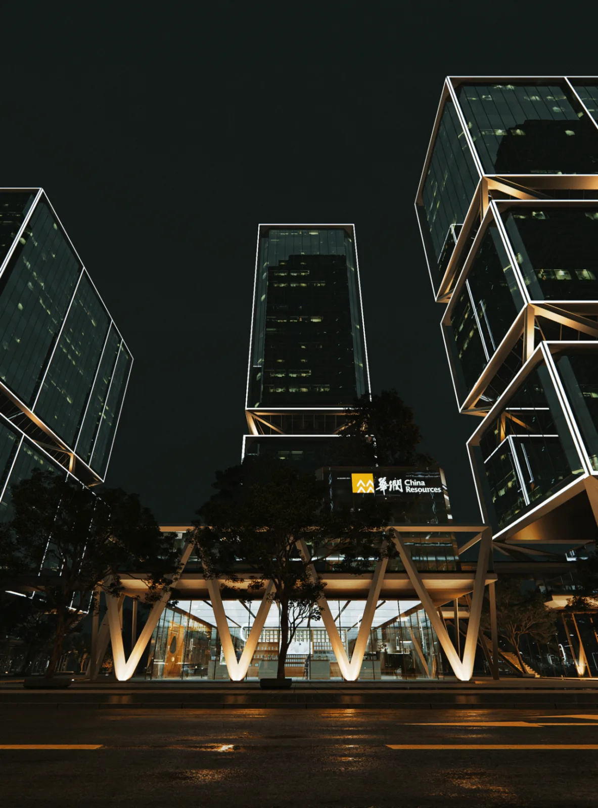
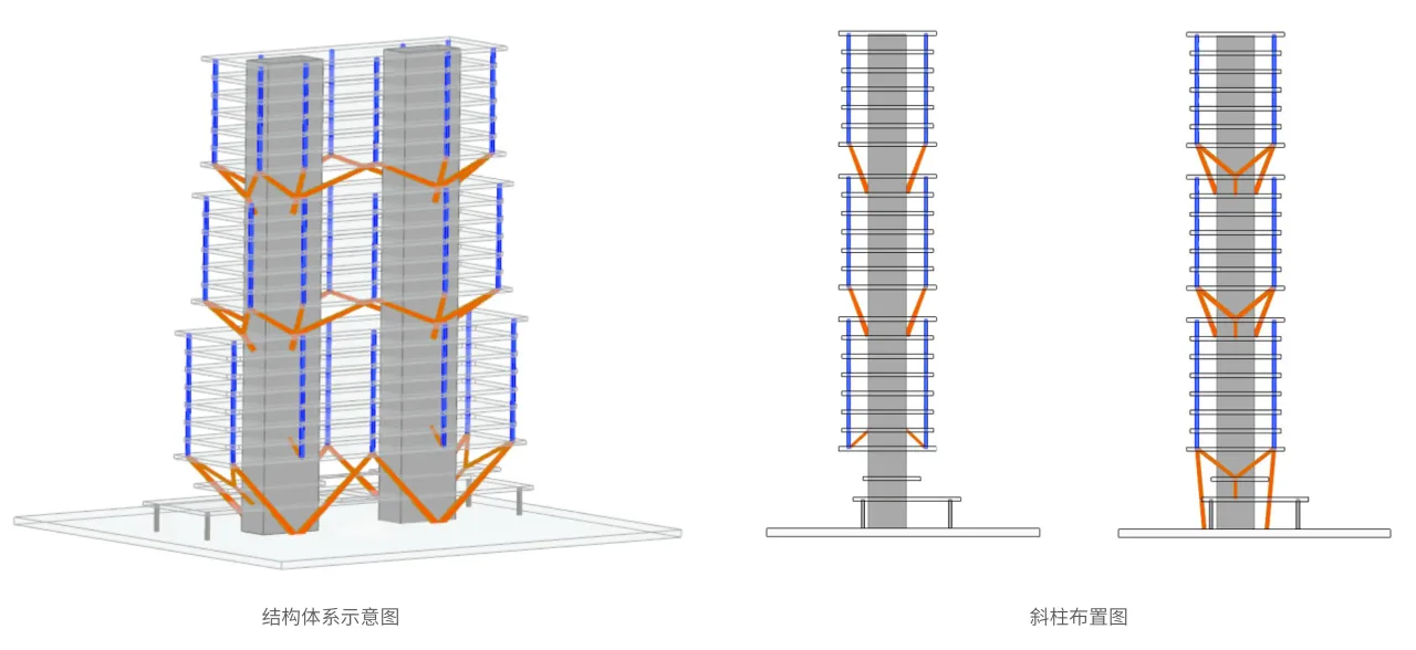
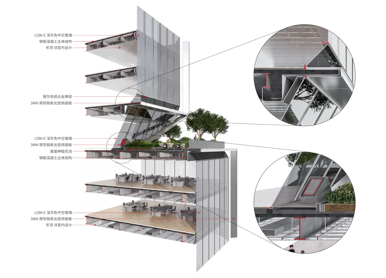
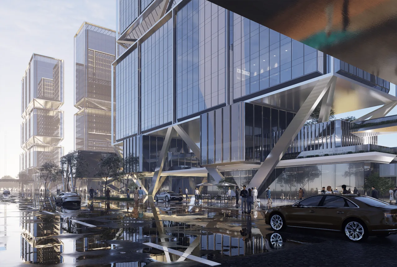
To meet these needs, we adopted a steel frame concrete core tube structural system, using vertical cores to transfer loads efficiently between the core tube and Y-shaped inclined columns, creating three distinct platforms in the form.
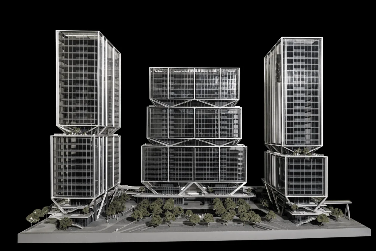
△ Single Plot Model Photo
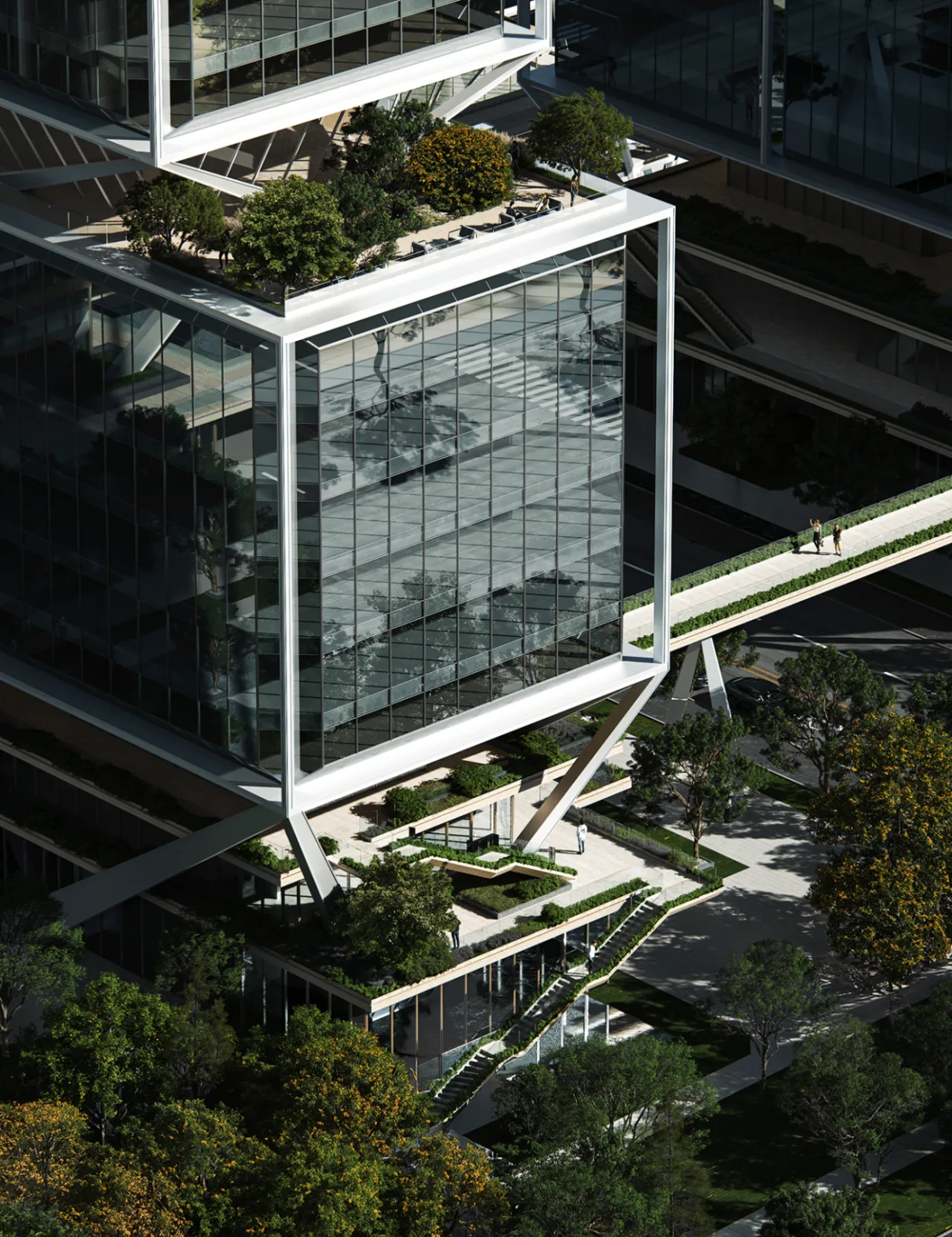
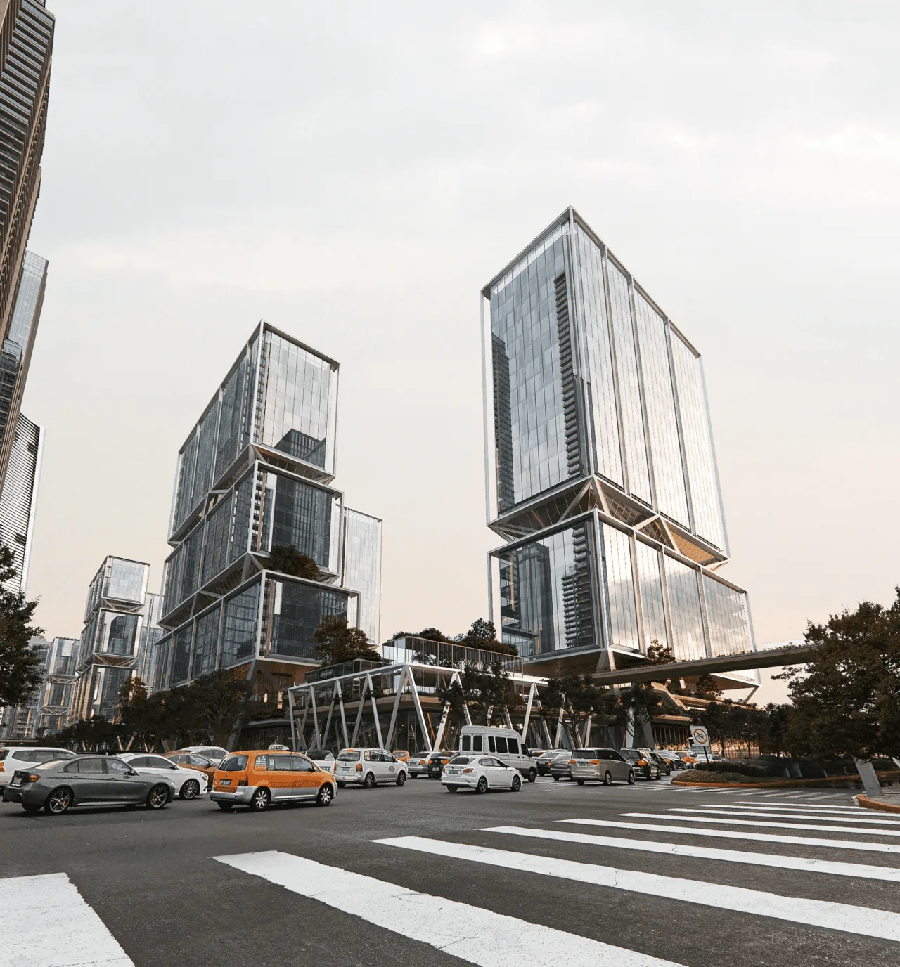
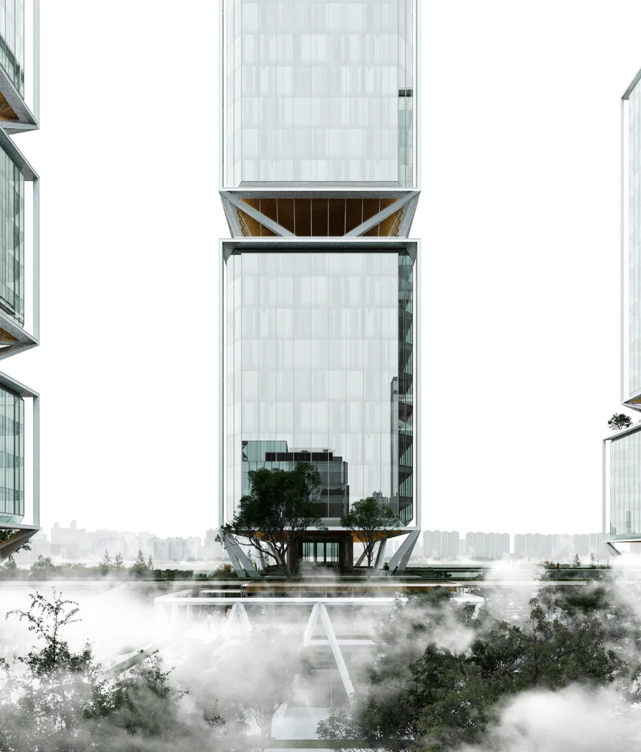
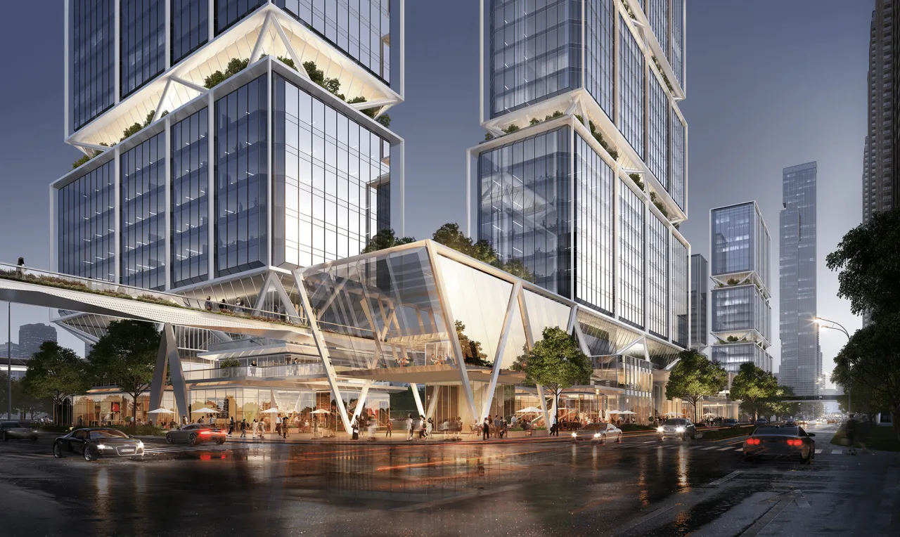
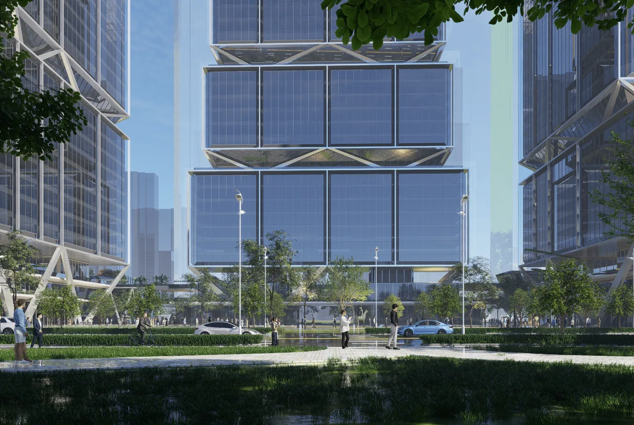
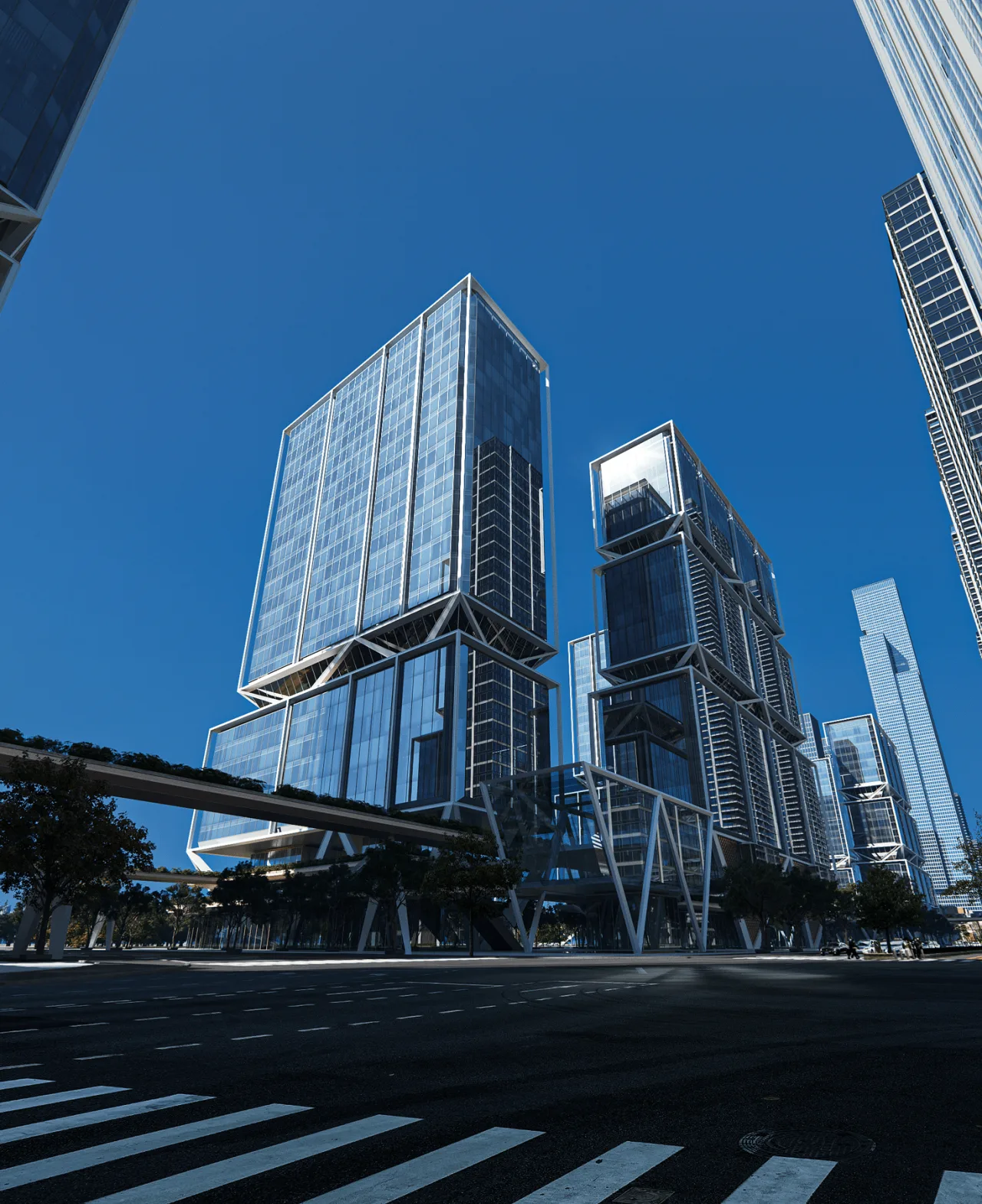
This structural approach gives the impression of high-rise buildings “suspended” above the site and three-dimensional podium. It ensures traffic flow and functional continuity in the lower zone while eliminating standard floor columns to maximize river views and preserve flexible spaces for future uses.
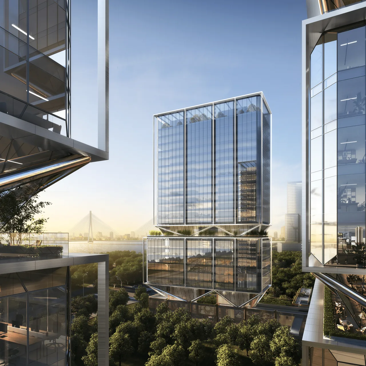
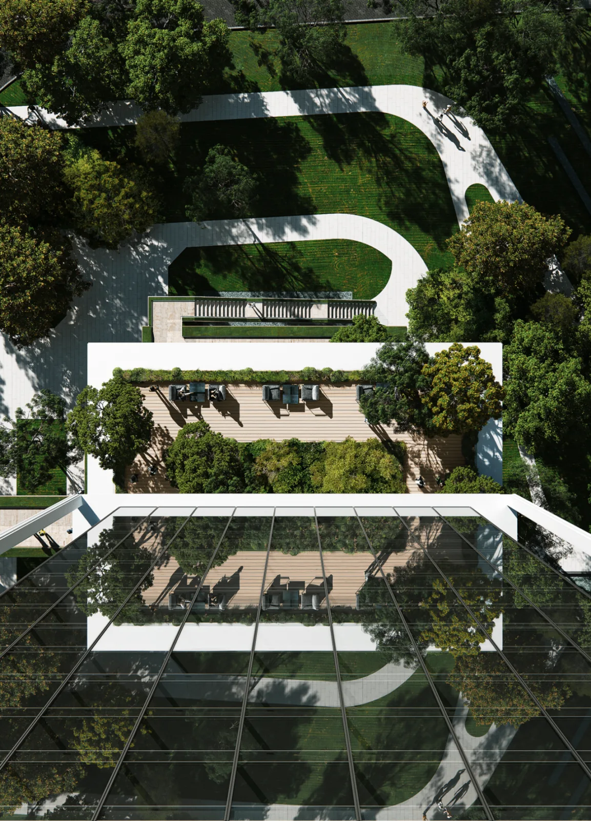
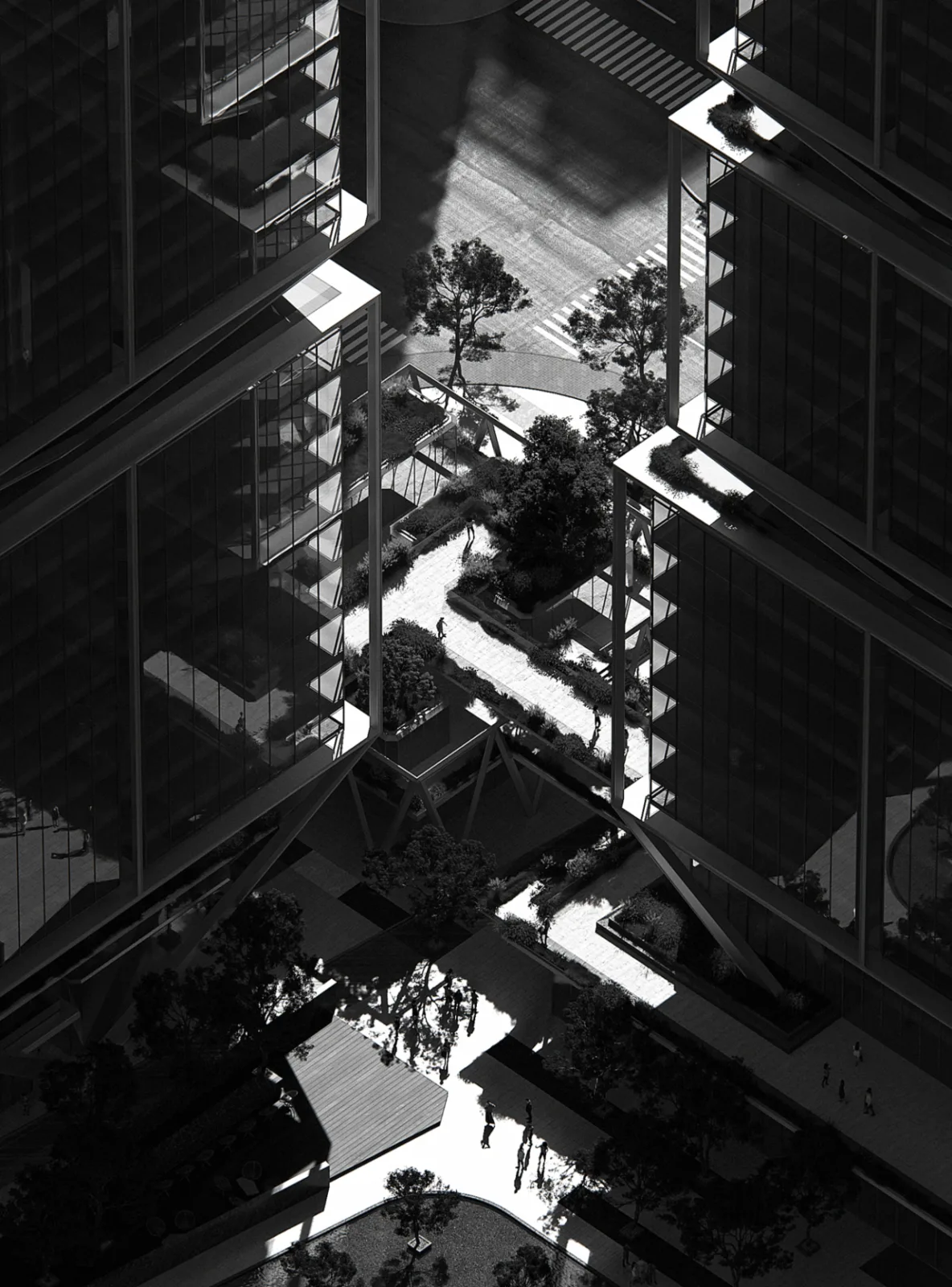
The arrangement and setbacks of the eight towers, featuring exposed structures, incorporate two sky gardens and a rooftop garden, offering natural public spaces elevated above the ground.
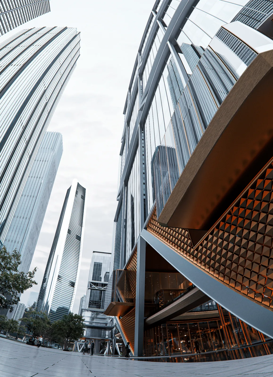
△ Terrace Structure
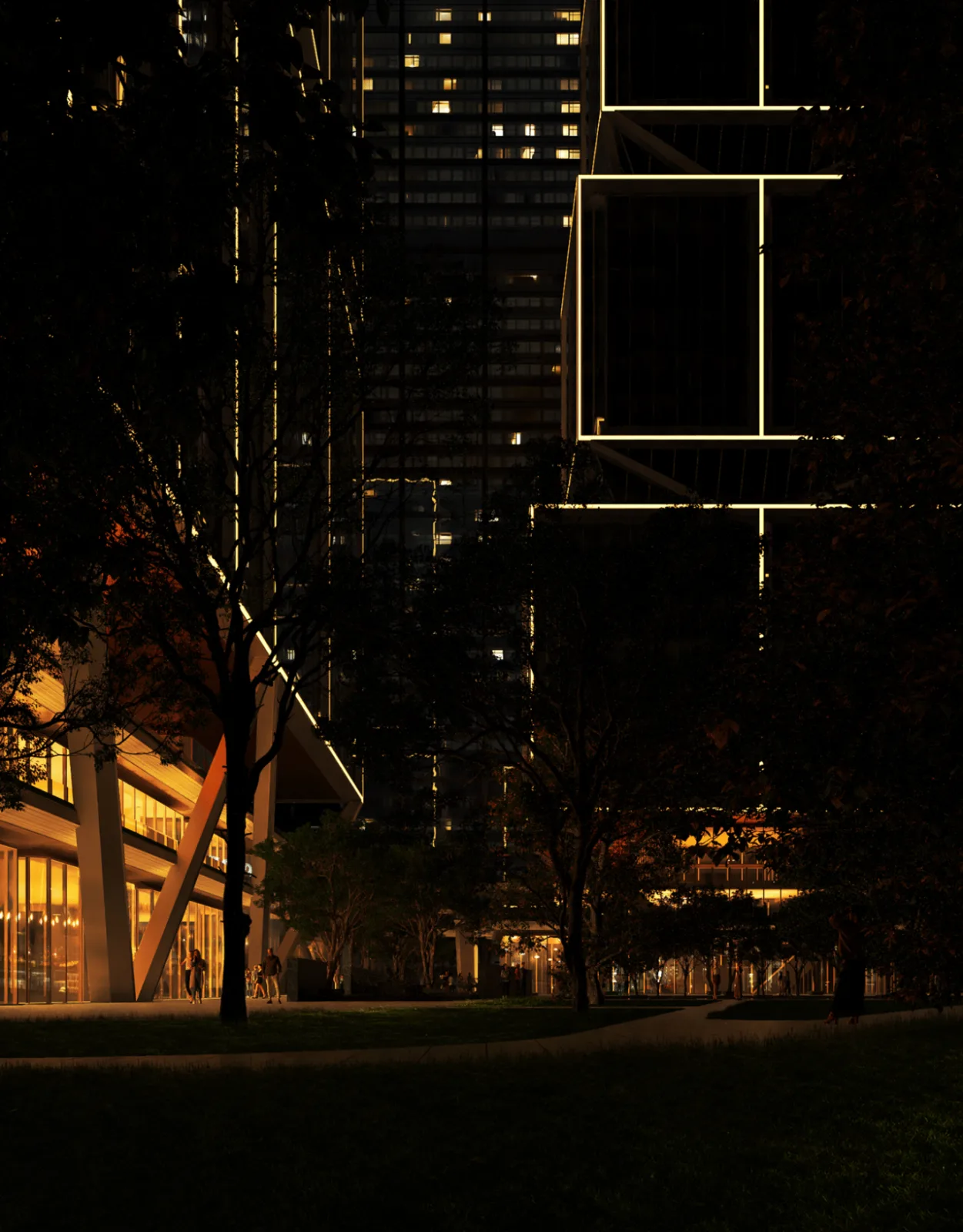
△ High-Rise Facade Detail
Openness: Connecting Urban Spirit and Vitality
Openness is a guiding principle throughout the design process and the ultimate goal of the project. By equally welcoming urban citizens, local residents, and users, we aim to foster vibrant social interactions and diverse urban energy.
This openness not only amplifies commercial opportunities but also offers varied leisure spaces and urban landscapes. It revitalizes the Wuchang Riverside open belt, turning the architecture into a vibrant, shared, and interactive spiritual coordinate space.
A New Ideal Prototype for Waterfront City Coordinates
The true value of coordinate architecture lies not in form, scale, or height but in the vibrancy of its energy and its authentic expression of urban spirit.
Under the open-ended theme of “waterfront city coordinates,” we have envisioned an ideal prototype that is integrated with the city, suited to the neighborhood, close to nature, and interwoven with everyday life.
Through a group layout concept and a three-dimensional, fully open urban living complex, we aim to transform traditional static landmarks into dynamic, experiential spaces shared by enterprises, users, and citizens alike.
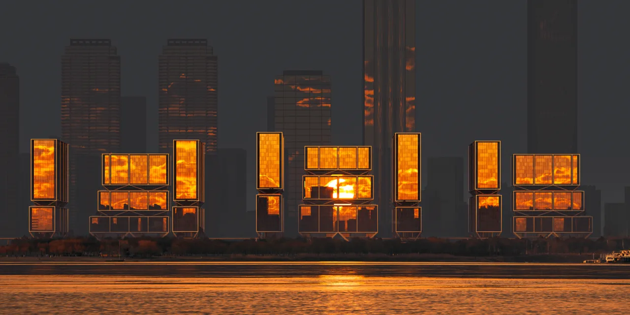
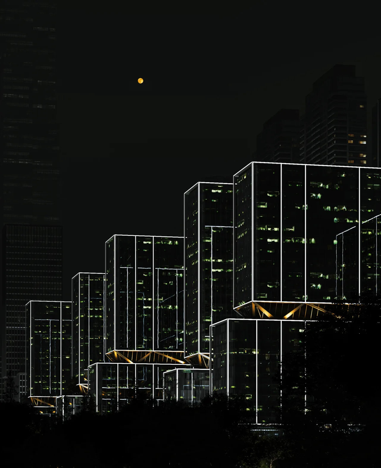
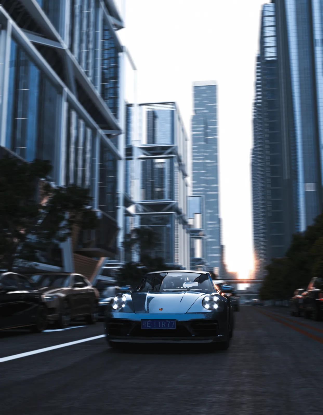
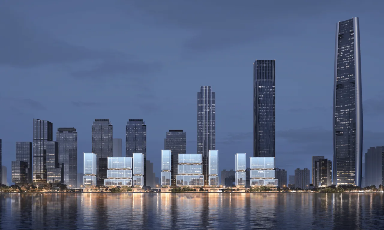
The tower group along the river forms a “Yangtze River painting screen,” reflecting the city’s vitality and river scenery with a crystalline surface. The structural integration evokes the imagery of “hundreds of boats and thousands of sails” along the riverbank, preserving urban memory in a contemporary context.
In mid-2024, the project owner, China Resources Land, entrusted Line+ to develop a new design scheme based on the confirmed spatial pattern. This milestone provides a tangible opportunity to bring the “waterfront city coordinates” concept from vision into reality.
Project Information
Project Name: Wuhan Yangtze River Center C Plot Project International Competition
Design Firm: Line+ Architectural Firm
Lead Architect & Project Creator: Zhu Peidong
Design Team: Wu Haiwen, Wang Jun, Zhong Yifen, Jiang Yuan, Cai Xianghang, Zhang Yi, Zhang Zhen, Chen Puyu
Owner: China Resources Land
Location: Wuhan, Hubei Province
Total Building Area: 207,000 square meters


Must log in before commenting!
Sign Up