The international competition for urban design schemes in the central area of Changping New City East District is hosted by the People’s Government of Changping District and the Beijing Municipal Commission of Planning and Natural Resources. Situated on the east bank of the Dongsha River in Changping District, Beijing, the project encompasses a 9.1 square kilometer planning research area and a 1.5 square kilometer central urban design zone.
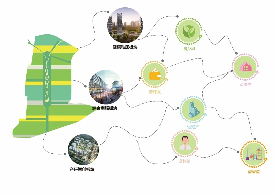
Located north of the capital city, the eastern area of Changping New City rests along the Grand Canal and at the foot of Mangshan Mountain. This region serves as a crucial axis for industrial expansion and ecological development in northern Beijing. Beyond supporting the southern Changping industrial agglomeration belt, Changping Xinchengdong District adopts the “green spectrum” planning concept, focusing on urban functions and spatial environmental resources. This approach aims to harmonize ecological livability with strategic industrial positioning.
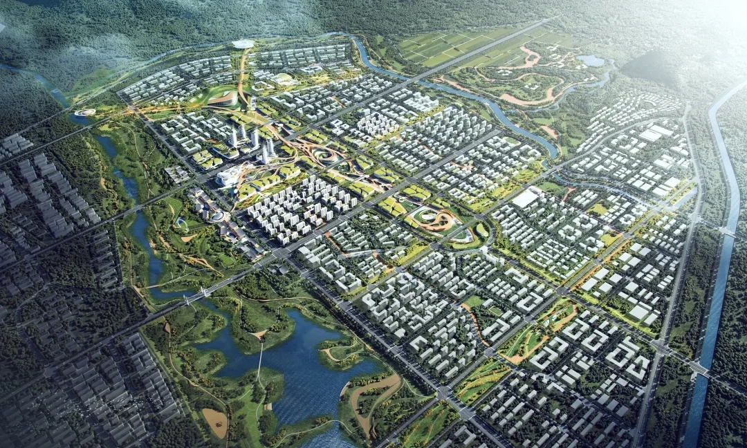
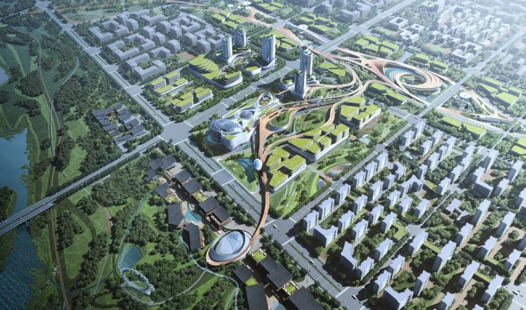
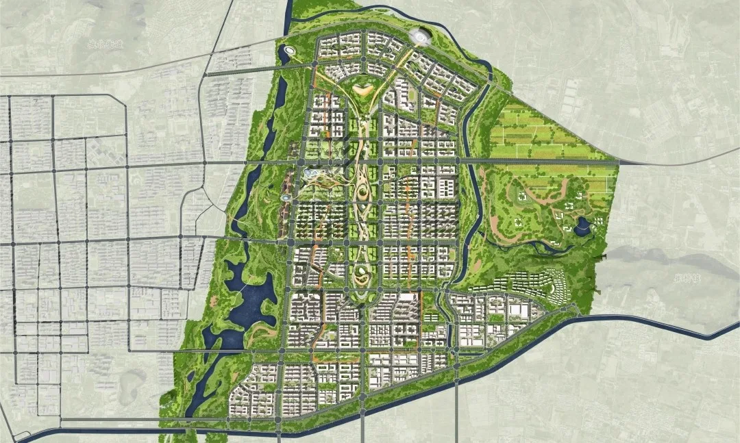
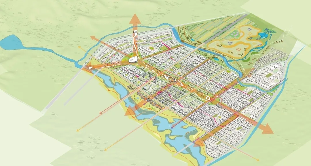
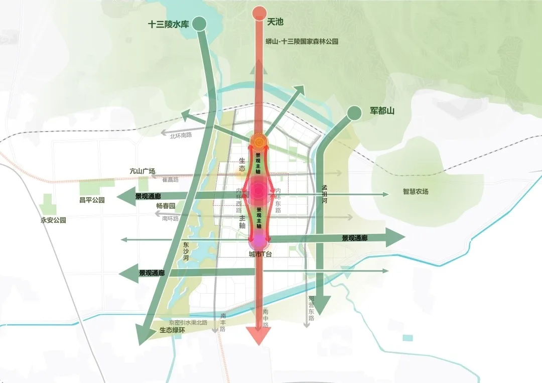
The overall framework draws inspiration from natural ecology through the spectrum layout model, simulating natural spectrum patterns and vine growth. Leveraging the favorable natural backdrop of “one mountain and three waters” surrounding the site, the design integrates a complete industrial system and outlines a planning framework defined as “one heart, two belts, five areas, and multiple nodes.”
This vision culminates in the “Park City 3.0 Plan,” themed “building a city within a park.” It achieves seamless integration of water and greenery, creating a dual identity as both park and city. This model showcases a pioneering new city construction approach focused on green urbanism and enriched living.
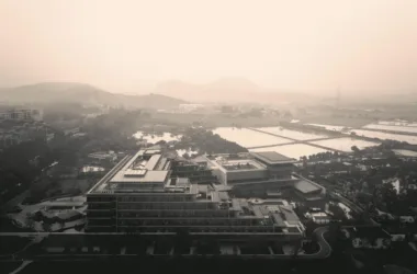
The blue ecosystem project is bordered by water bodies on the east, west, and south sides. Beyond exploring the environmental regulation and landscape benefits of these water systems, the plan emphasizes connecting the urban fabric with waterfront zones.
The Dongsha River waterfront on the west acts as a showcase for the eastern district, linking riverside areas with the urban hinterland through thoughtful renovation. Meanwhile, the eastern bank of Mengzu River has been upgraded to bridge urban and rural zones, fostering an integrated modern agricultural tourism system distinctive to Beijing.
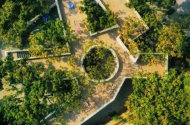
The green ecological system project leverages the area’s abundant natural resources and aligns closely with the city’s texture and ecological context. The design aims to establish a green ecological system and an urban open corridor that is inclusive yet unobstructed, featuring a dense and orderly layout.
At the heart of the site, an unrestricted ecological axis connects the waterfronts on both sides, enhanced by urban viewing balconies along this axis. These balconies integrate with green corridors, naturally outlining multiple urban visual corridors. This design not only enriches the city center’s ecological diversity but also positions the ecological framework within the urban fabric at an appropriate scale, alleviating increasing urban density pressures.
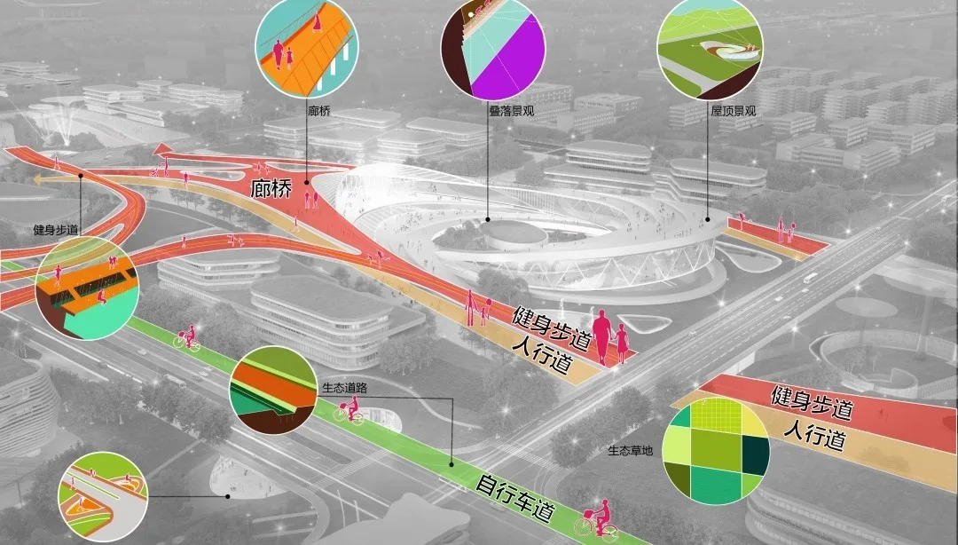
The urban open space system prioritizes equal ecological access and residents’ right to a healthy life, especially in the post-pandemic era. By implementing a resilient, coherent open park network, the plan significantly improves access to ecological spaces and addresses uneven natural resource distribution.
The goal is to create a circular urban open system, establishing a green ecological network within a 300-meter walking distance for residents. This circular system interweaves with the ecological axis, forming a new urban ecological fabric.
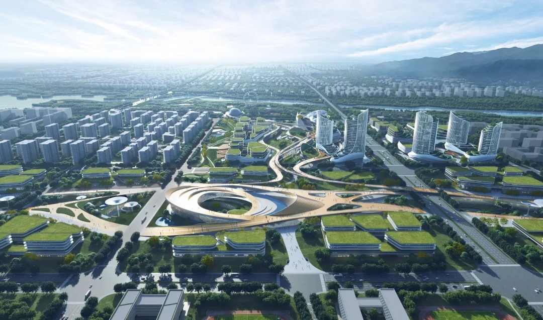
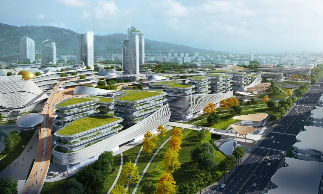
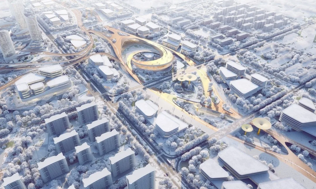
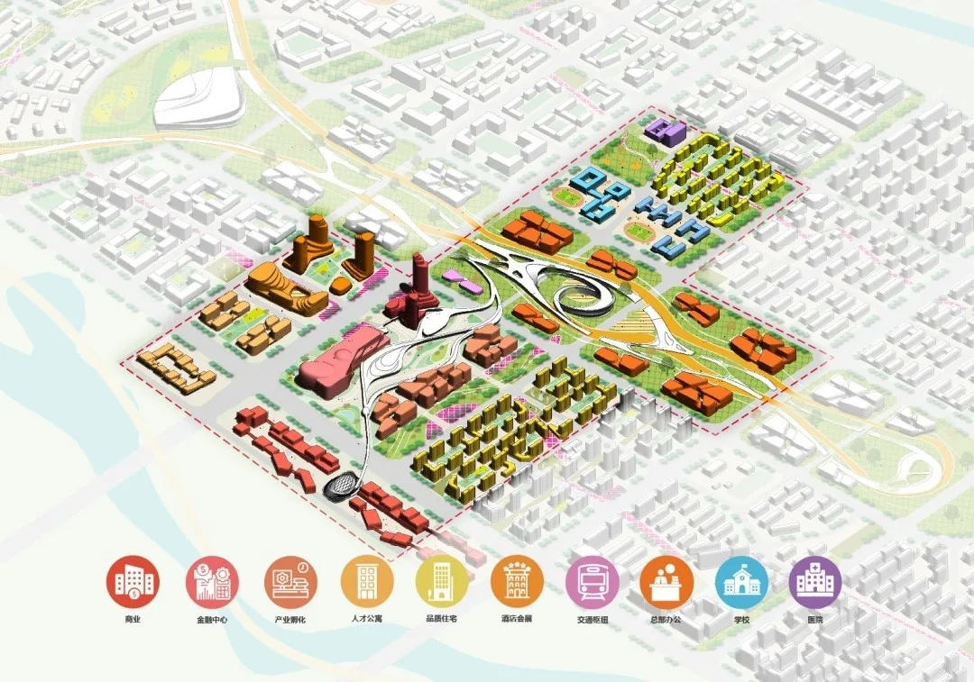
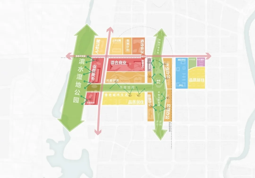
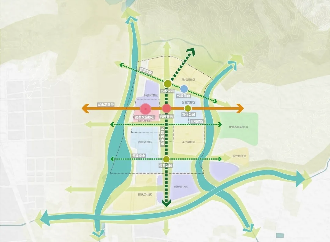
The urban experience space in the central area serves as both the project’s focal point and the initial demonstration zone for phased development. To highlight a new model of city development, the plan proposes five multidimensional core nodes within Changping Dongcheng New District’s central area.
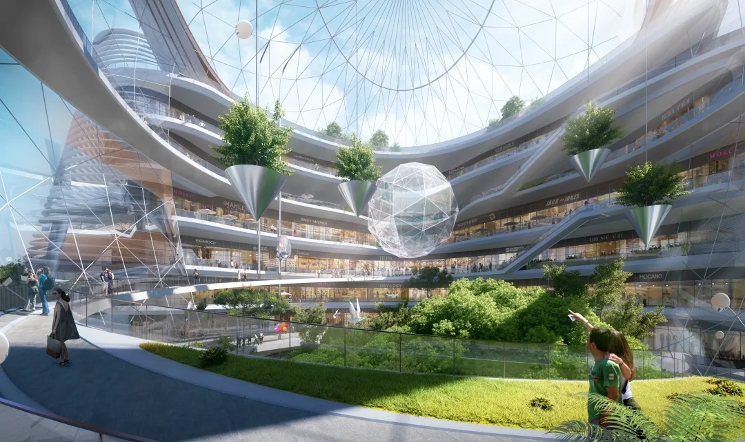
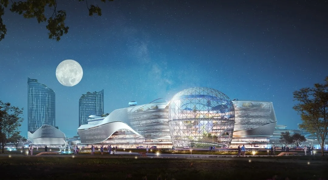
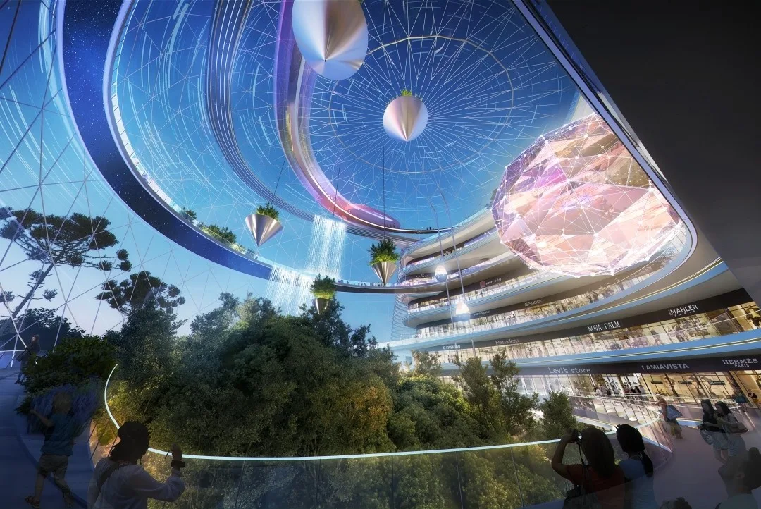
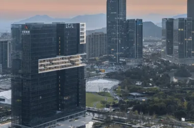
The comprehensive commercial services node centers on a single building within a commercial complex. It aims to establish the Beijing North Science and Technology Cultural Consumption Center, a multifunctional space that blends entertainment, natural ecology, and international leisure experiences.
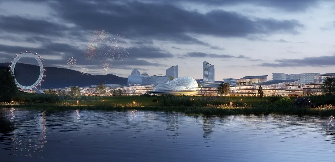
The waterfront business and travel node is centered around the Dongsha River, integrating urban life, commerce, and scenic elements. Waterways are incorporated within the blocks to create an open, themed area that preserves canal culture. This node functions as an urban post station ideal for business and tourism, collaboratively crafting a vibrant and desirable city living example.
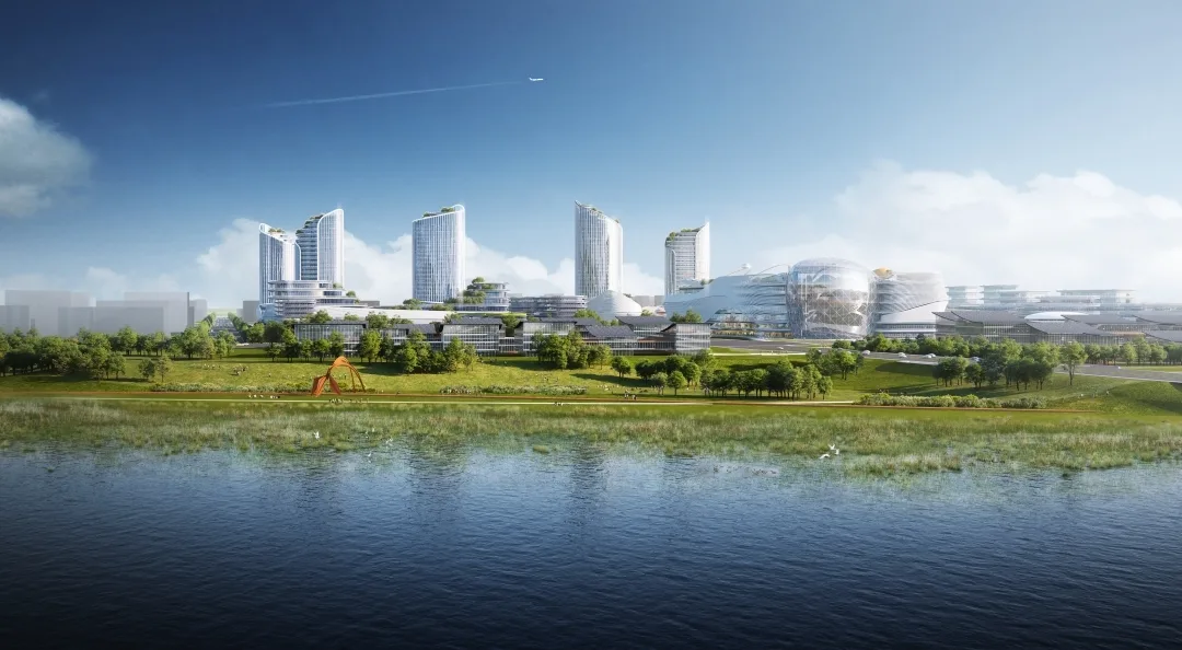
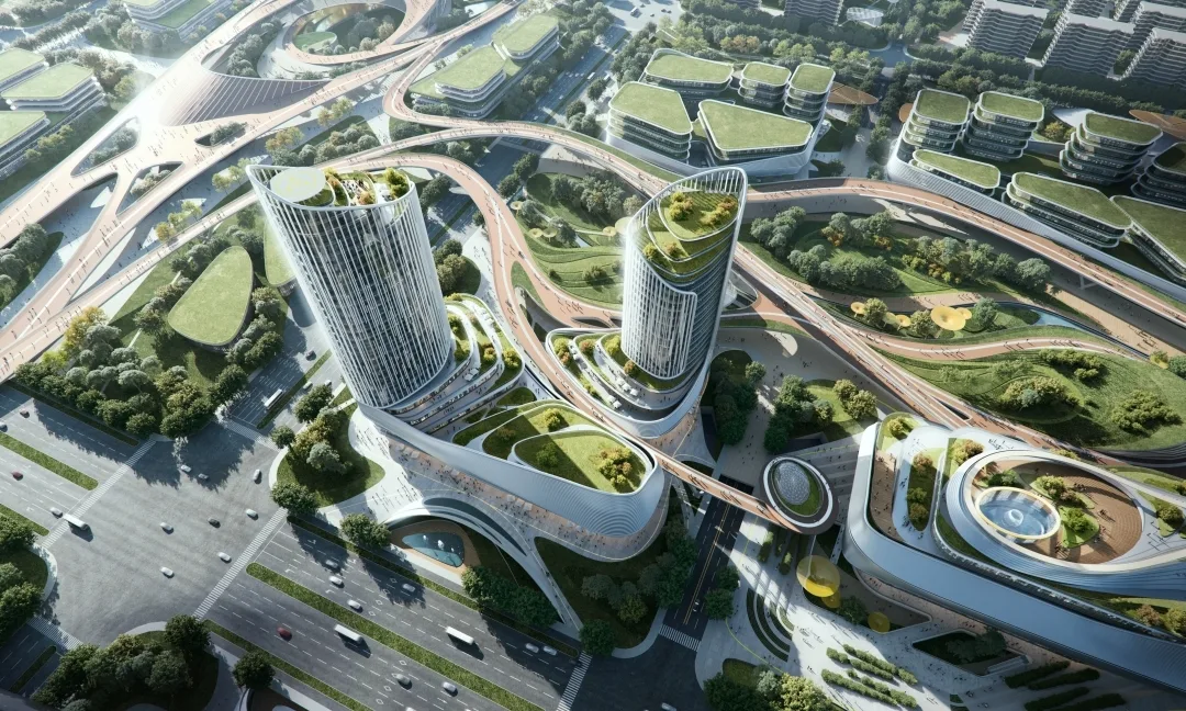
Industrial catalyst nodes feature industrial office complexes built above subway stations, with commercial spaces situated directly over rail transit hubs. These create a new city gateway characterized by clusters of super high-rise buildings, integrating subway transfer hubs and urban waiting areas into a three-dimensional mixed-use super business complex.
Financial empowerment nodes consist of clusters of corporate headquarters, where various enterprises occupy independent industrial buildings. This creates a low-density corporate headquarters area distinct from Beijing’s city center.
Project Drawings
△ General Layout Plan
△ Analysis Chart
△ Analysis Chart
△ Analysis Chart
△ Analysis Chart
△ Analysis Chart
△ Analysis Chart
△ Analysis Chart
Project Information
Project: International solicitation competition for urban design schemes in the central area of Changping Xinchengdong District
Location: Beijing, China
Scope: 9.1 km² planning research; 1.5 km² central urban design
Consortium: COFCO Real Estate, China Zhongyuan, Qingdao Coastal
Owners: Changping District People’s Government of Beijing and Beijing Municipal Commission of Planning and Natural Resources
Total planned land area: 9.1 square kilometers
Central area planned land: 1.5 square kilometers


Must log in before commenting!
Sign Up