1. Who Needs Aerial Survey Images?
Drone surveying is primarily used for foundational surveying tasks across various projects. These include rural land information investigations, mining surveys, road planning, land surveys, comprehensive improvements, terrain surveys of road strips, and assessments of landslides and steep road sections.
Additionally, many industries apply drone surveying in diverse fields such as mountain flood disaster assessment, forest stock estimation, geological surveys of the Qinghai-Tibet Plateau, land landscape use studies, power grid engineering construction, line inspections, earthwork balancing, and oil exploration.
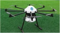
2. How to Choose the Right Aircraft?
The choice of aircraft depends mainly on the desired image size and resolution. When image resolution requirements are fixed, a larger camera focal length necessitates flying at higher altitudes, which also increases the image frame or coverage area.
Therefore, for high-resolution images covering large target areas and when budget allows, high-altitude aerial surveys are more suitable. Conversely, drones offer advantages such as speed, reliability, flexibility, and affordability, especially in complex geographic environments. Their measurement accuracy and coverage are well-regarded in the industry, making them ideal for smaller projects or those with limited budgets.
3. How to Choose a Suitable Aerial Surveying Company?
Data shows that five years ago, there were only about 40 companies engaged in aerial photography and surveying in China. Today, the number of aerial survey companies has grown significantly.
According to the former National Bureau of Surveying, Mapping and Geoinformation, Guangdong Province alone has at least 20 enterprises, including Zhongwei Space, that hold drone surveying qualifications. These companies provide professional drone aerial photography services and support.
4. How Much Does Aerial Surveying Cost? Is It Expensive?
Within the UAV surveying industry, competition has intensified, leading to lower bids during tenders. However, to ensure safe and reliable flights along with accurate, effective data, professional-grade industrial drones are necessary. Such equipment can cost anywhere from tens of thousands to millions of dollars.
For many users, purchasing drones for aerial survey tasks remains costly. The main reasons include:
- The upfront cost of buying a drone is relatively high.
- Non-professional users often struggle with after-sales support and maintenance.
- Drones tend to be idle when there are no applicable projects, reducing cost-effectiveness.
Due to these challenges, buying industrial aerial survey drones may not be the most economical solution for meeting project needs.
In response, Zhongwei Space Technology (Shenzhen) Co., Ltd. offers a one-stop solution service that is more cost-effective. They provide professional aerial survey drone services, ensuring reliable results without concerns over operational issues. Additionally, they offer training services, creating a win-win situation for users.


Must log in before commenting!
Sign Up